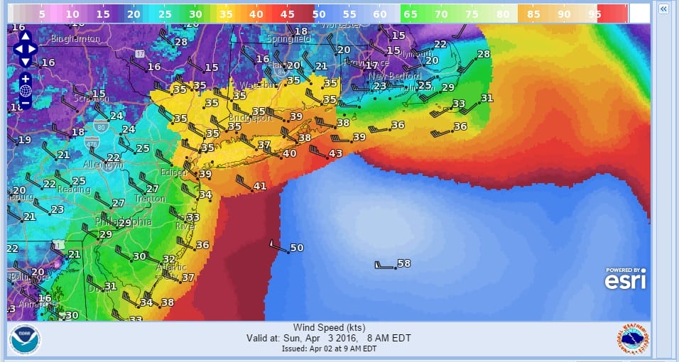
Synopsis: WEAK LOW PRESSURE WILL PASS OFF TO THE SOUTHEAST TODAY. INTENSIFYING LOW PRESSURE ALONG A STRONG ARCTIC COLD FRONT WILL BOTH PASS THROUGH LATE TONIGHT…AND MOVE EAST OF NEW ENGLAND ON SUNDAY. LOW PRESSURE APPROACHING FROM THE WEST WILL TRACK NEARBY ON MONDAY…FOLLOWED BY HIGH PRESSURE FOR MID WEEK.
Today
NE winds 10 to 15 kt with gusts up to 20 kt…becoming W 5 to 10 kt early this afternoon… Then becoming SW 10 to 15 kt with gusts up to 20 kt late. Seas 5 to 8 ft. Rain.
Tonight
SW winds 15 to 20 kt with gusts up to 30 kt… Increasing to 25 to 35 kt with gusts up to 55 kt after midnight. Seas 5 to 8 ft…building to 8 to 11 ft after midnight. Showers and tstms likely after midnight with vsby 1 to 3 nm.
Sun
W winds 30 to 40 kt. Gusts up to 55 kt in the morning. Seas 10 to 14 ft…subsiding to 8 to 11 ft in the afternoon. Chance of showers in the morning.
Sun Night
NW winds 20 to 25 kt with gusts up to 35 kt… Becoming W 15 to 20 kt with gusts up to 25 kt after midnight. Seas 5 to 8 ft…subsiding to 3 to 5 ft after midnight.
Mon
SW winds 15 to 20 kt with gusts up to 30 kt. Seas 4 to 6 ft. Rain likely…mainly in the afternoon. Vsby 1 to 3 nm in the morning.
Mon Night
W winds 10 to 15 kt…becoming N 15 to 20 kt after midnight. Gusts up to 30 kt. Seas 4 to 7 ft. Rain likely in the evening…then rain likely with chance of snow after midnight with vsby 1 to 3 nm.
Tue
N winds 20 to 25 kt…diminishing to 15 to 20 kt after midnight. Seas 4 to 7 ft…subsiding to 3 to 5 ft after midnight.
MARINE FORECAST NEW JERSEY COASTAL WATERS
..SMALL CRAFT ADVISORY FOR HAZARDOUS SEAS IN EFFECT THROUGH THIS EVENING…
…STORM WARNING IN EFFECT FROM LATE TONIGHT THROUGH SUNDAY MORNING…
Synopsis: AN AREA OF LOW PRESSURE TRACKING TO OUR EAST ALONG A FRONTAL BOUNDARY WILL MOVE FARTHER AWAY FROM OUR REGION THIS AFTERNOON. AS ANOTHER AREA OF LOW PRESSURE TRACKS FROM THE EASTERN GREAT LAKES REGION THIS AFTERNOON TO SOUTHERN NEW ENGLAND TONIGHT, A STRONG COLD FRONT SWEEPS ACROSS OUR AREA LATER TONIGHT. THE NEXT LOW PRESSURE SYSTEM QUICKLY ARRIVES MONDAY BEFORE MOVING OUT TO SEA MONDAY NIGHT INTO TUESDAY. HIGH PRESSURE BUILDS IN LATER TUESDAY BEFORE SHIFTING OFFSHORE EARLY WEDNESDAY.
Rest Of Today
NE winds 10 to 15 kt with gusts up to 20 kt late this morning….becoming light and variable this afternoon and then SW around 10 kt late. Seas 4 to 7 ft. Mainly in S swell with a dominant period of 8 seconds. Rain early…then showers.
Tonight
W winds 10 to 15 kt with gusts up to 25 kt… Increasing to 30 to 40 kt with gusts up to 50 kt after midnight. Seas 5 to 8 ft dominant period 8 seconds. A slight chance of showers early in the evening…then a chance of showers in the late evening and overnight.
Sun
NW winds 30 to 40 kt with gusts up to 55 kt…diminishing to 25 to 30 kt with gusts up to 45 kt in the afternoon. Seas 6 to 9 ft dominant period 7 seconds…subsiding to 4 to 7 ft dominant period 6 seconds early in the afternoon.
Sun Night
NW winds 20 to 25 kt with gusts up to 35 kt… Diminishing to 15 to 20 kt with gusts up to 25 kt late in the evening…then becoming W 5 to 10 kt after midnight…becoming SW 10 to 15 kt with gusts up to 20 kt late. Seas 3 to 5 ft… Subsiding to 2 to 3 ft after midnight. Mainly in N swell with a dominant period of 5 seconds.
Mon
SW winds 15 to 20 kt with gusts up to 25 kt. Seas 3 to 5 ft. Rain likely…mainly in the afternoon.
Mon Night
NW winds 10 to 15 kt with gusts up to 20 kt… Becoming N 20 to 25 kt with gusts up to 30 kt after midnight. Seas 4 to 7 ft. Rain likely.