
Storm Passes South And East
Nuisance Snow Showers Later Thursday Into Thursday Night

Storm Passes South And East
Nuisance Snow Showers Later Thursday Into Thursday Night
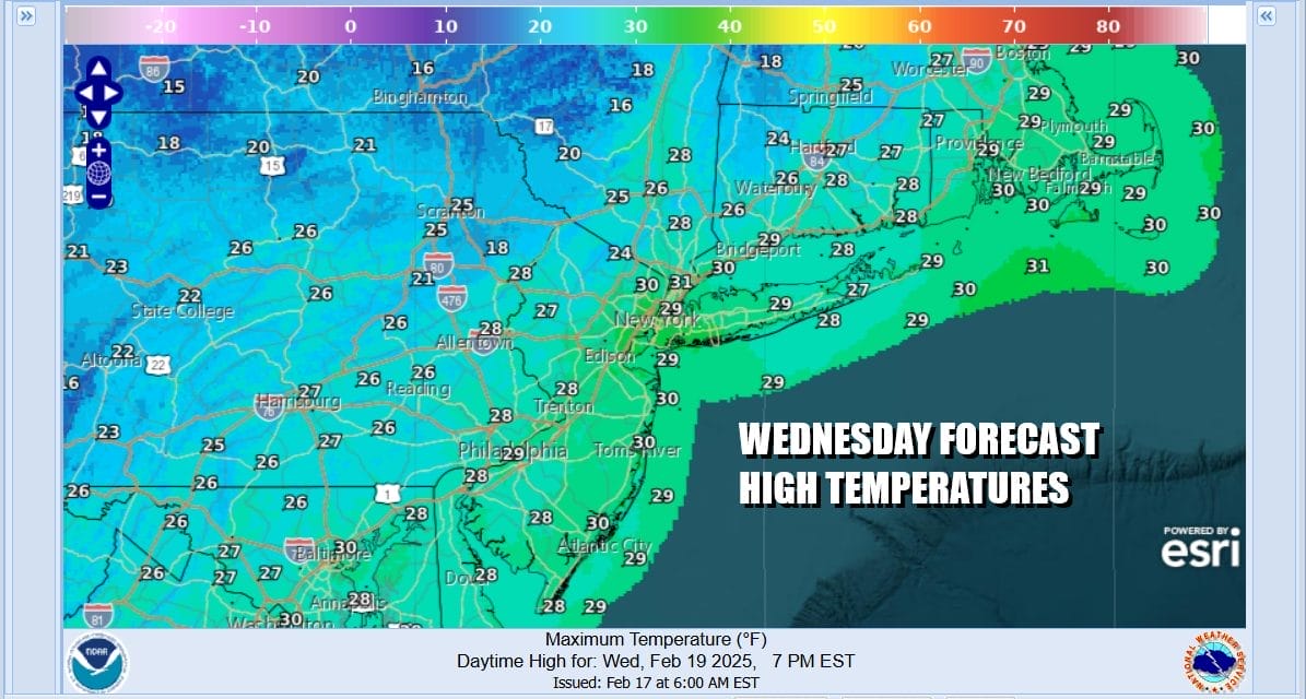
Another cold day and another day with gusty winds though the winds will have come down off their peaks of the last 2 days. We still deal with gusts in the 20 to 30 mph range and we will have a day of sunshine giving way to increasing high clouds. We have the latest storm system moving along the Gulf Coast and it will make its way off the Southeast US coast tonight into Thursday. Meanwhile we have high temperatures across Eastern Pennsylvania to Southern New England that will not get out of the 20s.
SATELLITE WITH LIGHTNING STRIKES

WEATHER RADAR

The regional radar loop is showing an area of snow expanding across Virginia and North Carolina and it will continue to push east ward. To the north we have lots of dry air which is going to help suppress the snow southward, keeping it from reaching areas further north such as Eastern Pennsylvania to Southern New England.
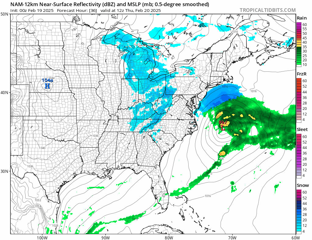
While we will not be seeing snow from the coastal low, we will see some patchy areas of snow develop with the upper air storm system that is driving this offshore track. This could happen during Thursday afternoon into Thursday night. I think we could see some places get the ground whitened up. Other places might see a coating to maybe as much as an inch. Still there will be some places that just see a few flurries.

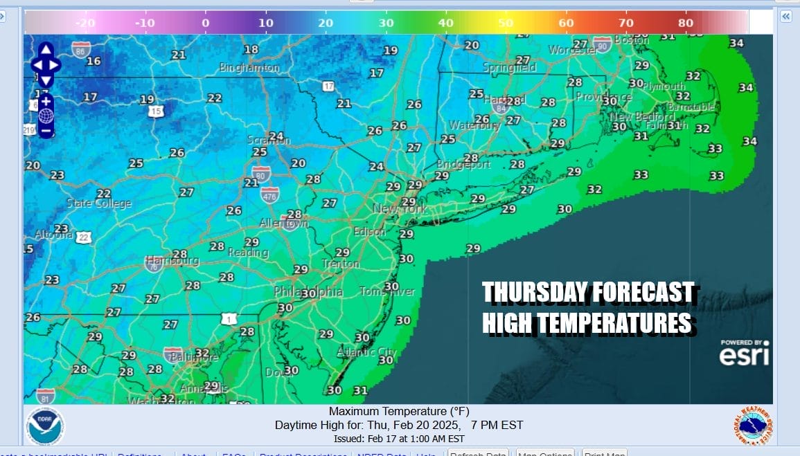
While all this is going on we will continue to see very cold temperatures dominate the region. Lows Thursday morning will be in the teens just about everywhere. Clouds will likely keep temperatures from falling off the wall. Thursday under a mainly cloudy sky, high temperatures once again will not be getting out of the 20s.
The good news with all of this is as the storm system moves away to the northeast we will see a temporary shift in the weather pattern through the weekend. The core of the cold air will move out and a moderation in temperatures begins Friday with highs back into the 30s along with some sunshine. The weekend will see temperatures go higher with highs in the upper 30s and lower 40s Saturday and mostly 40s Sunday. Also we will be storm free with no rain or snow forecast over the weekend and into the start of next week!
BE SURE TO DOWNLOAD THE FREE METEOROLOGIST JOE CIOFFI WEATHER APP &
ANGRY BEN’S FREE WEATHER APP “THE ANGRY WEATHERMAN!
MANY THANKS TO TROPICAL TIDBITS FOR THE USE OF MAPS
Please note that with regards to any severe weather, tropical storms, or hurricanes, should a storm be threatening, please consult your local National Weather Service office or your local government officials about what action you should be taking to protect life and property.


