

A Period of Light Snow Or Snow Showers Cold Air Begins to Pull Out Friday
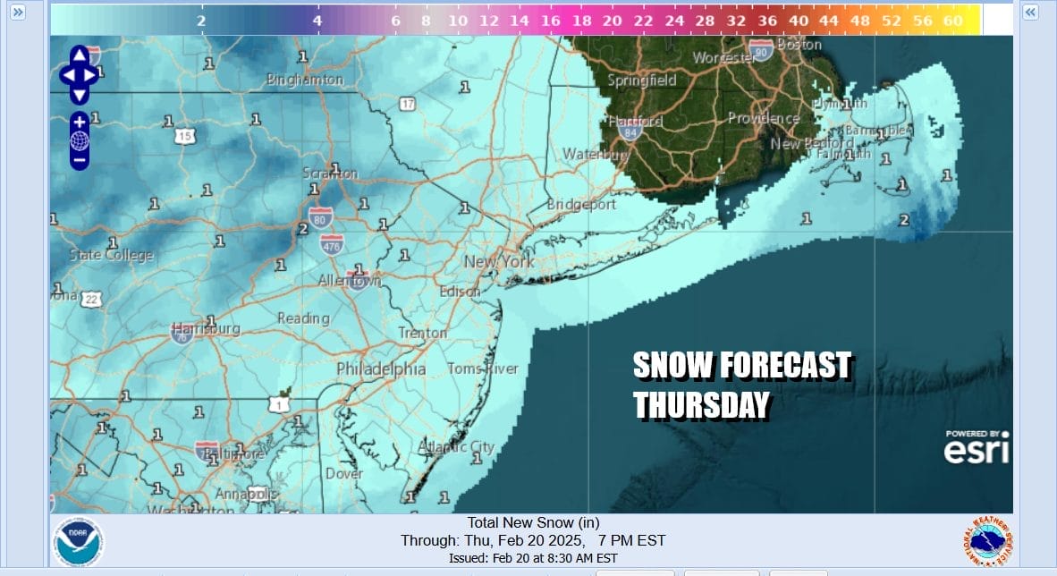
The storm system that brought heavy snow to Eastern Virginia and North Carolina is now making its exit to the east and has taken the snow with it. Now we turn our attention today to an upper air storm system that is exiting Ohio today and will move across Southern Pennsylvania and Southern New Jersey. Along and north of the track of the upper low there will be some of what I have been describing as nuisance snow showers or perhaps even an area of steadier snow. This looks to produce a coating to at most an inch or so in some places. Other places will see maybe just the coating and still other will see just flurries.
SATELLITE WITH LIGHTNING STRIKES

WEATHER RADAR

We will keep an eye on the radars today as the upper low moves along. Upper lows can have the tendency to surprise sometimes so I want to be a little cautious about it. Otherwise it will just pass through and exit to the east tonight. Today we will see mainly cloudy skies and the risk for any snow will be this afternoon and evening. High temperatures once again will likely not get out of the 20s in most places.
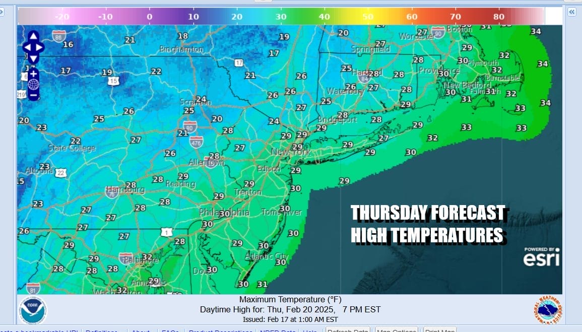
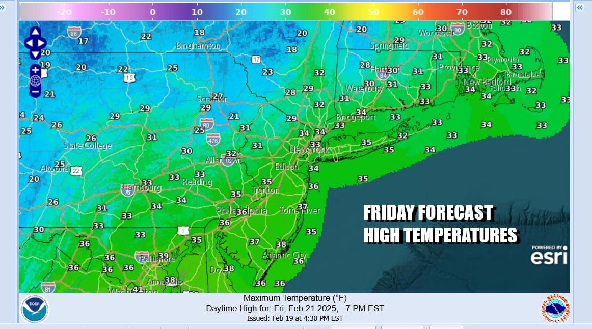
This is going to be the last very cold day as once the upper low moves out, it will take the cold air out with. Skies will clear tonight and most lows will be in the mid teens to low 20s. Friday we should see a fair amount of sunshine and high temperatures will likely reach the low and middle 30s in most places.
We do not see any weather issues this weekend other than perhaps some passing clouds from time to time. Saturday and Sunday should see at least some sunshine both days. Winds which have been an issue for days will be reasonable this weekend. Temperatures will rise with Saturday highs reaching the upper 30s and lower 40s after a cold start. Sunday highs will move a little higher and reach the 40s everywhere. Next week starts dry Monday and mild. We have the chance for some rain or showers Tuesday and again Thursday as cold fronts move through.No major storms are on the horizon.
BE SURE TO DOWNLOAD THE FREE METEOROLOGIST JOE CIOFFI WEATHER APP &
ANGRY BEN’S FREE WEATHER APP “THE ANGRY WEATHERMAN!
MANY THANKS TO TROPICAL TIDBITS FOR THE USE OF MAPS
Please note that with regards to any severe weather, tropical storms, or hurricanes, should a storm be threatening, please consult your local National Weather Service office or your local government officials about what action you should be taking to protect life and property.


