
Steam Bath Weather Continues With Scattered Storm Risk Late Today & Tonight

Steam Bath Weather Continues With Scattered Storm Risk Late Today & Tonight
We have what I would call steam bath conditions across much of the Northeast and Mid Atlantic states today. Some areas have seen some downpours and thunderstorms roll through overnight night which only adds to the very humid conditions. Dew points are very high today with readings in the low 70s. Combine that with temperatures in the low to middle 90s and you have the makings for a very uncomfortable day indeed.
SATELLITE WITH LIGHTNING STRIKES

WEATHER RADAR

We do have a weak upper trough that is moving through the Northeast and Middle Atlantic states and while we do see the risk for some scattered afternoon and evening thunderstorms, we suspect that those storms will be few and far between as the system coming through is weaker than advertised a few days ago.

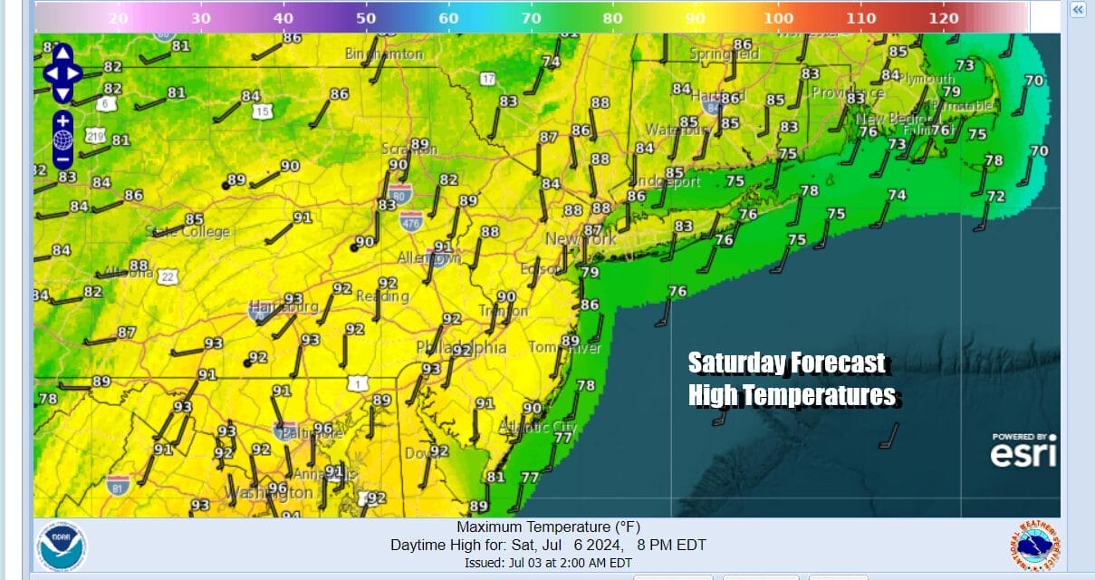
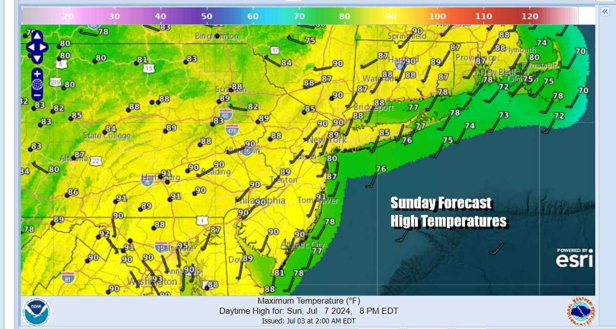
The weaker upper trough means little if any relief from the high humidity Sunday or for that matter, early next week. It will continue to be very humid Sunday. Perhaps the dew points drop a few degrees but not enough to make a big difference. We will have sunshine around Sunday with high temperatures in the upper 80s and lower 90s. Temperatures will be a little lower with sea breezes at area beaches.
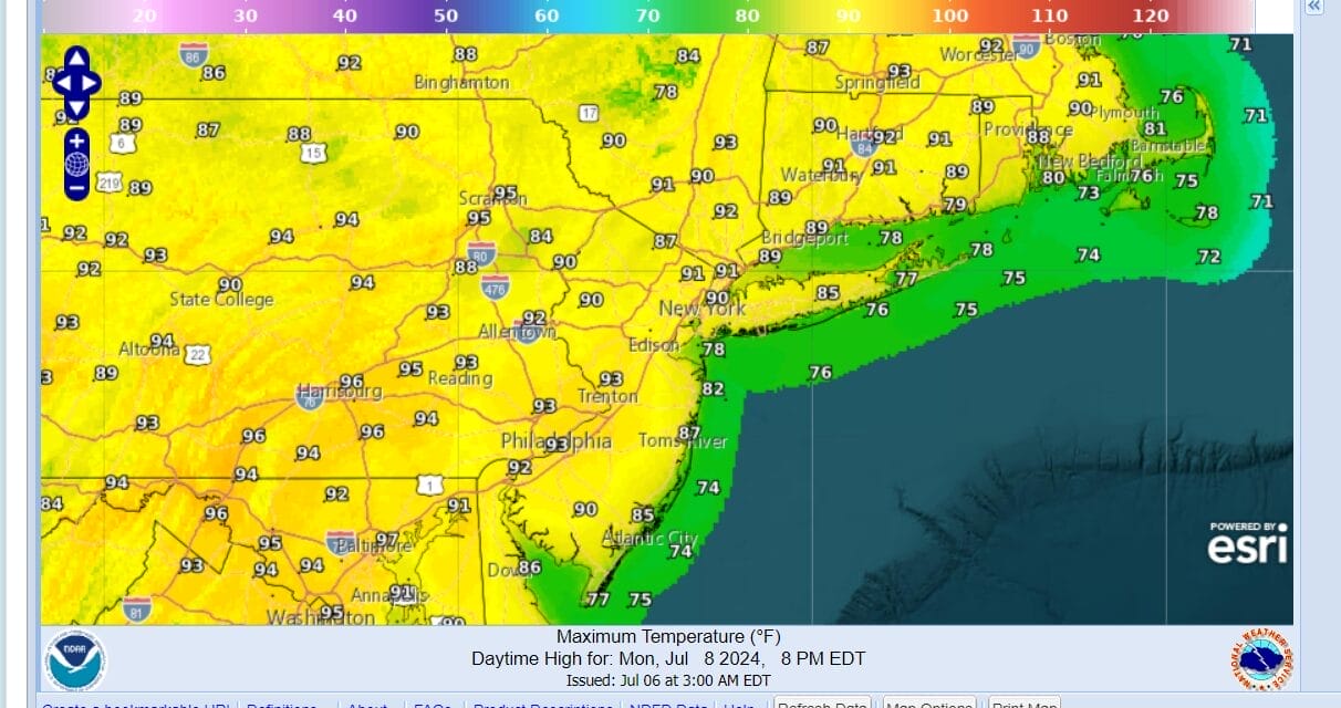
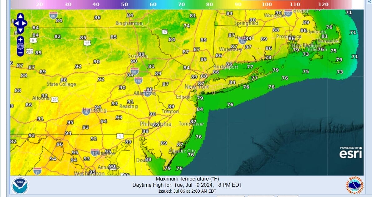
We will continue to march to the same drum of very warm to hot and humid conditions for Monday and Tuesday. We might see a thunderstorm or two late Monday night or early Tuesday morning as we set up for another upper trough and cold front late in the day Tuesday and Tuesday night. Until then Monday highs will reach the upper 80s and lower 90s. Tuesday highs will be in the mid 80s to around 90 degrees on the idea that there might be more clouds around.
We may see temperatures ease a bit Wednesday and Thursday of next week but we may also see an increasing chance for showers and thunderstorms particularly late next week as a frontal boundary stalls along the East Coast and there is the potential for some waves to move along it producing rounds of downpours and thunderstorms. However at this stage there is some uncertainty about how this plays out with regards to timing. In the meantime enjoy the hot humid weekend as best you can.
BE SURE TO DOWNLOAD THE FREE METEOROLOGIST JOE CIOFFI WEATHER APP &
ANGRY BEN’S FREE WEATHER APP “THE ANGRY WEATHERMAN!
MANY THANKS TO TROPICAL TIDBITS FOR THE USE OF MAPS
Please note that with regards to any severe weather, tropical storms, or hurricanes, should a storm be threatening, please consult your local National Weather Service office or your local government officials about what action you should be taking to protect life and property.
(Amazon is an affilate of Meteorologist Joe Cioffi & earns commissions on sales.)


