Heat Humidity Continue Inland Highs in the 90s Cooler Along The Shore

Heat Humidity Continue Inland Highs in the 90s Cooler Along The Shore

Though a weak weather front and upper trough passed through overnight, it wasn’t much of a front. The air ahead of it and the air behind it are pretty much the same so there will be little change in temperature and humidity levels in the coming days. Apparently the fireworks shows of the last few days have left behind poor air quality conditions over much of the area and don’t expect this to change much until we get a solid cold front with a nice cool dry air mass behind it. Unfortunately that won’t be happening anytime soon.
SATELLITE WITH LIGHTNING STRIKES

WEATHER RADAR

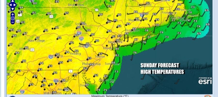
That leaves us today with heat humidity and probably no chance at all for a cooling shower or thunderstorm. Most highs this afternoon will be in the upper 80s and lower 90s except for areas in South Jersey and Southern Pennsylvania where highs will be in the low to middle 90s. Temperatures will be cooler along coastal areas and beaches as local sea breezes take hold.
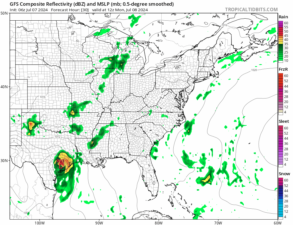
There isn’t much hope for any big changes in the week ahead. A weak weather front approaching late Tuesday looks to be even weaker as we get closer. There may not be much of a change in weather conditions until perhaps late in the week when we might see a chance for thunderstorms. Beryl in the Western Gulf of Mexico will likely strengthen to a hurricane before making landfall early Monday morning along the Texas coast. The remnant low runs northeast up the Mississippi Valley to the Great Lakes and we will not see any rain from this storm.
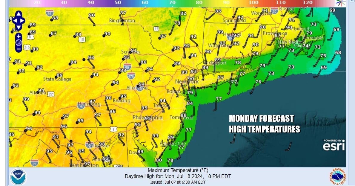
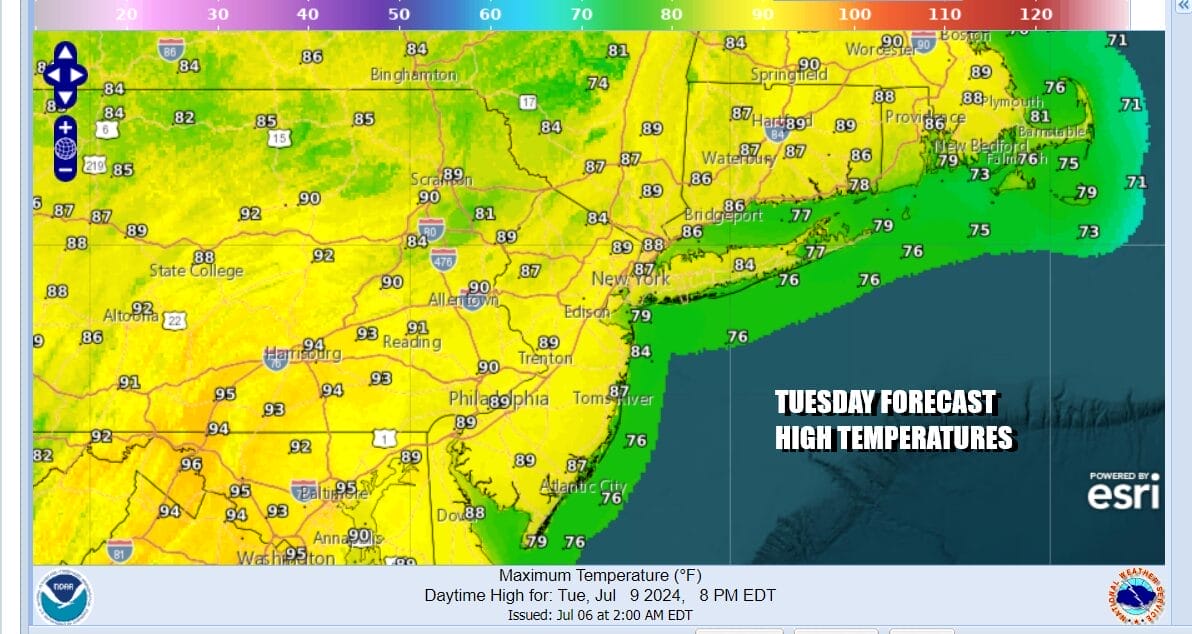
This leaves us with hot and humid conditions Monday and Tuesday with partly sunny skies both days. Humidity levels will be high. Thunderstorm risks will be very low if at all. High temperatures both Monday and Tuesday in the low to a few middle 90s while temperatures at the shore will likely be cooler thanks to developing afternoon sea breezes.
We will see more of the same Wednesday and Thursday though by Thursday perhaps with an approaching weather front we see a higher risk for showers and thunderstorms but we are pretty much in wait and see mode on that. It just simply means that we are in July weather mode until further notice.
BE SURE TO DOWNLOAD THE FREE METEOROLOGIST JOE CIOFFI WEATHER APP &
ANGRY BEN’S FREE WEATHER APP “THE ANGRY WEATHERMAN!
MANY THANKS TO TROPICAL TIDBITS FOR THE USE OF MAPS
Please note that with regards to any severe weather, tropical storms, or hurricanes, should a storm be threatening, please consult your local National Weather Service office or your local government officials about what action you should be taking to protect life and property.
(Amazon is an affilate of Meteorologist Joe Cioffi & earns commissions on sales.)


