Beryl Remnants To Pass Well North & West While East Remains Steamy All Week

Beryl Remnants To Pass Well North & West While East Remains Steamy All Week

If you are looking for a break in humidity and the steamy conditions, prepare yourself for a long wait. It certainly won’t be happening this week. We have high pressure offshore or the Bermuda/Azores highs that has build its way westward into the Eastern US and really shows no sign of moving. Any dry air coming from Canada gets spent in the Upper Midwest and Plains and can’t move east. Hurricane Beryl is making landfall in Coastal Texas today between near Bay City. Moisture from Beryl will be coming around the backside of the Bermuda high later this week.
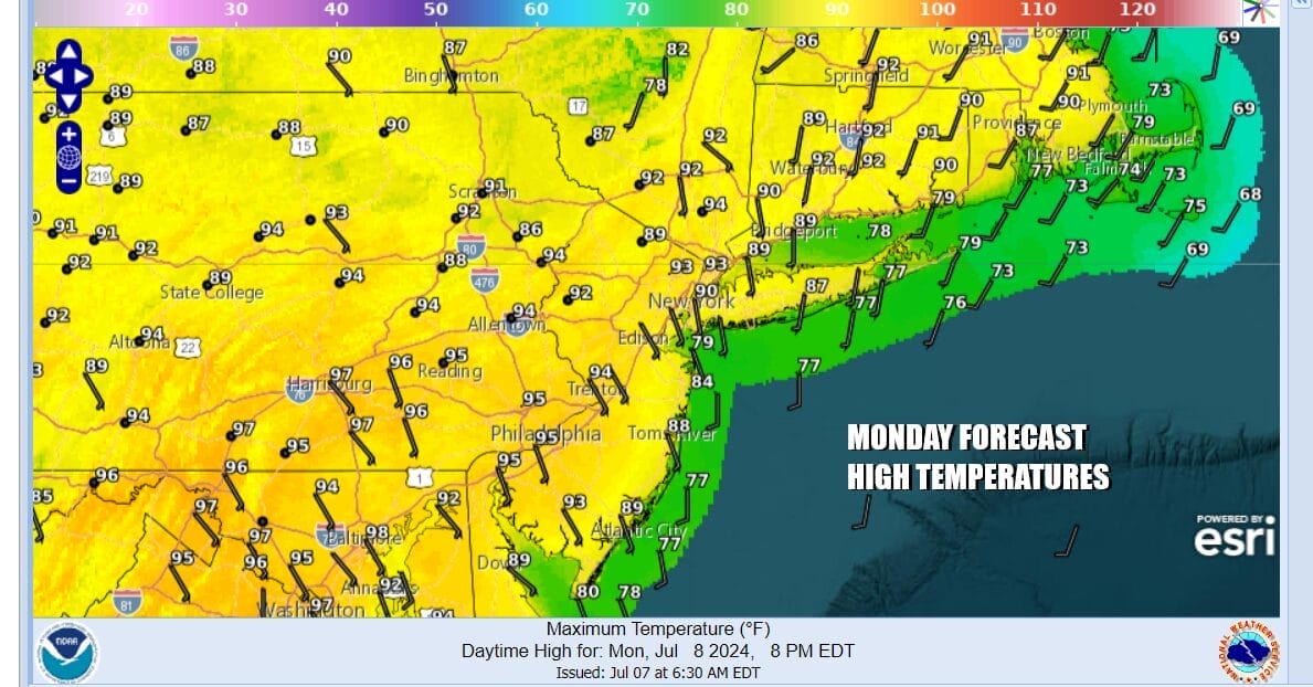
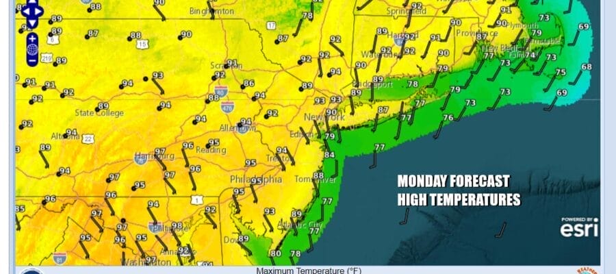
Today we have another steamy day with heat advisories up for most of Eastern Pennsylvania to Southern New England. It will be a hot humid day with sunshine taking highs to the low and middle 90s. High dew points mean that humidity levels will be on the high side yet again making for a very uncomfortable day. There is always the chance for a pop up isolated thunderstorms but there will be very few of those and the vast majority of the area won’t see anything today or into tonight.
SATELLITE WITH LIGHTNING STRIKES

WEATHER RADAR

As noted earlier with the Bermuda high to the east and the remnant low of Hurricane Beryl moving up the Mississippi River Valley to the lower Great Lakes, we see a very warm and humid night with lows in the upper 60s to mid 70s. Tuesday will be steamy with some sunshine. Highs again will be in the low to middle 90s. Cooler temperatures will prevail at shore locations for both today and Tuesday. There could be a shower or thunderstorm running around late in the day into the evening.
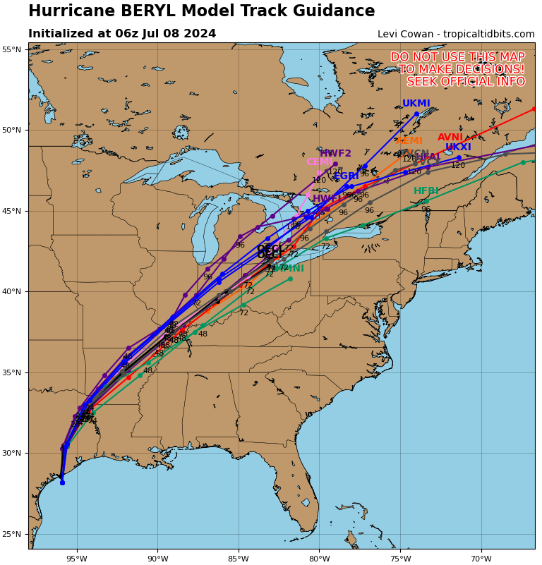
Wednesday will be hot and humid with highs in the upper 80s and lower 90s. There may be a better chance for some scattered thunderstorms in the afternoon and evening. Late this week we will see the remnant low of Hurricane Beryl take a track to the Great Lakes and then across Southeastern Canada. Remnant lows that track to the west of the Appalachians typically do not cause tropical storm related rain issues for Eastern Pennsylvania to Southern New England. Instead we will push a weather front east but that front will have a very tough time moving through. This means that we could see an increasing chance for showers and thunderstorms beginning Thursday and lasting into the weekend with no real change in the very steamy conditions.
BE SURE TO DOWNLOAD THE FREE METEOROLOGIST JOE CIOFFI WEATHER APP &
ANGRY BEN’S FREE WEATHER APP “THE ANGRY WEATHERMAN!
MANY THANKS TO TROPICAL TIDBITS FOR THE USE OF MAPS
Please note that with regards to any severe weather, tropical storms, or hurricanes, should a storm be threatening, please consult your local National Weather Service office or your local government officials about what action you should be taking to protect life and property.
(Amazon is an affilate of Meteorologist Joe Cioffi & earns commissions on sales.)


