Stalled Front Remains Stalled
Category 4 Hurricane Ida To Bring Soaking Rains Here Wednesday
Weather in 5/Joe & Joe Weather Show Latest Podcast
Stalled Front Remains Stalled
Category 4 Hurricane Ida To Bring Soaking Rains Here Wednesday
Our stalled cold front remains just that, stalled. If anything it has drifted a little further south overnight. Winds continue to remain onshore and that is going to leave us in lots of clouds all day long. Some areas could see the sun poke through. There might also be the odd downpour or thunderstorm. There is even a little spotty light rain or drizzle around in spots.
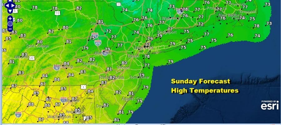
Once again there will be a rather wide range of high temperatures this afternoon. From NYC north and northeast highs will be in the mid to upper 70s. From Philadelphia south and west highs will be in the low to middle 80s. In between those two points highs will be in the upper 70s and lower 80s.
SATELLITE
Note the clouds off the Mid Atlantic coast are due to low pressure that has developed there. That low will drift southeastward and conditions are actually favorable for tropical cyclone development here. It is forecast to drift southeast and not be an issue. We have another tropical system of more pressing concern for the middle of the new week and that is Ida.
WEATHER RADAR
Before that the atmosphere needs priming and it will get it Monday as our stalled front moves northward and we turn very warm and humid with highs in the mid to upper 80s. A cold front arrives Monday night and ahead of it Monday evening there could be a shower or thunderstorm. Much like all the fronts this summer, stalls just to our south and this sets up the alley way for what will be the remnant system of Ida.
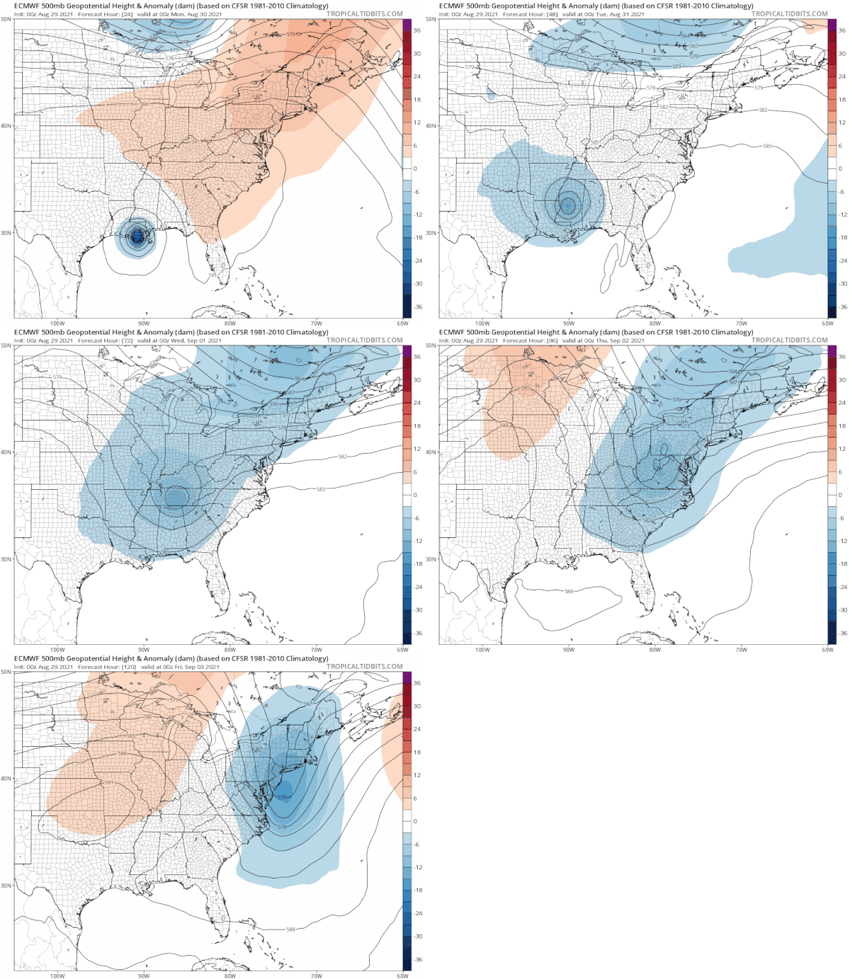
Ida is a category 4 hurricane with top winds of 145 mph. It will make landfall later today and track just to the west of New Orleans. From there heavy rains will spread north and northeastward. While the remnant low will initially track west of the Appalachians, it will merge with an upper trough dropping from Southeastern Canada. It will basically become a deepening frontal wave like we see in the fall or winter except that it will be extra loaded with moisture.
Tuesday brings increasing clouds with highs in the 70s to near 80. That will be followed by a soaking rain developing from west to east early Wednesday morning and lasting until early Thursday morning. At the very least it would seem we are in line for 2 to 4 inches of rain out of this and that certainly means flash flood watches likely going up at some point, probably Monday night or Tuesday for this midweek rainfall. Behind the front it clears out nicely, the humidity drops significantly, and we cool off for the end of the week leading into the Labor Day holiday weekend. By the way it is possible that Ida could reform as a tropical storm once it tracks offshore if the low center passes south of Southern New England. It will be moving away to the northeast but it would be a rather remarkable asterisk to the history of this hurricane.
BE SURE TO DOWNLOAD THE FREE METEOROLOGIST JOE CIOFFI WEATHER APP &
ANGRY BEN’S FREE WEATHER APP “THE ANGRY WEATHERMAN!
MANY THANKS TO TROPICAL TIDBITS & F5 WEATHER FOR THE USE OF MAPS
Please note that with regards to any severe weather, tropical storms, or hurricanes, should a storm be threatening, please consult your local National Weather Service office or your local government officials about what action you should be taking to protect life and property.


