
Springtime In January Temperatures 40s
Springtime In January Temperatures 40s
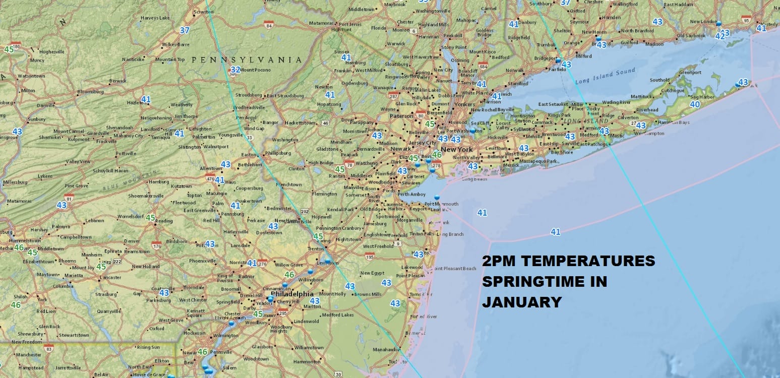
Springtime conditions have suddenly taken hold across the area. Not only are we above freezing for the first time over 2 weeks, but we are actually above average for the day. Considering how cold it has been, it feels wonderful outside with sunshine and not much wind. We are close to the highs of the day now and colder air is waiting to come in for tonight and Wednesday. It will be nothing extreme but we will be down in the teens to lower 20s tonight. Wednesday looks like a very nice day with sunshine and highs reaching the mid to upper 30s which is where are are supposed to be for this part of January.
REGIONAL RADAR

The next round of weather changes begins on Thursday as we start to warm up back into the 40s with arriving clouds. The temperature forecast for Friday and Saturday is going to be tough for inland areas where there is snow pack. Warm air is going to try and move northward but in situations like this it tends to have a tough time mixing down to the surface. The coast and areas to the south like Central and Southern New Jersey and Southeastern Pennsylvania should reach the 50s but inland it may struggle in the 30s and 40s. Rain and fog will be around Friday as a frontal boundary to the west and a series of waves on that front bring moisture up from the Gulf of Mexico and the Atlantic.
ICE STORM ACROSS OHIO VALLEY AND INTERIOR NORTHEAST

Ingredients for an ice storm seem to be coming together for the Ohio Valley and interior areas of the Northeast Friday and Saturday. The frontal boundary on the NAM seems to want to set up south of some of the other models and this is important for areas north and west of the coast. We also have a bitter cold air mass pushing into the Upper Midwest. Part of that high will build east into Southeastern Canada. We will have to watch this closely as cold air may try to bleed southward Friday night and Saturday across the Northeast. Right now it would seem that areas north and west of Route 84 might be borderline for ice if the cold air bleeds south. We will be watching model developments carefully over the coming days. Right now it appears that the cold air would not push south down to the coast except at the end as the wave goes by. Behind this system it is back to cold weather for Sunday and into next week and we could have an opportunity for snow later next Tuesday as the next disturbance swings down out of Canada.
 GET JOE A CIGAR IF YOU LIKE

FiOS1 News Weather Forecast For Long Island
FiOS1 News Weather Forecast For New Jersey
FiOS1 News Weather Forecast For Hudson Valley


