Some Rain Tonight, Arctic Air Arrives Over the Weekend
With Some Snow Possible Friday Night

Some Rain Tonight, Arctic Air Arrives Over the Weekend
With Some Snow Possible Friday Night

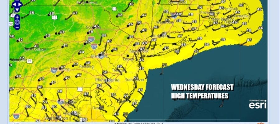
After a day of warm temperatures and near record highs, temperatures are going to settle back a bit today as winds turn more east and southeast ahead of a cold front and a developing wave. Clouds are showing up on satellite loops and we will see cloud cover increasing today. Radars are quiet for now but we will see some rain developing late today and into this evening as the front nears. Highs today will be mostly in the upper 40s and lower 50s.
SATELLITE WITH LIGHTNING STRIKES

WEATHER RADAR

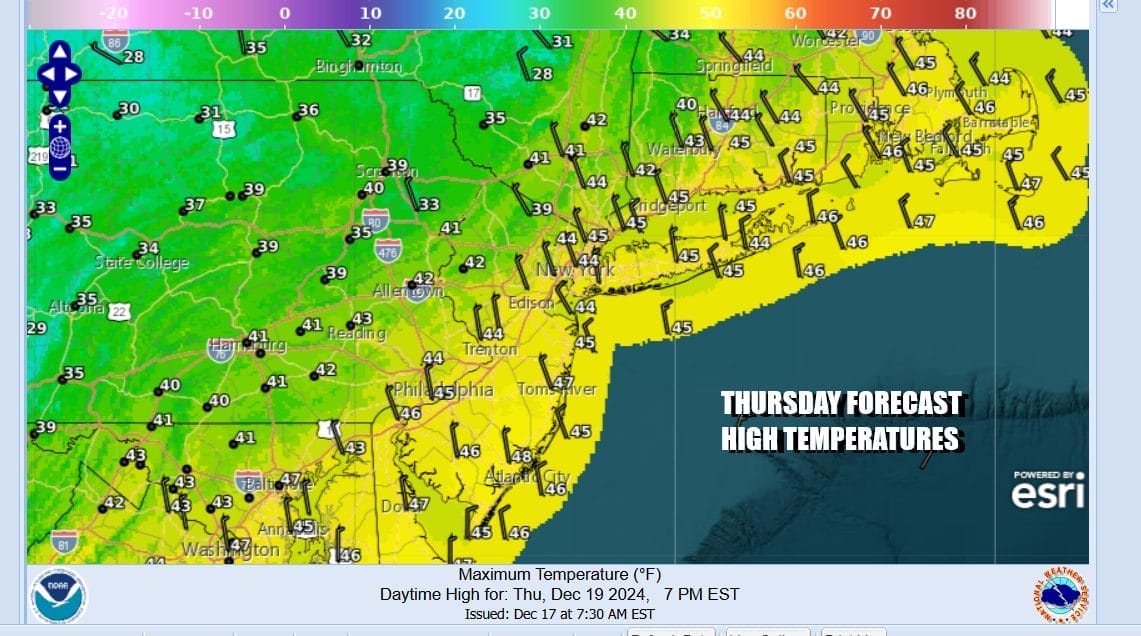
Rainfall overnight will be on the order of a quarter to a half inch and it will be all done before daybreak. Temperatures overnight will be in the upper 30s to around 40. Temperatures will take a step down Thursday with clouds and some sunshine developing. Highs will be mostly in the low to middle 40s.
After tonight’s weather front passes, it will stall offshore as it waits for another stronger upper trough to move into the Northeast and Middle Atlantic states Friday. This upper trough will force another storm system to develop offshore. The trough axis is along the coast which means that the surface low will develop out to the east and then move northeastward to off the coast of Eastern New England Friday night and Saturday.

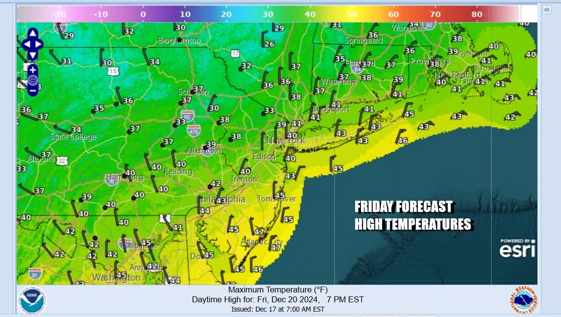
We will miss the moisture from the developing offshore storm however we will see some precipitation from the upper trough as it moves through Friday night into Saturday morning. Snow or a mix will develop Friday evening and as colder air comes in behind it both at the surface and aloft we will see areas of snow overnight into Saturday morning. It won’t be much but a coating to an inch or so seems doable in many areas. Temperatures Friday will be in the low to mid 40s and then drop to the upper 20s to near 30 by Saturday morning.
Very cold air will be coming in for the weekend and into early next week. It will be the coldest air of the young winter season so far as Saturday will be breezy and cold with temperatures settling in the 30s and then dropping to the teens to near 20 Sunday morning. Sunday will be very cold with ineffective sunshine and highs just in the 20s.

Sunday night into Monday morning we will see temperatures drop to the single digits and lower teens in many areas. Monday sees sunshine but again it will be cold with most highs in the upper 20s to some lower 30s. This cold high will likely hang on a little longer into Christmas and there is a chance a disturbance could bring a bit of snow to parts of Eastern Pennsylvania to Southern New England Tuesday night into Christmas Day. We will be taking a closer look at this system in the coming days.
BE SURE TO DOWNLOAD THE FREE METEOROLOGIST JOE CIOFFI WEATHER APP &
ANGRY BEN’S FREE WEATHER APP “THE ANGRY WEATHERMAN!
MANY THANKS TO TROPICAL TIDBITS FOR THE USE OF MAPS
Please note that with regards to any severe weather, tropical storms, or hurricanes, should a storm be threatening, please consult your local National Weather Service office or your local government officials about what action you should be taking to protect life and property.


