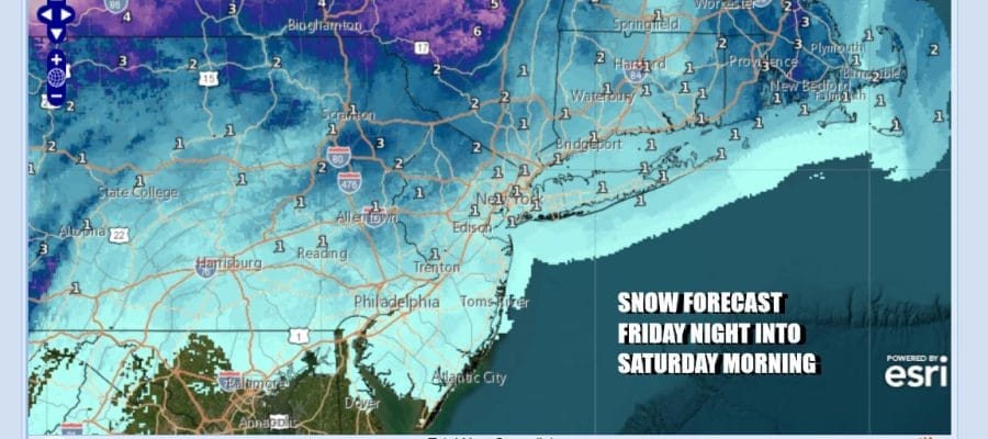
Coating to an Inch Of Snow Possible Friday Night Into Saturday
As Arctic Air Arrives

Coating to an Inch Of Snow Possible Friday Night Into Saturday
As Arctic Air Arrives

Last night’s cold front has now pushed offshore and now we wait for a diving system from the Western Great Lakes that will force storm development offshore Friday night into Saturday morning. We have a strong upper trough that is swinging to the east and that will generate some snow late Friday into early Saturday morning. Though there are some short term models that are showing a more aggressive snowfall, for now we are thinking that we will see a coating to an inch or so. There is probably a little wiggle room for some upside here if the upper trough outperforms. More on this shortly.
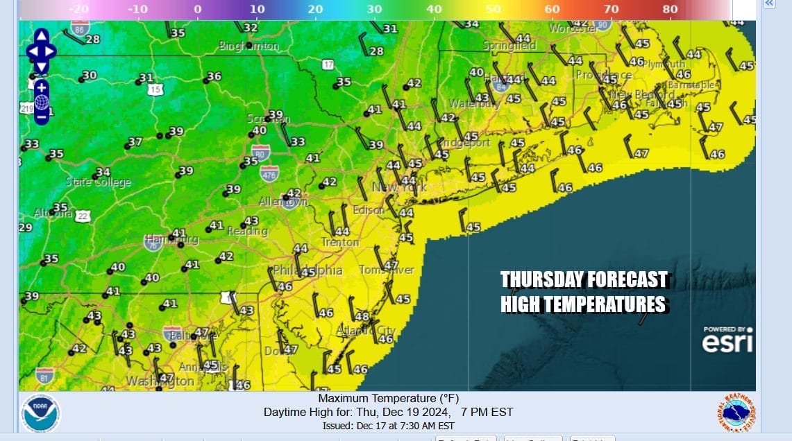
Slightly colder and drier air is moving in today and we should see some sunshine with a northwest breeze. Most high temperatures will be in the low to mid 40s Radars are nice and quiet today with no rain or snow issues. Most lows tonight will be in the 20s inland and lower 30s along the coast and in warmer urban locations.
SATELLITE WITH LIGHTNING STRIKES

WEATHER RADAR

Friday we will see increasing clouds as the low in the Great Lakes begins its dive to the southeast. The coastal storm that develops will start to strengthen but it will also slide out to the northeast. Most of the moisture with the developing low will likely stay offshore. In the meantime we have the upper trough that will be swinging east across the Great Lakes and then reach the Appalachians Friday night and then offshore Saturday morning.

A second trough follows the first one and that will bring down arctic air. The separation of the two systems keeps this storm from getting too out of hand. However it will be worth monitoring the situation closely given the dynamics aloft and room for a surprise to happen for someone. Again for now we are thinking along the lines of a coating to an inch should be the mostly outcome with some colder areas perhaps getting an inch or two. This is the general outlook for Eastern Pennsylvania to Southern New England. It is worth noting that the 2 weather systems we have seen in the last 2 weeks have produced surprises.

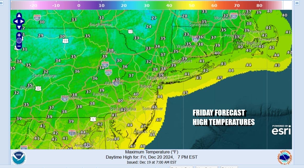
Overall Friday look for cloudy skies. A mix of rain and snow will develop along the coast and we will see some snow to develop inland later in the day into Friday night. Note that the areas of precipitation are likely to be patchy and uneven. Temperatures Friday will be mostly in the upper 30s and lower 40s. Temperatures Friday night will drop to the upper 20s and lower 30s.
There will still be on and off areas of light snow Saturday morning as the second upper trough moves through especially near the coast. Otherwise will for increasing northerly winds during Saturday. Temperatures Saturday will hover in the upper 20s and lower 30s for much of the day as the arctic air begins to drain southward across the Northeast and Mid Atlantic states.

Saturday night into Sunday morning will be very cold with most lows in the teens. Sunday look for ineffective sunshine with a cold north wind. Temperatures Sunday will be in the 20s all day and then Sunday night into Monday morning we will see the coldest temperatures of the young winter season with lows in the single digits in many inland areas from Northern New Jersey to Southern New England and low to mid teens as you head south through New Jersey and Eastern Pennsylvania.

Monday will still be very cold with sunshine but highs will only be in the upper 20s and lower 30s. The core of the cold air will move to the east Monday and Tuesday and that will allow temperatures to moderate some as we head into Christmas Eve and Christmas Day. We will be also watching a disturbance moving eastward early next week for signs that we could see some precipitation for Tuesday night into Wednesday Christmas Day.
BE SURE TO DOWNLOAD THE FREE METEOROLOGIST JOE CIOFFI WEATHER APP &
ANGRY BEN’S FREE WEATHER APP “THE ANGRY WEATHERMAN!
MANY THANKS TO TROPICAL TIDBITS FOR THE USE OF MAPS
Please note that with regards to any severe weather, tropical storms, or hurricanes, should a storm be threatening, please consult your local National Weather Service office or your local government officials about what action you should be taking to protect life and property.


