Record Highs Possible Ahead of More Rain And Cold Air Late Week & Weekend

Record Highs Possible Ahead of More Rain And Cold Air Late Week & Weekend

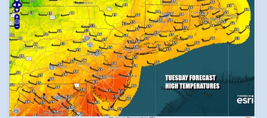
A warm front has passed by and now we are into a very warm Tuesday. We will be burning through the leftover clouds and transitioning over to sunshine. Thermometers have no where to go but up as there is really nothing to stop temperatures from reaching the upper 50s and lower 60s. Some weather stations could see record highs this afternoon especially those with small data sets. Overnight rains are well to the east and radars are going to be nice and quiet all day long.
SATELLITE WITH LIGHTNING STRIKES

WEATHER RADAR

Skies should be nice and clear tonight with light winds so morning lows will bottom in the 30s except for low 40s in warmer urban locations. Wednesday will start with sunshine but clouds will arrive as we do have an approaching cold front. Winds off the ocean and the increasing clouds cover will mean cooler temperatures in the upper 40s and lower 50s for highs.

This cold front will be moving through Wednesday night and there will be a wave developing on the front. We look for some rain to develop from southwest to northeast late in the day Wednesday and then moving out early Thursday morning. The front passes offshore and stalls as it waits for energy dropping into the Northern Plains and Western Great Lakes to move southeastward.

That energy we just spoke off will force another storm to develop on that stalled front. The low forms just offshore and then heads northeast. While it will be a close call, it seems that most if not all the precipitation will stay to the east. However the storm does help to pull down very cold air and that cold air will arrive once the storm departs starting Friday night. This weekend and into Monday morning of next week will be the coldest air of the very young winter season. By Sunday morning we will see lows in the teens everywhere. By Monday morning we will see lows in the lower teens and single digits inland. The weekend will be dry however with no snow in the forecast other than maybe a passing snow shower Friday night or early Saturday morning as the upper trough moves through and the cold air arrives. There is a low chance that the coastal low could be further west and graze the area with some snow Friday night but this seems a long shot at this stage.
BE SURE TO DOWNLOAD THE FREE METEOROLOGIST JOE CIOFFI WEATHER APP &
ANGRY BEN’S FREE WEATHER APP “THE ANGRY WEATHERMAN!
MANY THANKS TO TROPICAL TIDBITS FOR THE USE OF MAPS
Please note that with regards to any severe weather, tropical storms, or hurricanes, should a storm be threatening, please consult your local National Weather Service office or your local government officials about what action you should be taking to protect life and property.


