DOWNLOAD MY NEW FREE JOESTRADAMUS WEATHER APP FOR ANDROID
THE APP IS ABSOLUTELY FREE TO ALL BUT CONSIDERING SUBSCRIBING TO PATREON FOR A WEATHER EXPERIENCE FREE OF ADS, EXCLUSIVE VIDEOS FOR MEMBERS ONLY AND MUCH MORE…STARTS AT $2 A MONTH..MESSAGE ME AT ANY TIME
Snow Thursday Night Friday Morning Stronger Storm Weekend
We have a fairly solid line of clouds rolling in from the west. I though that at least we would see some sunshine today but apparently this is not going to be the case. This is the next cold front that is rolling through. It will be moving through with no precipitation of consequence but the clouds will hold the temperatures down a bit and highs will likely be in the upper 30s to perhaps a few lower 40s. The colder air has arrivied in Upstate NY around the Great Lakes and we are seeing some lake effect action going on there.
EASTERN SATELLITE

REGIONAL RADAR

Tonight it turns colder again with temperatures in the mid teens to lower 20s in most places as skies should at least partially clear out. Then Thursday we see the first of two weather systems and the inital approach with clouds coming back in and highs just in the low to at best middle 30s. This system is weak and will move along with its limited moisture. I don’t see much upside here so it will be basically a 1 to 2 inch broad brush snow fall. Some areas will get a bit more and some will get a bit less. Near the coast it will probably be more like a coating. This won’t be a big deal. Snow develops between 7pm and 11pm across Eastern Pennylvania and New Jersey and then from New York City Hudson Valley, Connecticut, Long Island a little after midnight.
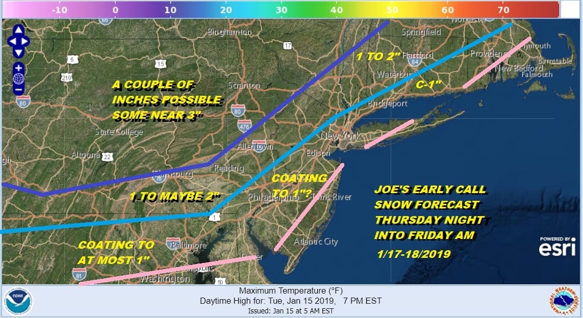
This was the early call from 2 days ago and I think this still holds up pretty well. Once all this ends tomorrow morning (during the morning commute) we see improving weather conditions and then it is on the over talked about system for the weekend.
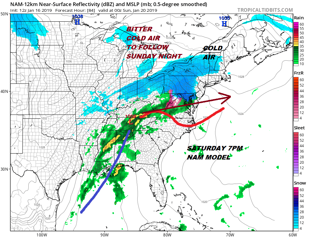
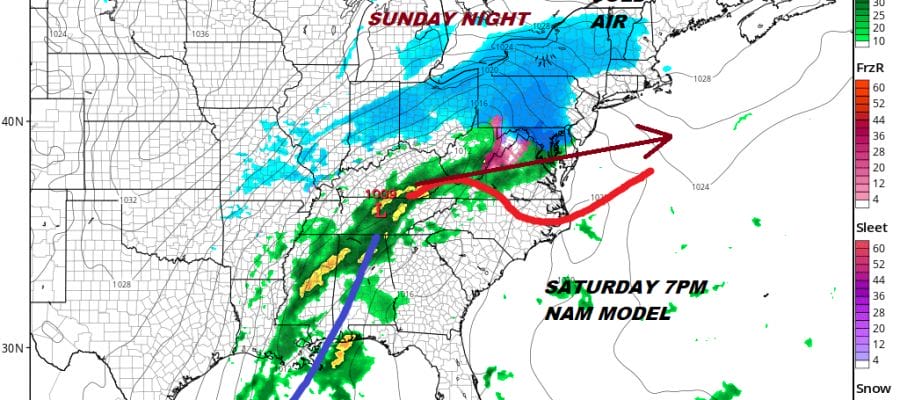
The new NAM model continues right on course with the colder trend it started last night. Snow looks to be developing across Pennsylvania southward into Maryland. The NAM suggests a much colder surface on Saturday with the strong high to the north. Also the flatter look in the upper air continues to appear in this model sequence which favors a colder solution for this. From here it becomes how far north the rain snow line gets before it ultimately collapses again Sunday on the backside. The colder front end would significantly juice up snow total potential here for all areas. These are short term forecast headaches that will be worked out in the coming days.
Once this is over with later Sunday bitter cold air will be here Sunday night and Monday with lows in the single digits to low teens and highs Monday only back into the 20s. This of course comes complete with a biting wind and anything that falls or melts will refreeze and do so quickly Sunday afternoon and evening as the cold air comes.
MANY THANKS TO TROPICAL TIDBITS FOR THE USE OF MAPS
Please note that with regards to any tropical storms or hurricanes, should a storm be threatening, please consult your local National Weather Service office or your local government officials about what action you should be taking to protect life and property.


