
Snow Threat Friday Saturday Very Cold
Snow Threat Friday Saturday Very Cold
Yesterday’s soaking rain is now history as it moves away to the northeast and now we wait for a cold front to finally pass through bringing drier air, clearing skies, and colder temperatures. The satellite loop this morning shows everything progressing along so we should start to see sky conditions slowly improve today and clearing out tonight. Temperatures today will be in the mild 50s briefly before falling off into the 20s by Thursday morning.


Local radars are nice and quiet this morning so I don’t think we have any showers to worry about. Thursday looks like we will see sunshine giving way to arriving clouds with highs in the 30s. Then we deal with the first of 2 storms. Weather models continue to become more impressive with the first weather system as it taps a little more moisture with each model run. Overnight NAM and GFS models continue to grow a little more robust with precipitation and snow amounts.
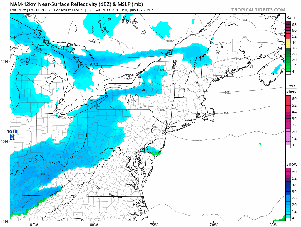
The new NAM model continues this overall trend this morning and opens the door for at least a fewl inches to accumulate along coastal areas with slightly less amounts as you go north and northwest. However even areas north and west now could see a coating to 2 inches.
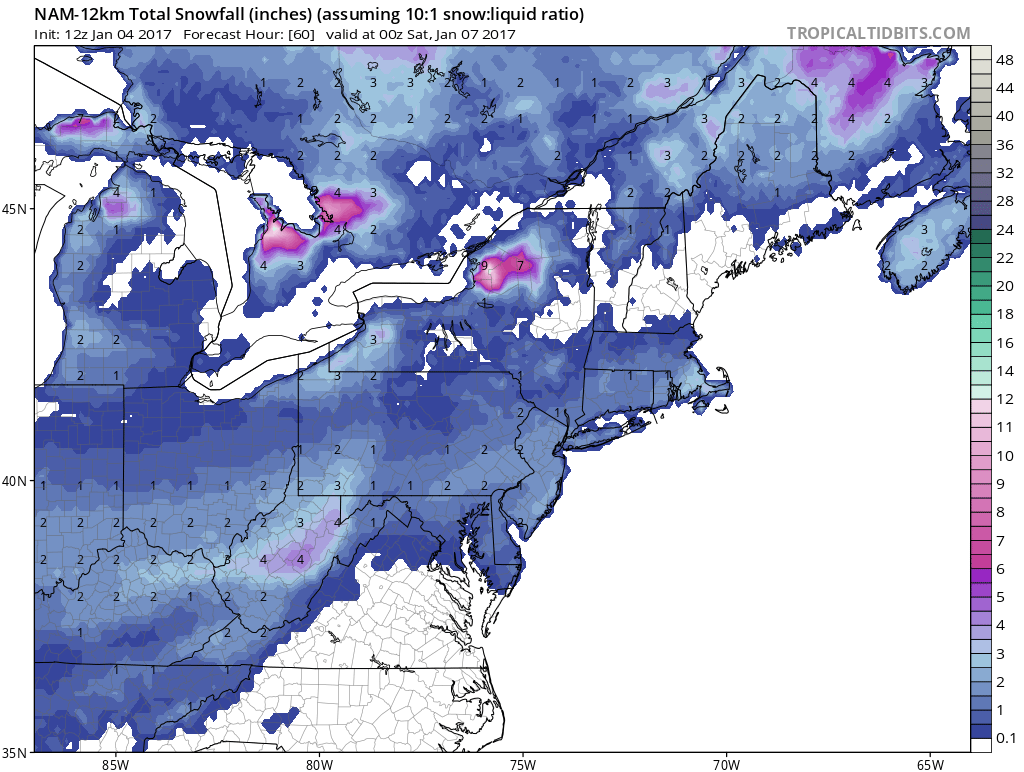
Also we will waiting to see whether weather models offer clues regarding the weekend as the European model last night had a 6 inch plus snowfall for the coast from Delaware to Southern New England but the weather model at least for now continues to stand alone.
SNOW REMOVAL COMPANIES FOR YOUR WINTER NEEDS
LONG ISLAND ROCKLAND COUNTY Connecticut

![]()

ROCKLAND COUNTY TRI STATE SNOW REMOVAL JOHNSTOWN PA


FiOS1 News Weather Forecast For Long Island
FiOS1 News Weather Forecast For New Jersey
FiOS1 News Weather Forecast For Hudson Valley
NATIONAL WEATHER SERVICE SNOW FORECASTS
LATEST JOESTRADAMUS ON THE LONG RANGE
Weather App

Don’t be without Meteorologist Joe Cioffi’s weather app. It is really a meteorologist app because you get my forecasts and my analysis and not some automated computer generated forecast based on the GFS model. This is why your app forecast changes every 6 hours. It is model driven with no human input at all. It gives you an icon, a temperature and no insight whatsoever.
It is a complete weather app to suit your forecast needs. All the weather information you need is right on your phone. Android or I-phone, use it to keep track of all the latest weather information and forecasts. This weather app is also free of advertising so you don’t have to worry about security issues with your device. An accurate forecast and no worries that your device is being compromised.
Use it in conjunction with my website and my facebook and twitter and you have complete weather coverage of all the latest weather and the long range outlook. The website has been redone and upgraded. Its easy to use and everything is archived so you can see how well Joe does or doesn’t do when it comes to forecasts and outlooks.
Just click on the google play button or the apple store button on the sidebar for my app which is on My Weather Concierge. Download the app for free. Subscribe to my forecasts on an ad free environment for just 99 cents a month.
Get my forecasts in the palm of your hand for less than the cost of a cup of Joe!


