DOWNLOAD MY NEW FREE JOESTRADAMUS WEATHER APP FOR ANDROID
THE APP IS ABSOLUTELY FREE TO ALL BUT CONSIDERING SUBSCRIBING TO PATREON FOR A WEATHER EXPERIENCE FREE OF ADS, EXCLUSIVE VIDEOS FOR MEMBERS ONLY AND MUCH MORE…STARTS AT $2 A MONTH..MESSAGE ME AT ANY TIME
Snow Squall Ushers Bitter Cold Air Late Today
Snow lovers should pay attention to the western sky today like you would in the summer time as you wait for the arrival of a line of thunderstorms. We have a rather sharp arctic front that will be moving though the area this afternoon. This squall line has some punch to it. We don’t see snow squalls too often like this but the dynamics here are quite impressive as a deep upper trough swings through.

This squall line is moving through quickly. That loop of the NAM 3km model is from 1pm to 6pm so it flies like a rocket ship. Somebody is going to see a quick inch or maybe even 2 as this thing rips by and winds will gust to 50 mph. You will know its coming because the sky will get very dark ahead of it. Don’t miss it. For those of you in the snow hole this may be your only chance.
EASTERN SATELLITE

REGIONAL RADAR

The squall line is actually beginning to come together on the regional radar in Western Pennsylvania. It looks like a narrow stick as it starts swinging to the east. There isn’t much of anything on the local radars yet as last night’s weather system is now long gone.
LOCAL RADAR NEW YORK CITY

LOCAL RADAR PHILADELPHIA


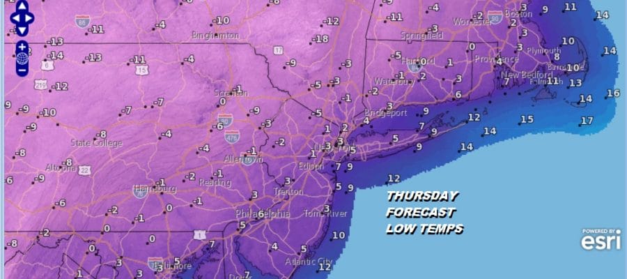
Temperatures today will be in the 20s but approach the low 30s along the immediate coast before the snow squall line moves through. Then after it goes by winds will howl for awhile and temperatures will drop to the single digits in the warmer urban centers but below zero in many inland areas Thursday morning. Wind chills will be -10 to -20.

Thursday we will have sunshine with a gusty wind and highs just into the teens and some places won’t get back to 10. Another bitter night into Friday morning with less wind and lows again single digits to below zero inland. Friday warmer air begins to arrive and there will be a weak area of snow that will head east and pass by to the south of us. Who ever gets in it could see see a cheap thrill coating to an inch. Otherwise it will be just clouds around Friday with highs in the teens to lower 20s.
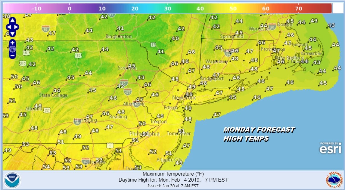
We will warm up in 10 degree steps over the weekend as we should reach into the 30s on Saturday and into the 40s on Sunday. Both weekend days look decent with some sun. And then by Monday we reach the 50s! We can say that barring any surprises, the first week to 10 days of February doesn’t look threatening as far as snow is concerned.
MANY THANKS TO TROPICAL TIDBITS FOR THE USE OF MAPS
Please note that with regards to any tropical storms or hurricanes, should a storm be threatening, please consult your local National Weather Service office or your local government officials about what action you should be taking to protect life and property.


