DOWNLOAD MY NEW FREE JOESTRADAMUS WEATHER APP FOR ALL DEVICES
THE APP IS ABSOLUTELY FREE TO ALL BUT CONSIDERING SUBSCRIBING TO PATREON FOR A WEATHER EXPERIENCE FREE OF ADS, EXCLUSIVE VIDEOS FOR MEMBERS ONLY AND MUCH MORE…STARTS AT $2 A MONTH..MESSAGE ME AT ANY TIME
Snow South Light Spotty Temperatures Moderate
Standby to go above freezing today as the recent cold air mass is moving out. Southwest of NYC you can see lots of clouds across Virginia reaching northward into Southern Pennsylvania. This is a weak low with patchy areas of snow moving east across parts of Virginia with rain just to the south in warmer air in North Carolina.
REGIONAL RADAR
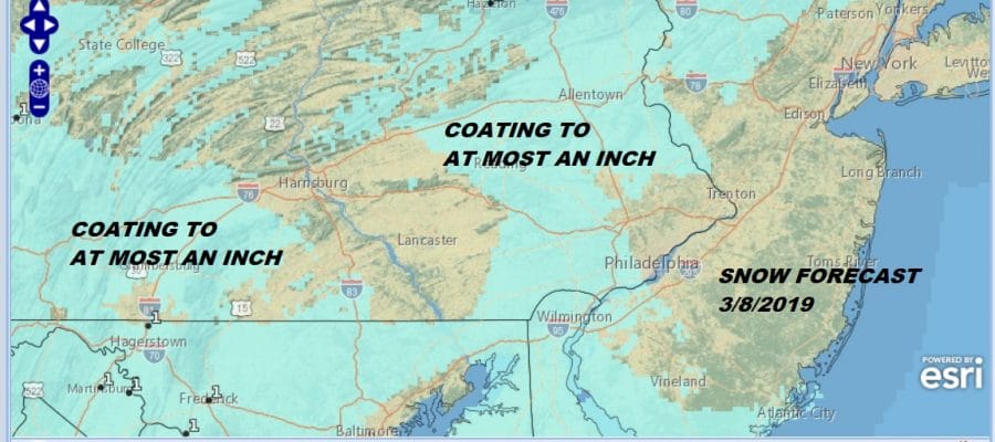
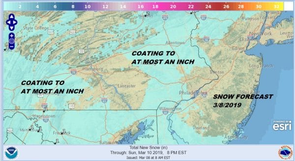
Not much is showing up on local radars at the moment but we expect to see some snow show up later this morning and this afternoon as it moves in from the west. I don’t expect the snow to reach any further north than Southern New Jersey & Southern Pennsylvania.
LOCAL RADAR NEW YORK CITY
LOCAL RADAR PHILADELPHIA

At most I expect nothing more than a coating to maybe…maybe an inch in some places. Snow that falls this afternoon will likely not stick to paved surfaces and it should be mostly done by late afternoon and evening.
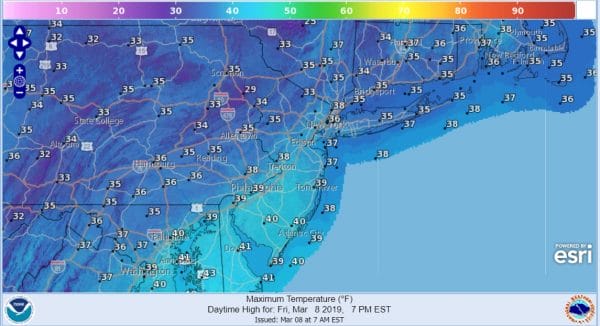
Everywhere else to the north it will be sunshine and high clouds as temperatures reach the 30s to near 40 in some places. It will be the first time we have been above freezing since Monday. It actually will feel a lot warmer when you are standing outside in the warm March sun.
Now on to Saturday where high pressure will be building south from Eastern Canada but this is not a cold high like the one we just went through. We will actually have a nice Saturday for the most part with sunshine at least into the afternoon before clouds arrive. Highs will reach the 40s just about everywhere! Then here comes the next weather system as strong low pressure heads for the Great Lakes.
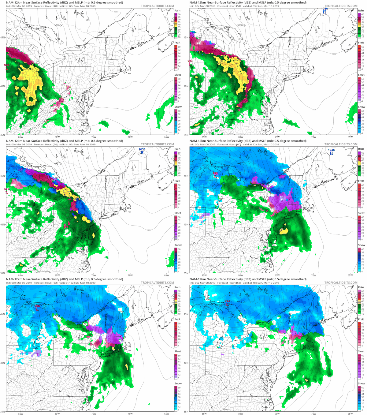
Precipitation arrives Saturday night and initially with cold air aloft there could be a burst of snow or a mix across Northeast Pennsylvania and NW New Jersey to the Hudson Valley (north of 84) into Connecticut at the start. Rain is the story everywhere else. Precipitation arrives between 11pm and 3am from west to east. Any frozen or freezing precipitation changes to rain during Sunday morning and then it ends frmo west to east by noontime. There could be a coating to an inch or two of accumulation north of Route 84 but it will all get washed away. We will be watching the 32 degree line with interest since it has had a habit of getting hung up in the Hudson Valley and interior Connecticut this winter.
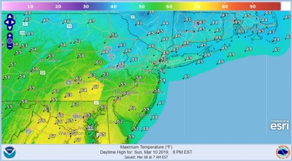
Weather conditions should start to improve during the afternoon. Temperatures Sunday are a tough call. Warm fronts always have a tough time moving northward so look for some areas not getting out of the 40s while areas in South Jersey and Southern Pennsylvania southward will make it into the 60s.
Next week we should have three nice days of sunshine and nothing more than some passing clouds. We should see highs into the 50s Monday and in the 40s to near 50 Tuesday and Wednesday. The next weather system won’t get here until later next week; perhaps on Thursday we will start to see it approach from the west. Even though it isn’t warm weather at least it is seasonable which is a whole lot better than the cold we just went through.
MANY THANKS TO TROPICAL TIDBITS FOR THE USE OF MAPS
Please note that with regards to any tropical storms or hurricanes, should a storm be threatening, please consult your local National Weather Service office or your local government officials about what action you should be taking to protect life and property.

