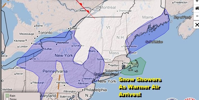
Snow Showers Warm Front Passes Sunshine Warmer Thursday Friday

Weather in 5/Joe & Joe Weather Show Latest Podcast
Snow Showers Warm Front Passes Sunshine Warmer Thursday Friday
We have a warm front that is moving across the Northeast US today which will transition us out of a cold air mass into a warmer air mass. Clouds are covering the Northeast and we are going to have areas of snow showers moving through from time to time and from place to place. There is the outside chance some colder spots could see the ground whitened up. Temperatures today will slowly rise and by the end of the day we will see highs in the upper 30s to lower 40s.
SATELLITE

REGIONAL RADAR

Regional and local radars are picking up on snow showers moving southeastward. Look for the snow showers to weaken as the day wears on.
LOCAL RADAR NEW YORK CITY

LOCAL RADAR PHILADELPHIA


Skies clear out tonight with lows in the upper 20s to middle 30s. Thursday and Friday should be two nice warmer days. Look for sunshine on Thursday with highs in the upper 40s to near 50. Friday’s highs will reach into the 50s.
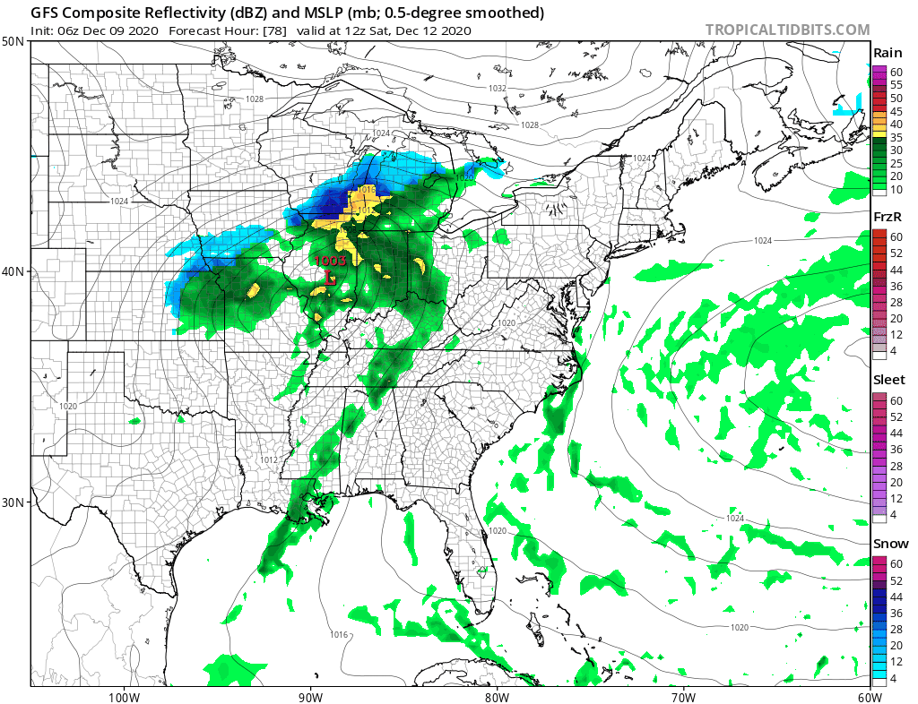
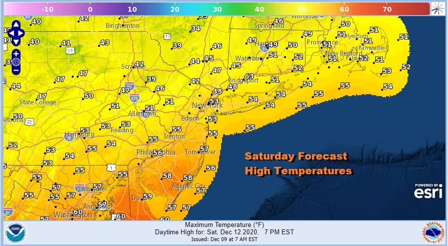
Over the weekend the next weather system heads our way from the Plains to the lower Great Lakes and that swings a cold front to the east. Saturday should be dry for much if not all of the day with sun and arriving clouds. Highs will be in the 50s to near 60.
We will see some showers Saturday night into Sunday morning and then those showers should exit. Leftover clouds will follow with highs early in the day in the 50s and then temperatures settle in the 40s later in the day.

Models diverge in a big way early next week. The cold front on Sunday stalls and we have a very vigorous upper system that shows up on the European and Icon (German) model but is much flatter and more progressive on other models.
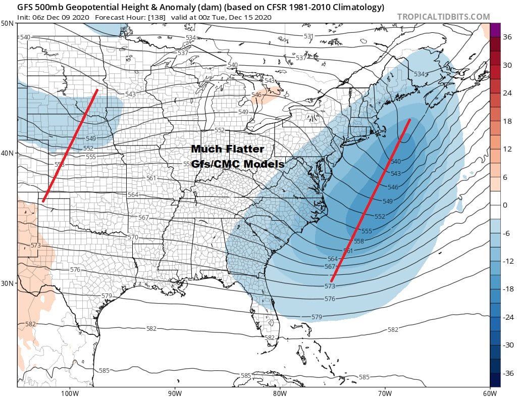
The European’s construction of the upper air actually leads to a cold snowy scenario for Southern New England down to the Mid Atlantic states while the other models lead to a cold dry start to next week. Whether the GFS or European model is right is a short term issue but the split flow northern and southern jet stream split is evident on both models for the next 2 weeks. This means that we will be timing out both the north and the south and looking to see if the two streams phase or stay separate. This might lead to events like we saw last weekend with colder air trying to bleed southward if these weather systems time out perfectly. It will be a double challenge going forward.
BE SURE TO DOWNLOAD THE FREE METEOROLOGIST JOE CIOFFI WEATHER APP &
ANGRY BEN’S FREE WEATHER APP “THE ANGRY WEATHERMAN!
MANY THANKS TO TROPICAL TIDBITS FOR THE USE OF MAPS
Please note that with regards to any severe weather, tropical storms, or hurricanes, should a storm be threatening, please consult your local National Weather Service office or your local government officials about what action you should be taking to protect life and property.


