Snow Showers Today, Summer Mid & Late Week
Snow Showers Today, Summer Mid & Late Week
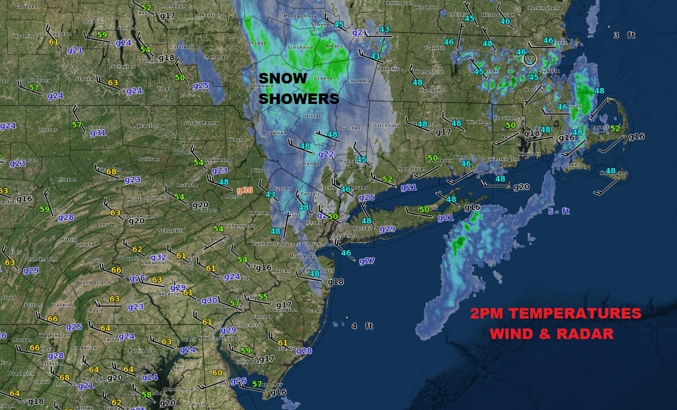
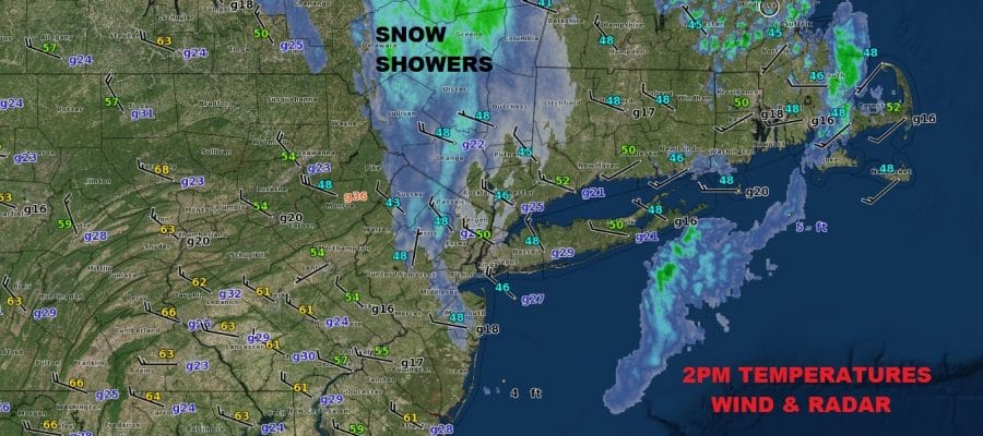
It is the last day of April & I suppose it shouldn’t be a huge shock that some elevated areas well to the north and west of the coast saw some snow showers. Some areas in the Catskills saw a coating to a couple of inches in elevated areas. Others as far south as Bergen County in New Jersey saw some snow flakes flying around. It is a cold afternoon with midday temperatures in the 40s and lower 50s. Some sun is breaking through cloud cover here and there. This is the last gasp from a strong upper air storm in New England that will be pulling away to the east tonight and Tuesday.
US SATELLITE

REGIONAL RADAR

You can see the counterclockwise rotation around the upper low to the north with a band of rain and snow showers moving southeastward. There could be one more round of showers going into this evening. Once the upper low pulls out, the warmer air to the west will come rushing in on Tuesday.
LOCAL RADAR NEW YORK CITY

LOCAL RADAR PHILADELPHIA


Tuesday we will see plenty of sunshine and temperatures will shoot up into the 70s. Wednesday and Thursday we will suddenly feel like it is summer with highs both days in most areas in the 80s. Even coastal areas will see the sea breeze in a limited way later in the afternoon.
WEDNESDAY AFTERNOON FORECAST HIGH TEMPERATURES
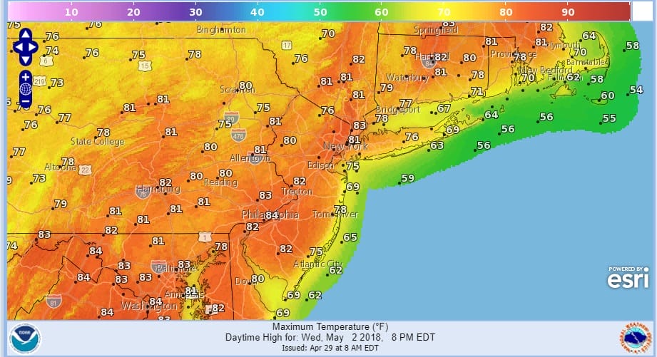
80s will last into Friday when the next cold front arrives with showers late Friday and Friday night. Weather conditions improve for the weekend with sunshine and highs in the 70s.
 GET JOE A CIGAR IF YOU LIKE

FiOS1 News Weather Forecast For Long Island
FiOS1 News Weather Forecast For New Jersey
FiOS1 News Weather Forecast For Hudson Valley


