Chilly Monday Warmer Air Moving East Tuesday Through Friday
Chilly Monday Warmer Air Moving East Tuesday Through Friday
One thing that stands out on the satellite picture this morning is the comma shaped swirl that goes back into New England & Upstate NY. This represents a strong upper low that is creating a cold unstable atmosphere in the Northeast today with clouds and even a few showers that are showing up on the radar. It is a chilly morning with temperatures mostly in the 40s. Clouds are going to keep a lid on temperatures today with most highs in the mid 50s to lower 60s.
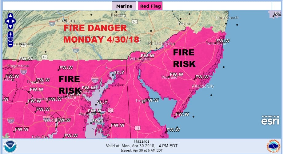
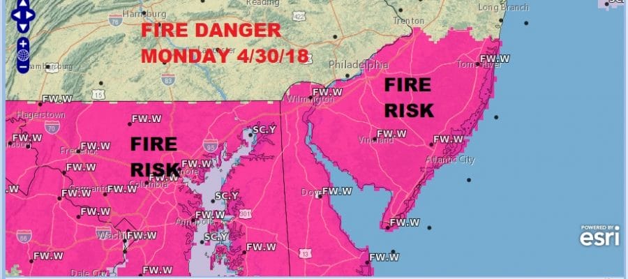
Areas in Southern New Jersey (south of Route 195) southward today are under a red flag warning due to dry conditions and the risk for fires so do be cautious. We are likely to see these develop over the next several days.
US SATELLITE

REGIONAL RADAR

LOCAL RADAR NEW YORK CITY

LOCAL RADAR PHILADELPHIA


Starting Tuesday, temperatures rise. Clouds will pull out tonight and Tuesday should be partly to mostly sunny with highs reaching into the 70s in most places. High pressure builds off the South Atlantic coast creating a dry west or even a west northwest wind. Low humidity, rising temperatures and a bit of wind set the table for some red flag warnings so don’t be surprised if they are raised to warn of fire danger.
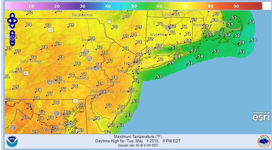
There are no changes in the weather outlook for the rest of the week. Sunshine and very warm temperatures will be with us Wednesday and Thursday with highs in the 80s. Friday will be the last warm day with highs in the 80s with the risk for showers. The next cold front will arrive later Friday and Friday night with some showers followed by cooler air with seasonal temperatures this coming weekend.
 GET JOE A CIGAR IF YOU LIKE

FiOS1 News Weather Forecast For Long Island
FiOS1 News Weather Forecast For New Jersey
FiOS1 News Weather Forecast For Hudson Valley


