Snow Showers Around Nice Weekend & Outlook For Next Storm
Snow Showers Around Nice Weekend & Outlook For Next Storm
Some of you may have woken to a fresh dusting of snow this morning. You can thank Wednesday’s storm which is still sitting off the coast of Nova Scotia this morning and churning away. This will be another day of upper air disturbances rotating around it meaning we will see clouds and the occasional snow shower. It is cold this morning with temperatures starting out in the 20s. Highs should make it back into the lower 40s in most places though sunshine will be limited. The chilly flow of air will be with us through the weekend.
US SATELLITE

REGIONAL RADAR

Regional and local radars show the scattering of snow showers across the Northeast US. The storm should move to more to the east tonight which should bring an end to snow showers and allow for skies to clear out somewhat. Another cold night ahead however as temperatures will drop to the 20s to near 30 by Saturday morning
LOCAL RADAR NEW YORK CITY

LOCAL RADAR PHILADELPHIA


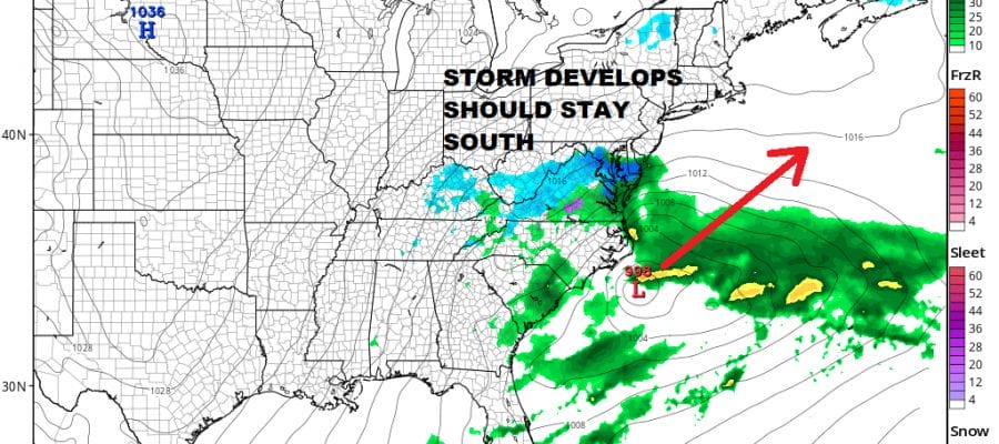
There are no weather issues for the weekend. We should see some sunshine both Saturday and Sunday with highs into the 40s both days. Clouds will increase later Sunday as the next storm heads from the Gulf States to the Middle Atlantic Coast Sunday night and Monday. Weather models are suggesting this system will stay south and east of us.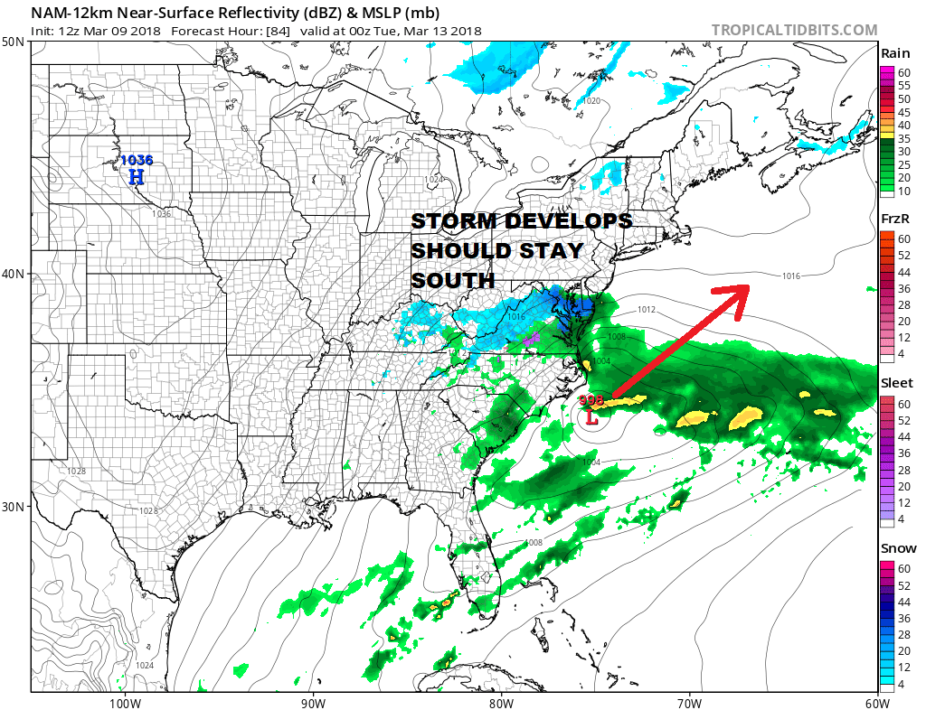
There are still lots of questions regarding the outcome of this next system which JOESTRADAMUS explores later today.
 GET JOE A CIGAR IF YOU LIKE

FiOS1 News Weather Forecast For Long Island
FiOS1 News Weather Forecast For New Jersey
FiOS1 News Weather Forecast For Hudson Valley


