Snow Looks Like A Miss Second Wave Suggests Caution Coastal Areas
Snow Looks Like A Miss
Second Wave Suggests Caution Coastal Areas
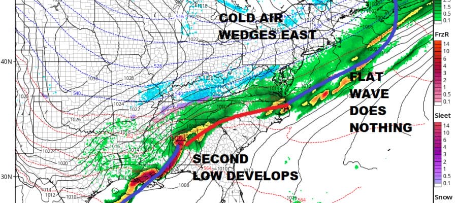
I suppose one can look at this and say that if it is going to find a way to snow this weekend it will. The entire evolution of this system has changed considerably since yesterday and while I think now this is mostly a miss, some caution is in order as weather models have a developing second wave that moves just offshore Saturday night clipping parts of coastal New Jersey and Long Island but not close enough to cause any snow harm..at least not yet. More on this later. Meanwhile this morning some light precipitation is falling in some areas and we emphasize light here as a warm front attempts to move northward.
US SATELLITE

REGIONAL RADAR
I’m not expecting anything more than light precipitation here out of this as it moves northeast. Along the coast it is rain. Inland it is mostly light snow and it isn’t even enough to whiten the ground as far as we can see. All of this moves northward and this afternoon we will just spend it in clouds. Central and South Jersey and Southeastern Pennsylvania could see some breaks of sun in which case highs could reach the 60s..while places to the north of NYC may have a tough time getting out of the 40s today.
LOCAL RADAR NEW YORK CITY

LOCAL RADAR PHILADELPHIA


Tonight we begin and end with clouds and there could be a few rain showers in the mix. By morning colder air will begin to arrive. Most lows will be in the 30s. Then we watch the evolution of this system for Saturday. The entire flavor of all this has changed over the last few days. The lead low that was supposed to come out as a vigorous wave is barely visible while a second low forms in the Gulf States Saturday morning.
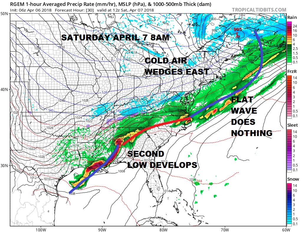
The second low moves northeast and is forecast to pass offshore but just offshore Saturday night. I’m in prove it to me mode. The upper air jet stream would have to be a little sharper as it pivots around to draw this in closer. While it is not impossible, it still seems a bit of a long shot at the moment. For now we will call it cloudy for Saturday and Saturday night with a rain or snow shower with highs in the 40s. Once this goes by weather conditions improve Sunday morning with sunshine but it will be cold. Saturday and Sunday highs will just be in the 40s.
 GET JOE A CIGAR IF YOU LIKE

FiOS1 News Weather Forecast For Long Island
FiOS1 News Weather Forecast For New Jersey
FiOS1 News Weather Forecast For Hudson Valley


