
Snow Ice Rain Wednesday Night Into Thursday As Active Stormy Pattern Develops

Snow Ice Rain Wednesday Night Into Thursday As Active Stormy Pattern Develops

A cold front has passed through overnight. It wasn’t much of a front with just clouds and no real moisture so we shift the winds to northwest today and look ahead to what should be a partly sunny type of day. Temperatures are not exactly in a rush to fall so most highs will be in the 40s to around 50 degrees. Eventually we do have colder temperatures ahead and that comes in tonight. Most lows Wednesday morning will be in the 20s with some colder teens inland under a clear sky.
SATELLITE WITH LIGHTNING STRIKES

WEATHER RADAR

We have no issues for Wednesday as we will see sunshine for much of the day. Some clouds will begin to arrive in the late afternoon and evening. Highs will be mostly in the 30s. The first of 4 or possibly 5 storm systems begins to head our way Wednesday night with snow developing around or a little before daybreak across much of the area.

This system is moving quickly and it doesn’t have a lot to it as far as moisture is concerned. We are talking about a quick half inch or so of total precipitation so obviously this limits how much we can get. Also we have a limited amount of cold air but this cold air is likely to get wedged into the mountains of Pennsylvania and this could create a serious icing situation especially from Western New Jersey westward and southwest into Maryland and Northern Virginia.
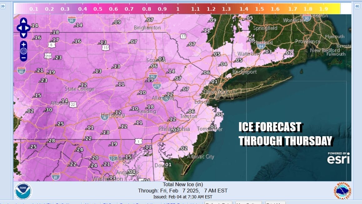
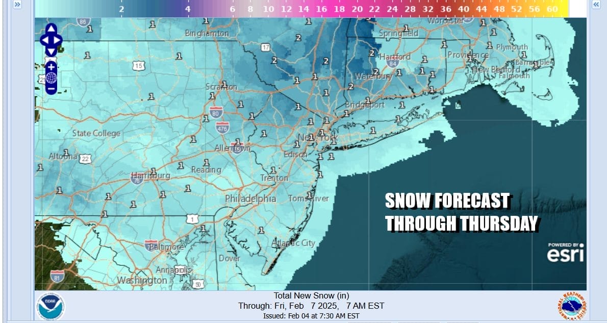
We see the potential for a quarter of an inch or more of ice accretion possible for areas away from the coast and we will be watching temperatures very closely during Thursday morning as they will have a struggle rising. Ahead of any ice is a period of snow which we think accumulates to a coating to an inch or maybe two inches in some places. There is room for some upside in the Hudson Valley and Connecticut where it will be colder for longer.
By late morning and early afternoon this will be ending from southwest to northeast. This will be followed by colder drier air for Friday into Saturday morning. Then as the gfs loop above shows, the next storm system comes east out of the Ohio Valley and it looks like it could be a repeat performance of the first. Snow ice and rain develop in the late afternoon Saturday and then lasts into the early morning hours of Sunday. This system might have a little more moisture with it. Following this we have two storm systems for next week that will be producing snow ice and rain across the Northeast and Mid Atlantic states.
BE SURE TO DOWNLOAD THE FREE METEOROLOGIST JOE CIOFFI WEATHER APP &
ANGRY BEN’S FREE WEATHER APP “THE ANGRY WEATHERMAN!
MANY THANKS TO TROPICAL TIDBITS FOR THE USE OF MAPS
Please note that with regards to any severe weather, tropical storms, or hurricanes, should a storm be threatening, please consult your local National Weather Service office or your local government officials about what action you should be taking to protect life and property.


