Winter Weather Advisory Snow Freezing Rain, Mostly Rain Immediate Coast

Winter Weather Advisory Snow Freezing Rain, Mostly Rain Immediate Coast
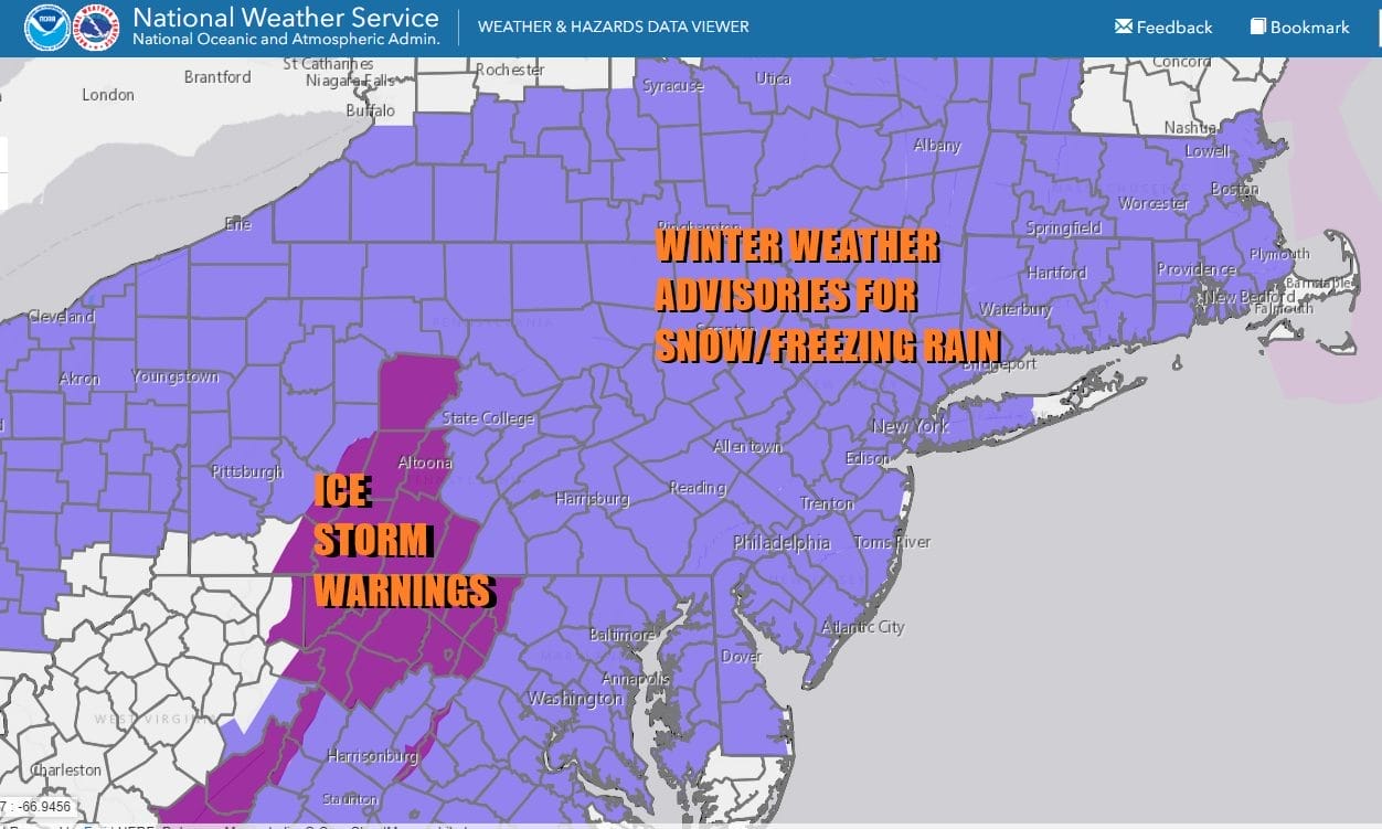
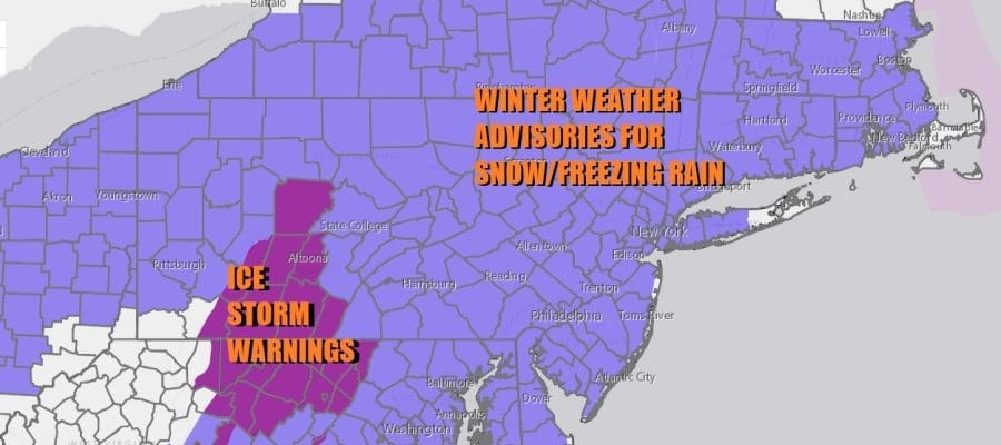
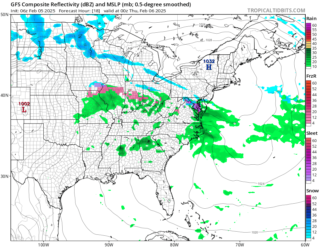
We are setting up for a very messy round of winter weather. Winter Weather Advisories are posted for a very large area of the Northeast and Middle Atlantic states. The Allegheny Mountains in Southwest Pennsylvania south into West Virginia, Western Maryland and Northwest Virginia could see a serious ice storm Thursday. All of the metro areas from Washington & Baltimore to Philiadelphia & New York City to Hartford & Boston are at risk and this is going to seriously impact travelling both by air and by roadways.
SATELLITE WITH LIGHTNING STRIKES

WEATHER RADAR

Satellite and radar loops are already showing the storm system setting up across the Middle Atlantic and Northeast as clouds increase. There is some light precipitation today over parts of the Middle Atlantic but it will be patchy and spotty. Temperatures today will be mostly in the 30s for highs. Then look for snow to develop overnight reaching Philadelphia and Southwest New Jersey around 4am and New York City around 5 or 6am. Snow then spreads into New England during the morning hours after daybreak.
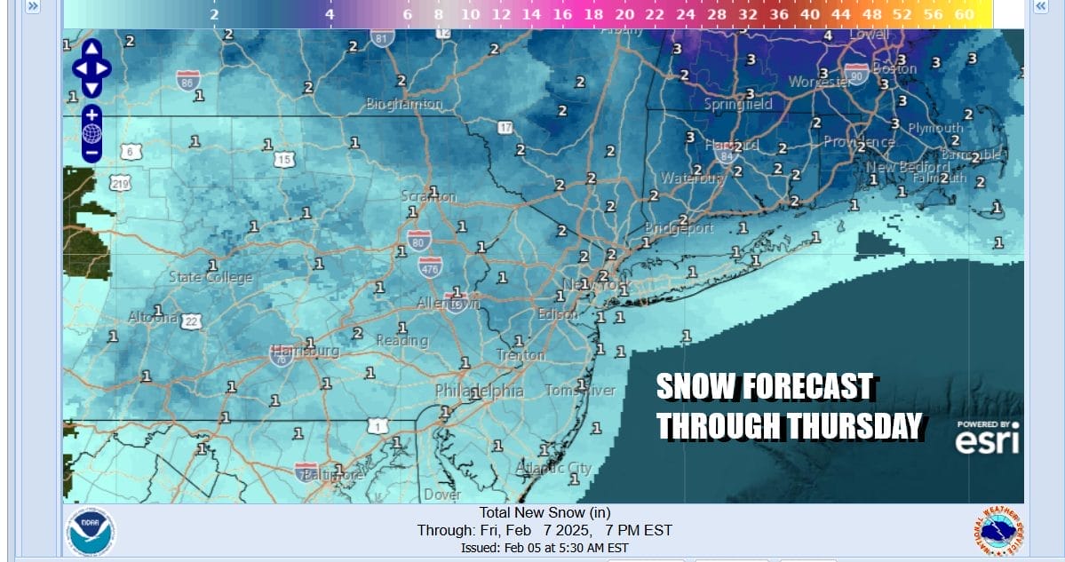
Snow accumlulations should be on the order of a coating to an inch from NYC and Long Island south but areas inland could be in a range of 1 to 2 inches and there might be some 3 inch amounts possible in areas in the Hudson Valley and in the interior of Connecticut. A lot depends on how long cold air hangs on. In situations like this sometimes we can see the cold air hold on stronger than advertised.
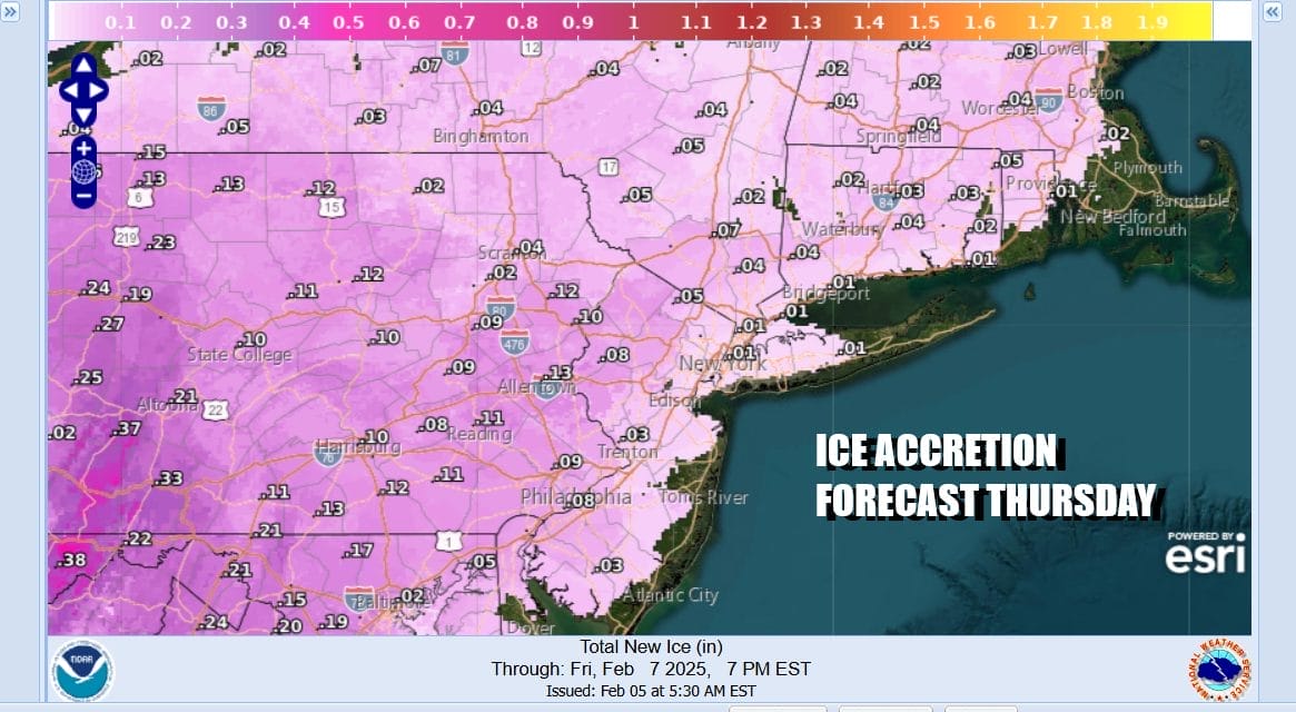
Freezing rain will be the bigger issue especially inland where ice accretion of a tenth of an inch or higher is possible especially in parts of Western New Jersey and back into Pennsylvania. We could see slippery if not dangerous conditions for travelers develop. The good news is that this system is going to be in and out fast and that may prevent this from becoming a widespread ice storm. Temperatures will be in the 30s but for many areas, getting back to freezing will be a struggle. Along the immediate coast we should see temperatures push into the mid and upper 30s during Thursday afternoon but at that point, the precipitation will be long over with.
Friday and Saturday morning will be dry but the next storm system will be heading our way for later Saturday afternoon into early Sunday morning. This system will be similar to this one with snow sleet and freezing rain likely however it may be a little bit colder and a little stronger this time around which could mean higher snow amounts before any change to sleet, freezing rain or rain. An even stronger system looms behind this one for the middle of next week.
BE SURE TO DOWNLOAD THE FREE METEOROLOGIST JOE CIOFFI WEATHER APP &
ANGRY BEN’S FREE WEATHER APP “THE ANGRY WEATHERMAN!
MANY THANKS TO TROPICAL TIDBITS FOR THE USE OF MAPS
Please note that with regards to any severe weather, tropical storms, or hurricanes, should a storm be threatening, please consult your local National Weather Service office or your local government officials about what action you should be taking to protect life and property.


