
Active Weather Pattern Ahead
Snow Sleet Freezing Rain & Rain Wednesday Night into Thursday

Active Weather Pattern Ahead
Snow Sleet Freezing Rain & Rain Wednesday Night into Thursday
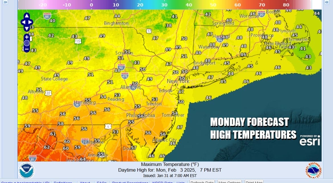
Last night’s warm front left anywhere from a coating to an inch or 2 in most places with up to several inches falling across parts of Southern New England. Now we sit back and wait for a cold front that will be passing through tonight with little fanfare other than a few clouds and a wind shift from southwest to northwest. In the meantime we will see partly sunny skies today and it will be on the mild side with most highs in the upper 40s to middle 50s from north to south. Radars are nice and quiet and should remain so.
SATELLITE WITH LIGHTNING STRIKES

WEATHER RADAR

We will clear skies out tonight. Most lows Tuesday morning will be in the mid 30s to lower 40s. Temperatures will be lower Tuesday but they will still be above average as the colder comes in slowly rather than in a rush. We should see a fair amount of sunshine Tuesday but temperatures will likely top out in the 40s to around 50 degrees or so and then drop to the upper teens to mid 20s Wednesday morning. Wednesday we should see sunshine giving way to late day arriving clouds. Most highs will be just into the 30s.
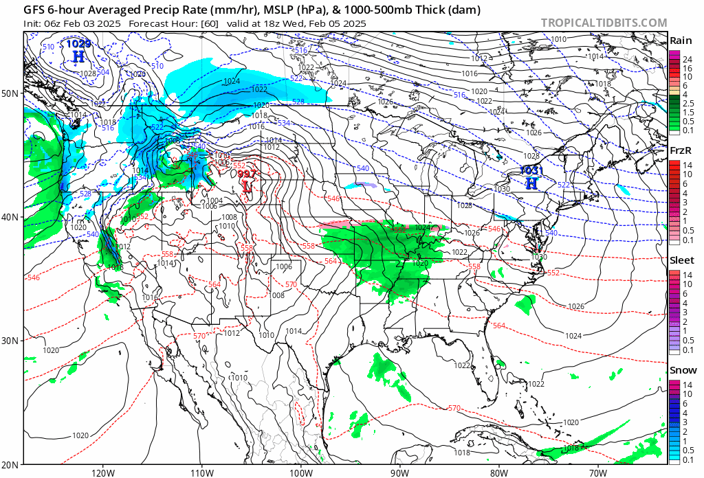
Wednesday night and Thursday we will see the first of two storm systems. Colder air is going to try and hang on ahead of the low. This is not a particularly strong weather system but it will produce issues around snow sleet freezing rain especially for inland areas. Freezing rain could be a big issue for inland New Jersey, the Hudson Valley and Connecticut.
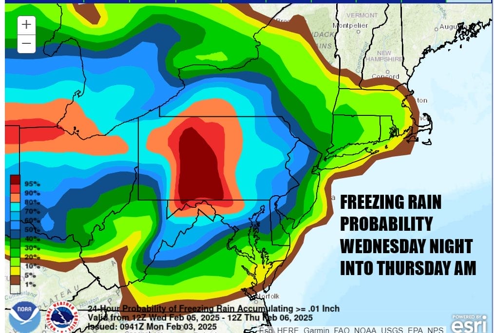
This system has now come into the short range of the Weather Prediction Center probability forecast tool and we see a 50 percent of higher chance for freezing rain accretion for much of New Jersey and especially for Pennsylvania and northeastward into the Catskills. This map only takes us through Thursday morning and precipitation is likely continue for much of Thursday. There could also be a short period of snow on the front end that could leave a coating to an inch or 2 before we see a change over to freezing rain inland and just rain along the immediate cooast.
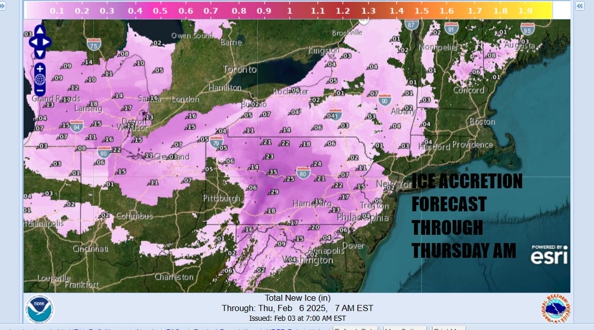
The National Weather Service ice accretion forecast through Thursday morning shows a rather robust amount of icing developing inland especially across Pennsylvania and bakc to Northern Ohio & Michigan. It will just be starting out across Upstate NY and Western New England. These maps will both be updated at some point to cover the precipitation that falls for the rest of Thursday. Models show another system very similar to this coming for Saturday and Saturday night. There may be a little bit more of colder air for the weekend system so we could see perhaps more snow ahead of a chance to sleet freezing rain and rain. We will be monitoring both weather systems closely as the week moves along.


