Snow Ice Forecasts Wednesday 02072018 National Weather Service Forecast Maps
Snow Ice Forecasts Wednesday 02072018
National Weather Service Forecast Maps Updated
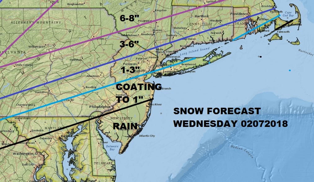
My snow forecast map above from yesterday remains the same. I’ve made no changes here. Snow develops during the morning between 7 and 10am and then it is a matter of how much snow falls before a change to rain occurs from south to north around lunch time. The National Weather Service maps below are all up and updated.
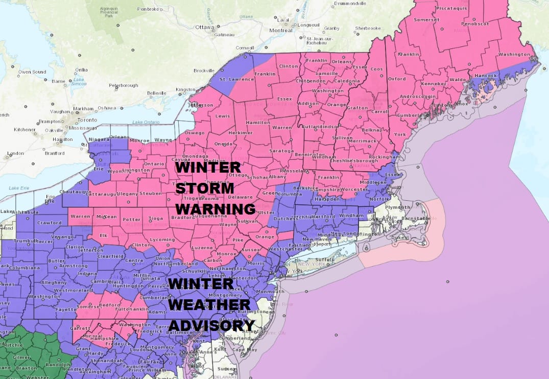
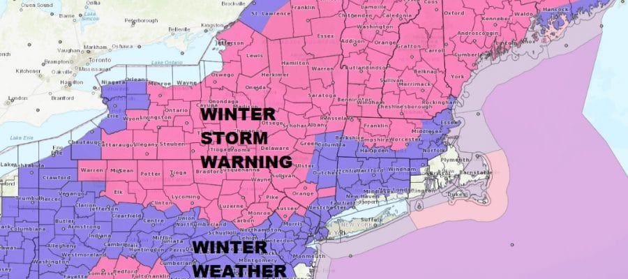
Much of the Northeast is under a Winter Storm Warning with Winter Weather Advisories posted for most areas of the Middle Atlantic States. Coastal areas probably will be spared any serious issues though there could be a quick burst of snow in those areas Wednesday morning. The biggest issue is the timing of the 32 degree line and how far north it gets. The second issue may come later Wednesday night into Thursday morning and temperatures fall into the 20s. Any standing moisture will refreeze.

GET JOE A CIGAR SO HE CAN RELAX!
NEW YORK CITY AND VICINITY SNOW

NEW YORK CITY & VICINITY ICE

NEW JERSEY SE PA & VICINITY ICE
NEW JERSEY & PARTS OF NE PA

SOUTHERN AND SOUTHEAST NEW ENGLAND

NORTHERN NEW ENGLAND

WESTERN NEW ENGLAND

MIDDLE AND UPPER HUDSON VALLEY

CENTRAL NEW YORK & NE PA

WESTERN NEW YORK

CENTRAL & SOUTH CENTRAL PA

VIRGINIA & MARYLAND

DAILY NORTHEAST SNOWFALL

Please be advised that these are National Weather Service Forecast Maps and they auto update. Each office may update at different times and some offices are slower to update then others. Maps are usually updated before 5am and & 5pm however they may be updated at other times depending on forecast conditions. These are not my forecasts. My forecasts can be found on the JOE’S SNOWFORECAST PAGE. Individual forecasts for specific areas may also be found when conditions warrant on the my area forecasts. Those can be found on the website menu. Click on forecasts and then select your specific area.