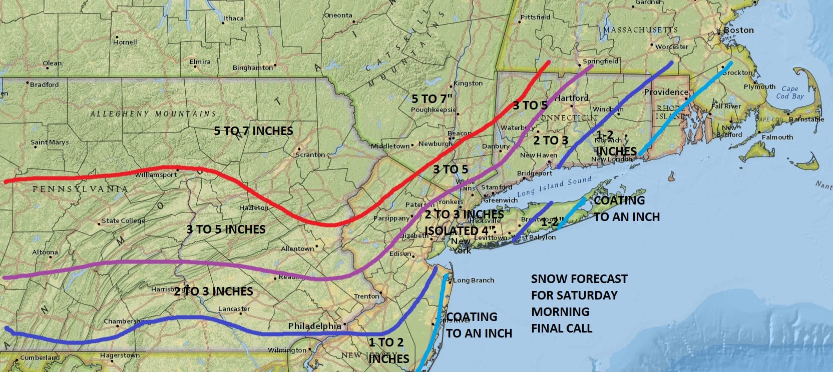
Snow Forecast Maps Updated Friday Evening
Snow Forecast Maps Updated Friday Evening
I have made no changes in my forecast for now and remain fairly confident based on the afternoon weather model runs. Models are leaning a shade colder which could mean an extra hour or 2 of snow. This opens the door to an upside surprise to some coastal area amounts so we need to be on the alert for this possibility. Inland numbers look pretty solid to me. Snow is beginning to show up on the radar. We might see some snow break out after midnight in the cold air. The heaviest snow should be from 4am to 10am in most areas. There could be a period of freezing rain inland before the precipitation moves out by early afternoon. Most areas would have long changed to rain by then as temperatures rise.


The maps below are the National Weather Service forecast snow maps with the most likely snowfall prediction.


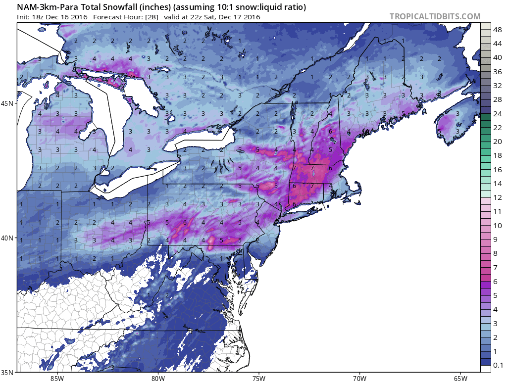
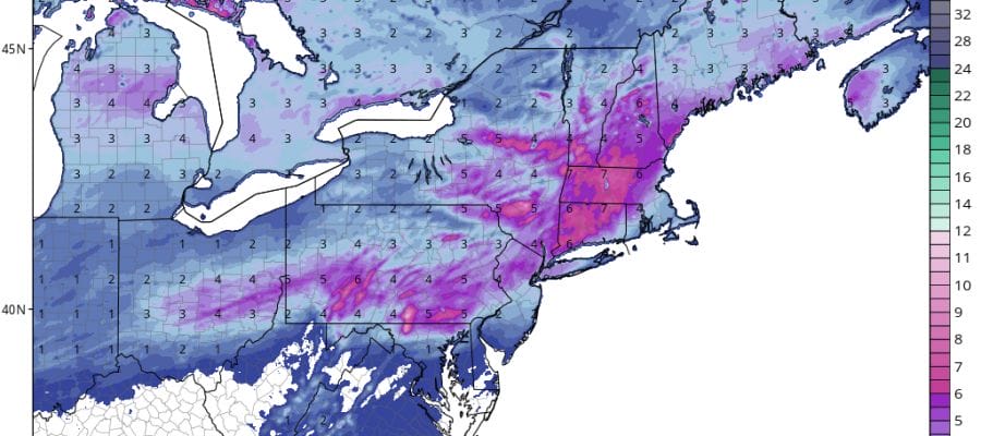
Latest weather models continue to show a slightly colder more robust snowfall for overnight into Saturday morning. NAM RGEM GFS and European Models as well as other short range models continue to move in this direction.