
Snow Forecast Maps Through Christmas Day
Snow Forecast Maps Through Christmas Day
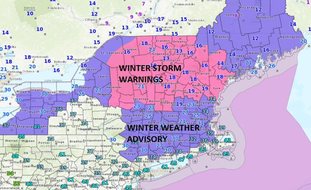
The National Weather Service snow forecast maps are up for the Eastern US and the maps for our area show snow forecasts for Sunday night into Monday morning while the others may show snowfall only through Saturday as there are two lows in play here. The first one for tonight and Saturday is impacting upstate NY & New England while the second is going to impact much of the Northeast Sunday night into Monday. The White Christmas no White Christmas line seems to be running right through New York City to just west of Philadelphia at the moment as the boundary of the cold air will be lying right on top of us Sunday night into Monday morning so where that low develops and how it develops will be key to whether that White Christmas line can shift a little further to the south.

GET JOE A CIGAR SO HE CAN RELAX!
NEW YORK CITY AND VICINITY SNOW

NEW YORK CITY & VICINITY ICE

NEW JERSEY & PARTS OF NE PA

SOUTHERN AND SOUTHEAST NEW ENGLAND

NORTHERN NEW ENGLAND

WESTERN NEW ENGLAND

MIDDLE AND UPPER HUDSON VALLEY

CENTRAL NEW YORK & NE PA

WESTERN NEW YORK

CENTRAL & SOUTH CENTRAL PA

VIRGINIA & MARYLAND

DAILY NORTHEAST SNOWFALL

Please be advised that these are National Weather Service Forecast Maps and they auto update. Each office may update at different times and some offices are slower to update then others. Maps are usually updated before 5am and & 5pm however they may be updated at other times depending on forecast conditions. These are not my forecasts. My forecasts can be found on the JOE’S SNOWFORECAST PAGE. Individual forecasts for specific areas may also be found when conditions warrant on the my area forecasts. Those can be found on the website menu. Click on forecasts and then select your specific area.