Snow Forecast Friday Saturday Unusually Cold Northeast Mid Atlantic Mothers Day Weekend
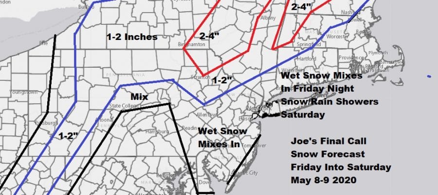
Hopefully this is the last time I will have to draw a snow forecast map and this is as late as I have very had to create one. The map above is from the National Weather Service digital data base which shows what all the local NWS offices are forecasting all plotted on one map. You can see the individual NWS forecast maps on the Meteorologist Joe Cioffi weather app which you can download for free. Below is my forecast map for Friday night and Saturday.
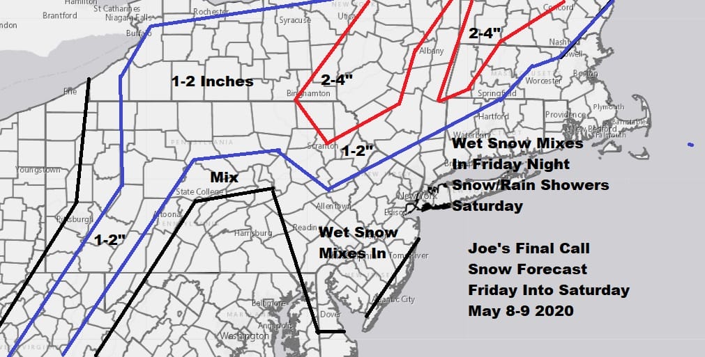
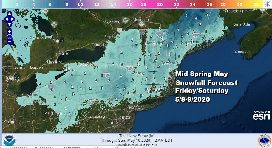
For the coast and most areas it will just be some wet snow mixing in Friday night as low pressure goes by. Even a trace of snow would be a record snowfall for most areas. Well inland in extreme Northwest New Jersey and into Northern Pennsylvania as well as upstate NY and New England down to Route 84 in Connecticut, this is where you could wind up with a coating to a couple of inches mainly on colder surfaces and in elevated areas above 1500 feet or so. That means the Catskills, Poconos, Berkshires, and Adirondacks should see the highest amounts. Amounts will be highest in Maine where 3 to 6 inches could fall in many areas but then again it is Maine!
SATELLITE

While most of the area from Northeast Virginia to Southern New England are seeing nice weather this evening, we are seeing showers moving across Upstate NY and Pennsylvania as a cold front is moving southeastward. Those showers should dry up overnight as the front passes south and sets up our weather system for Friday.
REGIONAL RADAR

Friday brings thickening clouds and rain developing during the afternoon and evening from south to north. Highs will be in the 50s. The northern fringe of the precipitation shield changes over to snow Friday evening and then the low moves to the northeast overnight and heads into the Gulf of Maine. The main threat for snow will be after 8pm with mixing occurring along the coast after 11pm. It is mostly gone by Saturday daybreak.

Once we get past sunrise any snow will disappear in a hurry. During the day Saturday it will be windy and cold with ineffective self destructive sunshine and the chance for a few rain or snow showers. Highs in many areas won’t get out of the 40s. This sets us up for a very cold Saturday night into Sunday morning and we have to look for the possibility of freezes in some areas inland. Winds will gust to 40 mph at times on Saturday and it will still be rather windy into Sunday morning.
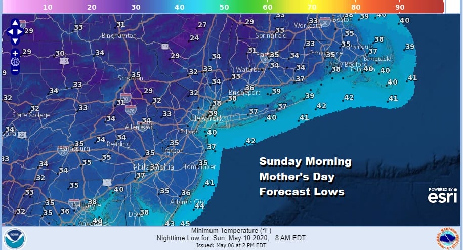
Sunday, Mother’s Day we will see plenty of sunshine and it will be breezy with highs back in the mid to upper 50s. Another low will be diving southeastward from the Great Lakes to the Delaware/New Jersey coast setting us up for rain or showers on Monday with highs in the 50s. The good news is that the cold pattern relaxes later next week as temperatures trend back to normal or even above normal for next weekend.
BE SURE TO DOWNLOAD THE FREE METEOROLOGIST JOE CIOFFI WEATHER APP &
ANGRY BEN’S FREE WEATHER APP “THE ANGRY WEATHERMAN!
MANY THANKS TO TROPICAL TIDBITS FOR THE USE OF MAPS
Please note that with regards to any severe weather, tropical storms, or hurricanes, should a storm be threatening, please consult your local National Weather Service office or your local government officials about what action you should be taking to protect life and property.


