Snow Cheap Thrill Possible Thursday Morning Well Inland

Snow Cheap Thrill Possible Thursday Morning Well Inland
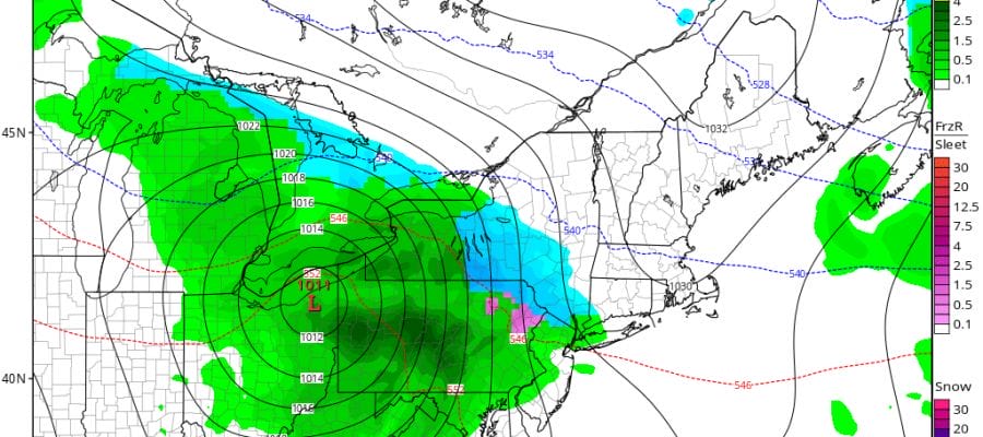
After looking at the overnight model trends and seeing a slightly colder look overall, and a faster look on arriving precipitation on Thursday, it is possible that some areas north and west of the coast could get an early season cheap thrill of sleet or wet snow. In fact it might be more than just a cheap thrill in elevated areas but 2 things have to happen.
- Cold air gets wedged in Wednesday night thanks to the blocky pattern we are in. GFS has a colder look to it than the others. NAM Canadian & European are much warmer and slower. The Nam snow is probably a fair compromise

2. Precipitation has to come in during the early morning hours and before daybreak. The GFS rushes it in before daybreak while the others are somewhat slower with the European the slowest. The NAM actually brings it in faster but it pulls the high out faster. You can’t have it both ways. If the high holds the precip holds back.
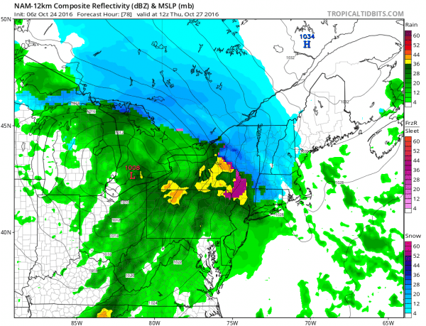
Honestly it may be more sleet than anything else with some wet snowflakes mixed in. But in either case I think it would be for areas north and west of RT 84 in the Hudson Valley and north and west of RT 287/80 in New Jersey and I might be pushing it too far south and west here.
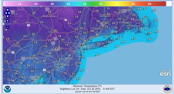
For now the first issue on the table is the possibility of a frost/freeze Wednesday morning it is still on the table and i think areas north and west of the coast stand the best chance of that.
So for the moment we look with all this with a bit of skepticism as far as the snow sleet issue is concerned and see what the next model run brings us later today. The forecasting fun seems to want to start early.
MANY THANKS TO TROPICAL TIDBITS FOR THE WONDERFUL USE OF THE MAPS
SNOW REMOVAL COMPANIES FOR YOUR WINTER NEEDS
LONG ISLAND ROCKLAND COUNTY Connecticut

![]()

WINTER 2016-2017 PART 1 OCEAN WATER TEMPERATURES
WINTER 2016-2017 PART 2 ARCTIC SEA ICE AND SIBERIAN SNOW COVER
FiOS1 News Weather Forecast For Long Island
FiOS1 News Weather Forecast For New Jersey
FiOS1 News Weather Forecast For Hudson Valley
NATIONAL WEATHER SERVICE SNOW FORECASTS
LATEST JOESTRADAMUS ON THE LONG RANGE
Weather App

Don’t be without Meteorologist Joe Cioffi’s weather app. It is really a meteorologist app because you get my forecasts and my analysis and not some automated computer generated forecast based on the GFS model. This is why your app forecast changes every 6 hours. It is model driven with no human input at all. It gives you an icon, a temperature and no insight whatsoever.
It is a complete weather app to suit your forecast needs. All the weather information you need is right on your phone. Android or I-phone, use it to keep track of all the latest weather information and forecasts. This weather app is also free of advertising so you don’t have to worry about security issues with your device. An accurate forecast and no worries that your device is being compromised.
Use it in conjunction with my website and my facebook and twitter and you have complete weather coverage of all the latest weather and the long range outlook. The website has been redone and upgraded. Its easy to use and everything is archived so you can see how well Joe does or doesn’t do when it comes to forecasts and outlooks.
Just click on the google play button or the apple store button on the sidebar for my app which is on My Weather Concierge. Download the app for free. Subscribe to my forecasts on an ad free environment for just 99 cents a month.
Get my forecasts in the palm of your hand for less than the cost of a cup of Joe!
![]()


