Snow Cheap Thrill Possibilities Inland Thursday

Snow Cheap Thrill Possibilities Inland Thursday
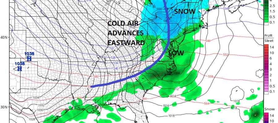
So far this winter we have seen 5 of what I would call nickle and dime events which have produced accumulating snows inland in all 5 cases and a 3 to 4 inch snowfall for some coastal areas over a week ago. This is the kind of pattern we are in at them moment with marginal cold air at best which tends to favor inland areas. Another such event will occur on Thursday as colder air pushes east with a cold front and a wave develops on the front.

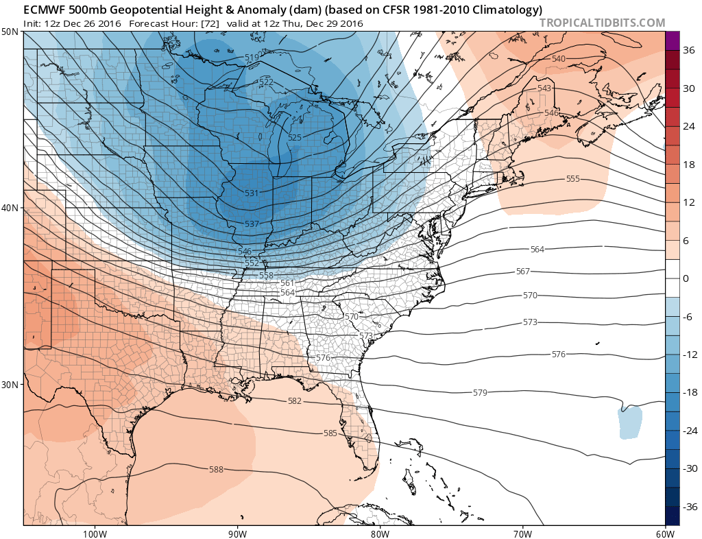
All the models show this idea with the Canadian & European model showing the most bullish outcome. It comes down to a question of timing and where the wave develops. The Canadian & European model start the wave further south than the other two which allows for a little more time and a little more cold air to get involved. The GFS & Nam model start the wave further north and are faster which basically cuts the precipitation off before the cold air moves in. This is the driving issue here. The upper air feature with this is stronger than the one moving through tonight which leads one to be cautious in both directions.
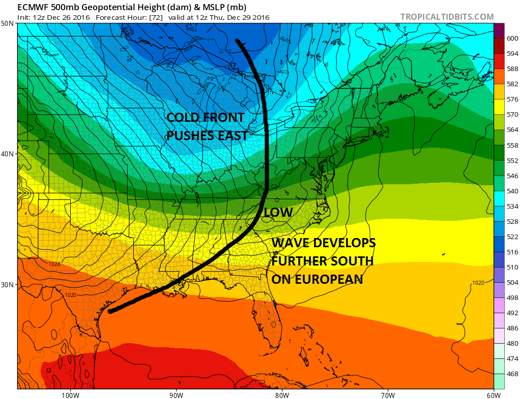
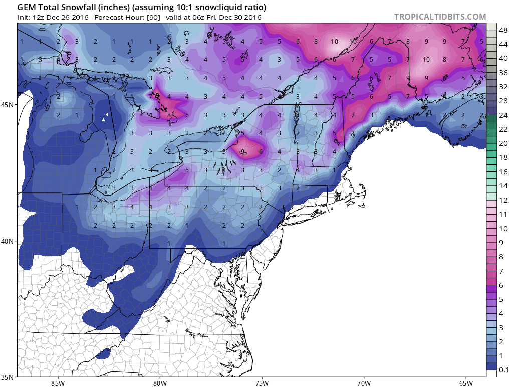
Oddly enough all the models have similar snowfall forecast maps. Right now I am taking a wait and see approach to this and see how things trend as we get closer to Thursday. Below is the Canadian model snow forecast for Thursday.
MANY THANKS TO TROPICAL TIDBITS FOR THE WONDERFUL USE OF THE MAPS
SNOW REMOVAL COMPANIES FOR YOUR WINTER NEEDS
LONG ISLAND ROCKLAND COUNTY Connecticut

![]()


JOHNSTOWN PA
COLOSIMO LAWNCARE

FiOS1 News Weather Forecast For Long Island
FiOS1 News Weather Forecast For New Jersey
FiOS1 News Weather Forecast For Hudson Valley
NATIONAL WEATHER SERVICE SNOW FORECASTS
LATEST JOESTRADAMUS ON THE LONG RANGE
Weather App

Don’t be without Meteorologist Joe Cioffi’s weather app. It is really a meteorologist app because you get my forecasts and my analysis and not some automated computer generated forecast based on the GFS model. This is why your app forecast changes every 6 hours. It is model driven with no human input at all. It gives you an icon, a temperature and no insight whatsoever.
It is a complete weather app to suit your forecast needs. All the weather information you need is right on your phone. Android or I-phone, use it to keep track of all the latest weather information and forecasts. This weather app is also free of advertising so you don’t have to worry about security issues with your device. An accurate forecast and no worries that your device is being compromised.
Use it in conjunction with my website and my facebook and twitter and you have complete weather coverage of all the latest weather and the long range outlook. The website has been redone and upgraded. Its easy to use and everything is archived so you can see how well Joe does or doesn’t do when it comes to forecasts and outlooks.
Just click on the google play button or the apple store button on the sidebar for my app which is on My Weather Concierge. Download the app for free. Subscribe to my forecasts on an ad free environment for just 99 cents a month.
Get my forecasts in the palm of your hand for less than the cost of a cup of Joe!
![]()
