Slow Improvement Lower Humidity Next 2 Days
Weekend Brings Shower Thunderstorm Risk

Slow Improvement Lower Humidity Next 2 Days
Weekend Brings Shower Thunderstorm Risk
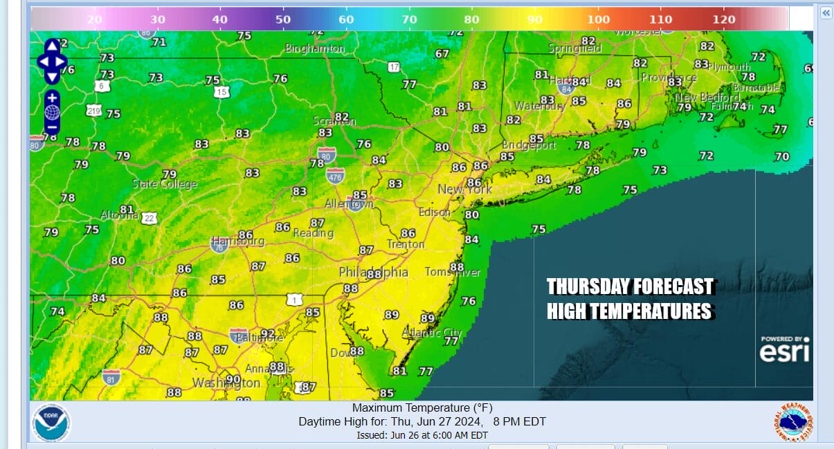
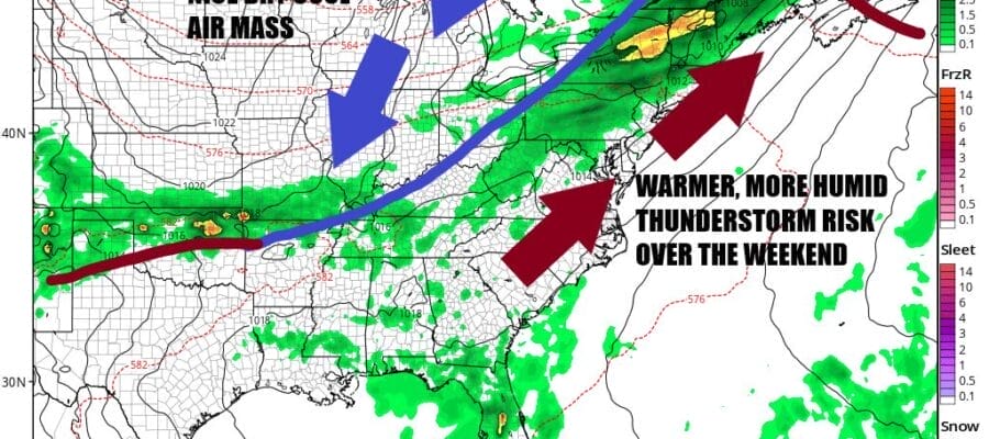
We have a cold front moving offshore today taking the last of the showers and thunderstorms out to sea. We will see improving weather conditions from west to east as skies clear out. Skies will go partly to mostly sunny as the day wears on. Dew points will be dropping and temperatures this afternoon will reach the mid to upper 80s. High pressure is building into the Northeast as this pattern of cold fronts passing every 3 days or so continues through the weekend and into next week.
SATELLITE WITH LIGHTNING STRIKES

WEATHER RADAR

Tonight will be nice and clear and reasonably cool and comfortable with most lows in the upper 50s away from the coast and low to mid 60s in coastal and normally warmer urban locations. Friday we see a beautiful weather day with plenty of sunshine, very low dew points and a nice dry flow of air from the north. Friday high temperatures will be generally in the low to mid 80s.
Saturday we will see temperatures rise and humidity levels will be going up as well. Most of the day should be dry with sunshine and some arriving clouds. High temperatures will reach the mid to upper 80s in most places. Temperatures will be a little cooler at the shore with local sea breezes. The approaching cold front will bring the risk for showers and perhaps a thunderstorm or two late Saturday. At the moment it doesn’t appear to be a severe weather risk day.

The next cold front will lag a bit and probably not come though until late in the day Sunday or Sunday night. This will make Sunday a rather hot day as we see winds turning west and that is normally a “hot” wind. We will see some sunshine Sunday as highs reach the upper 80s and lower 90s. However we are likely to see some thunderstorms around especially in the afternoon and evening. Sunday could be a day of severe weather risk as the cold front passes and a sharp upper trough moves through the Great Lakes and the Northeast.

Once the front passes next week will start out quite nice with lots of sunshine, low humidity, and highs in the upper 70s to lower 80s Monday. Tuesday will also be nice and sunny with high temperatures in the low to mid 80s and we will continue to see dry weather at least into Wednesday. While there appears to be another cold front coming for late Wednesday or perhaps Thursday, the 4th of July, at this time the front doesn’t appear to be particularly active. We will keep an eye on all this as we approach the 4th of July holiday.
BE SURE TO DOWNLOAD THE FREE METEOROLOGIST JOE CIOFFI WEATHER APP &
ANGRY BEN’S FREE WEATHER APP “THE ANGRY WEATHERMAN!
MANY THANKS TO TROPICAL TIDBITS FOR THE USE OF MAPS
Please note that with regards to any severe weather, tropical storms, or hurricanes, should a storm be threatening, please consult your local National Weather Service office or your local government officials about what action you should be taking to protect life and property.
(Amazon is an affilate of Meteorologist Joe Cioffi & earns commissions on sales.)


