Slow Improvement Later Today
As Heat Humidity Return In A Big Way Starting Sunday

Slow Improvement Later Today
As Heat Humidity Return In A Big Way Starting Sunday
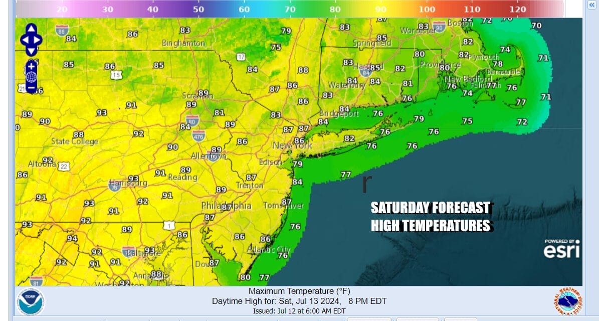
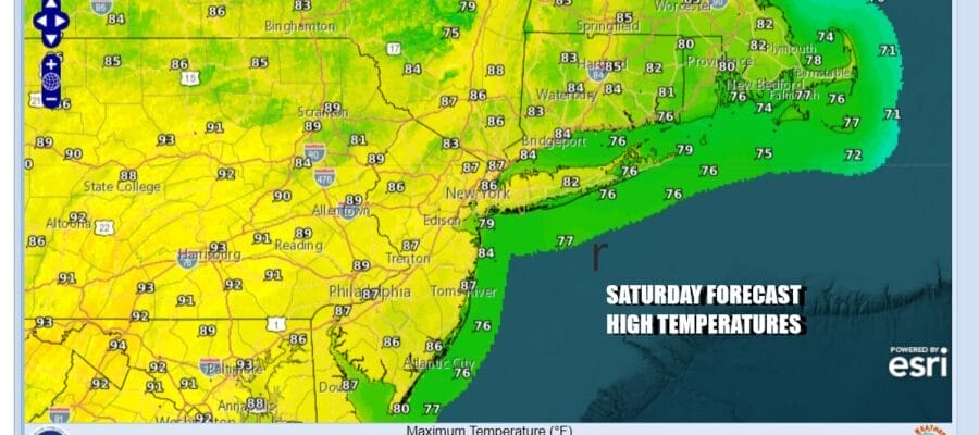
We do have moisture and clouds along the coast and this is due to an upper trough moving around a strong Bermuda high to the east. This system will be exiting to the northeast today. Any leftover rain around this morning will exit as well and we will see clouds giving way to some sunshine from west to east this afternoon, though coastal areas of New Jersey and Long Island as well as Southern and Southeast New England will be the last to clear. Highs inland will reach into the 80s while it will be in the 70s to near 80 along the coast. Flood watches will likely be taken down once the rain moves offshore.
SATELLITE WITH LIGHTNING STRIKES

WEATHER RADAR

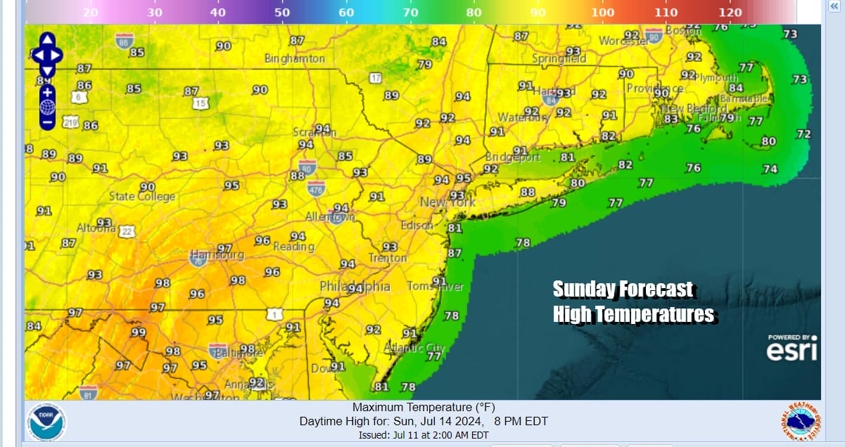
Clouds and rain this time of year help to keep temperatures down. We will be without both of those protections going forward so skies will clear tonight with most lows in the upper 60s to mid 70s. Sunday we see a return of heat and humidity with sunshine taking highs back into the 90s inland and in the 80s along coastal locations. No thunderstorms or downpours are forecast for Sunday.
The building Bermuda high into the Mid Atlantic states sets up conditions for very hot and very humid weather for the first half of next week. West winds will prevail and that keeps the sea breeze from coming inland and it also downslopes from the west and the air heats up even more. There are upper troughs in the northwest flow aloft and that could set off some thunderstorms late Monday and again late Tuesday though chances are higher for Monday.

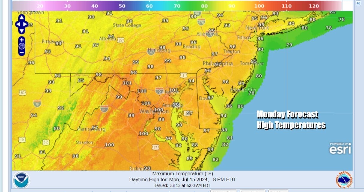
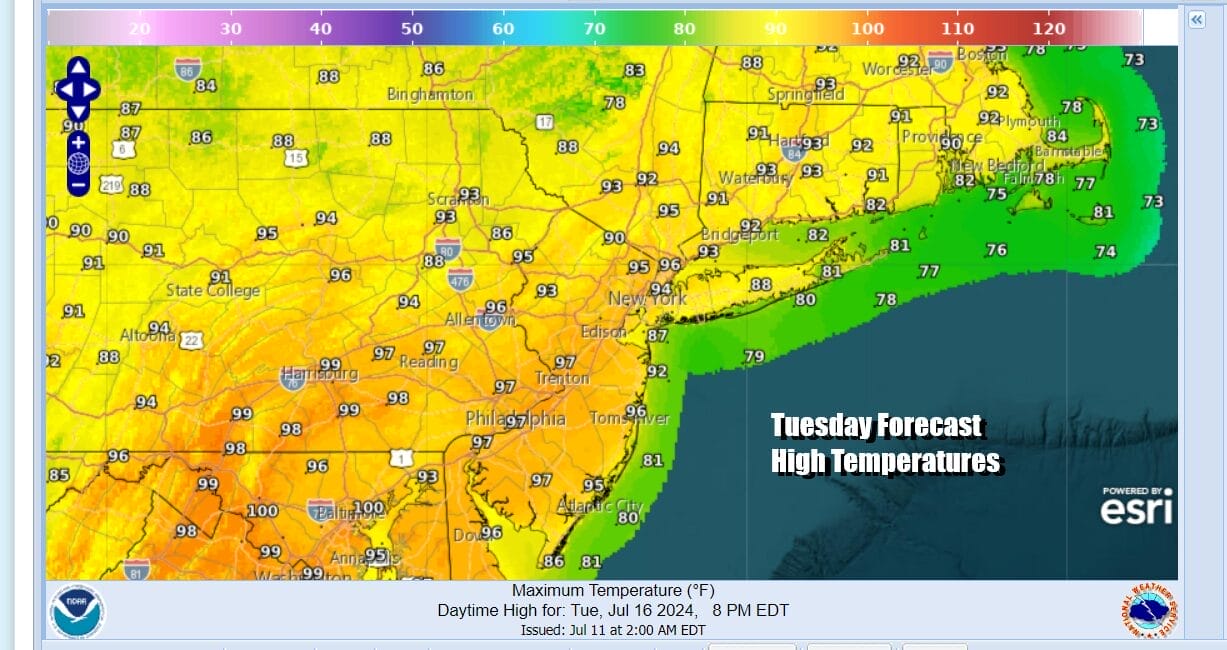
The bigger story though will be the high temperatures. Sunshine Monday will take temperatures up to the low to mid 90s from Northern New Jersey to NYC north and east and middle and upper 90s from Southern New Jersey and Southern Pennsylvania southward, highs will be in the upper 90s to near 100 degrees.

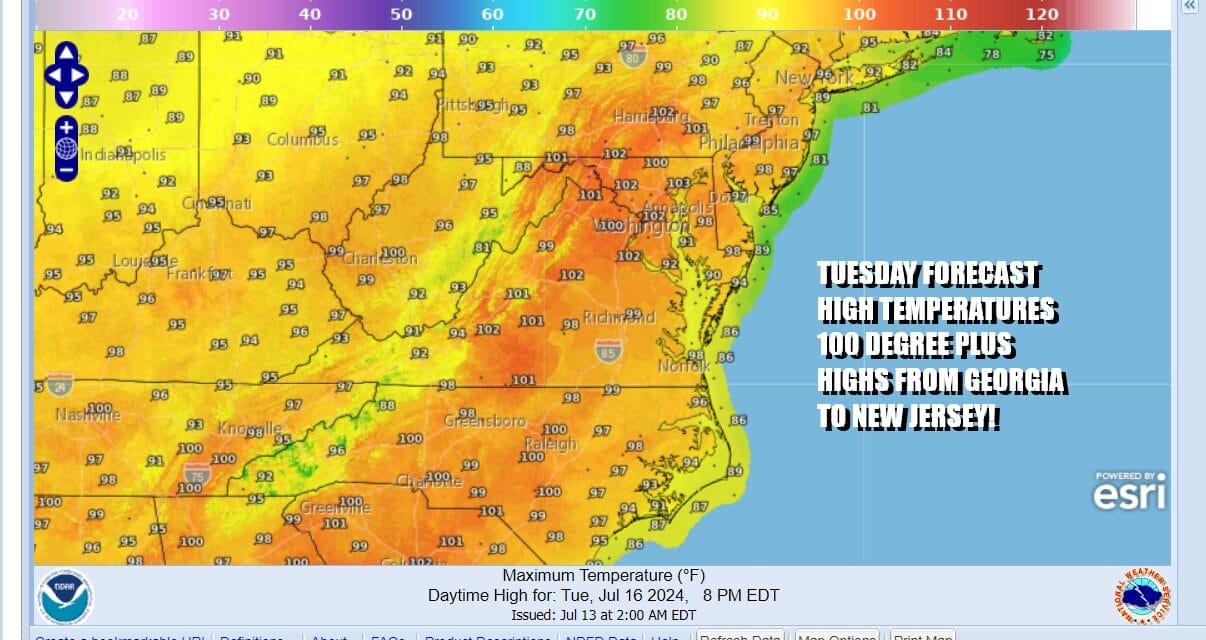
Tuesday could very well be the hottest day of the summer so far with widespread highs in the upper 90s to low 100s in a area that extends from Georgia and Eastern Tennessee all the way northward into Southern New England. We will likely see records being broken in some areas. Cooling thunderstorms will be few and far between, if at all for Tuesday.
Wednesday will be the last very hot day though temperatures will be a little lower than Tuesday. Widespread 90s will occur but we do have a strong cold front that will bring showers and thunderstorms across the Northeast and Mid Atlantic states and there is the risk that we could be dealing with severe weather with this cold front. The good news is that the front does bring a cooler drier air mass into the Northeast and Northern Mid Atlantic states late in the week though how far south that dry air gets remains a question at this point.
BE SURE TO DOWNLOAD THE FREE METEOROLOGIST JOE CIOFFI WEATHER APP &
ANGRY BEN’S FREE WEATHER APP “THE ANGRY WEATHERMAN!
MANY THANKS TO TROPICAL TIDBITS FOR THE USE OF MAPS
Please note that with regards to any severe weather, tropical storms, or hurricanes, should a storm be threatening, please consult your local National Weather Service office or your local government officials about what action you should be taking to protect life and property.
(Amazon is an affilate of Meteorologist Joe Cioffi & earns commissions on sales.)


