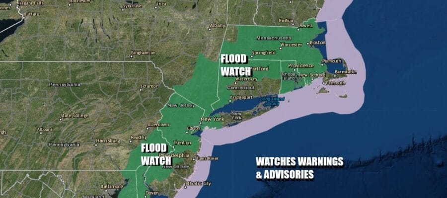
Flood Watch Southern New England Southward to the Mid Atlantic
As Subtropical Rain Moves In From the Ocean

Flood Watch Southern New England Southward to the Mid Atlantic
As Subtropical Rain Moves In From the Ocean
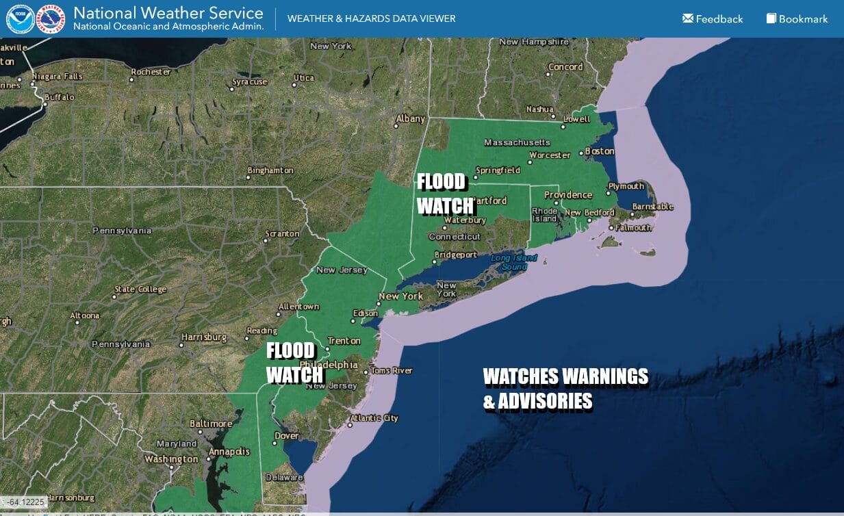
Flood watches have been posted along the East Coast from Southeastern New England southward through NYC, the Hudson Valley and most of New Jersey. Watches also cover Southeast Pennsylvania to Delaware & Eastern Maryland and Virginia. Rainfall amounts are forecast in the 1 to 2 inch range but this time of year, given the subtropical nature of the rain, we could see some areas wind up with double the amounts forecast.

Satellite and radar loops show rain and thunderstorms already pushing back westward along the coast and it has already moved into Southern New Jersey, Maryland and Delaware this morning. We will continue to see the rain arc northwestward this afternoon into tonight. The moisture is coming around the backside of the Bermuda high combined with a cold upper air low off the Southeast US Coast. The energy from this is pushing northward as the high offshore builds westward.
SATELLITE WITH LIGHTNING STRIKES

WEATHER RADAR

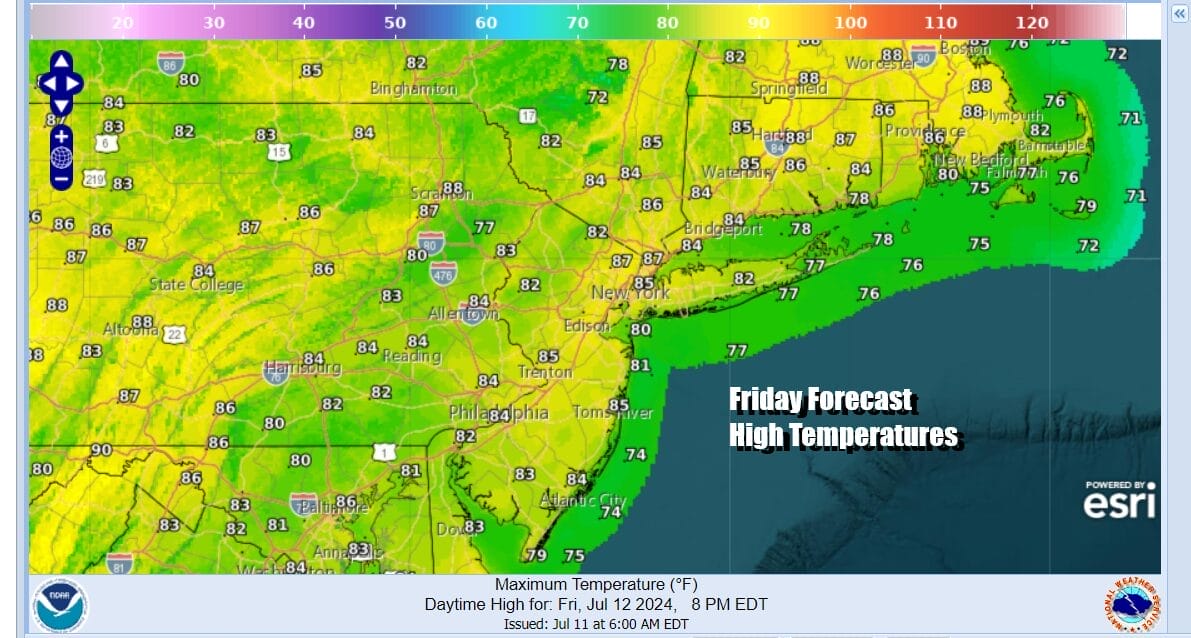
This is one of those situations where the further inland you go the less rain you will get. The good news is between the rain and the cloud cover, at least that will keep temperatures down today though highs will still reach into the 80s before the rains come and then fall back into the 70s. Humidity levels will be high regardless.
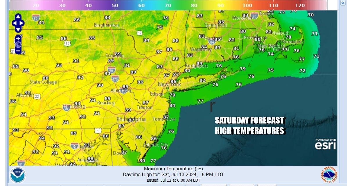
We will probably see rain overnight into Saturday morning but eventually the rain will play itself out and move away to the northeast. Skies should start to clear out from west to east during the day Saturday. Clouds will help to hold the temperatures down so most highs Saturday will be in the 80s and of course humidity levels will be on the high side.
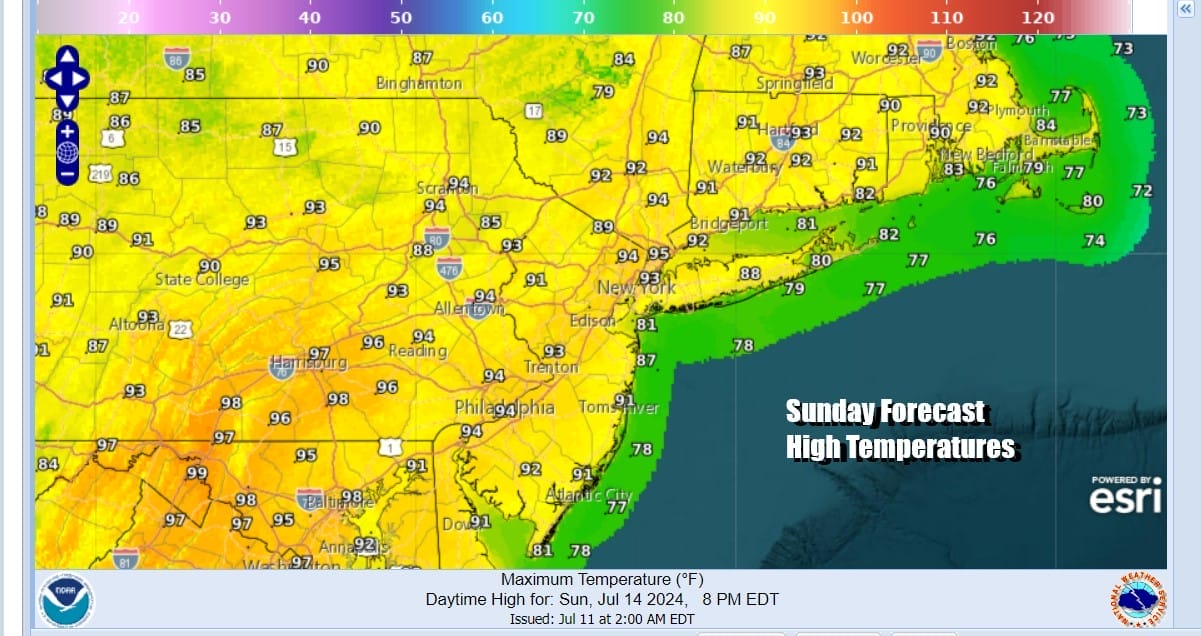
Sunday sees 90 degree plus highs return as we have the Bermuda high still offshore and no real relief coming until maybe the middle part of next week as a cold front finally is able to break through the Bermuda high and push through. Skies Sunday should me partly to mostly sunny and temperatures will be cooler at the beaches.
Monday Tuesday and Wednesday of next week will be very hot and very humid as a west wind takes hold with high pressure to the south. This means that highs Monday and Tuesday will be in the mid to upper 90s in many locations and there is just a small chance for a pop up isolated thunderstorm. Wednesday will be a little lower but highs will still reach the low and mid 90s. There is a higher chance for thunderstorms and possibly some severe weather risk as a significant cold front approaches. This should finally bring a significant break to the heat and humidity late next week.
BE SURE TO DOWNLOAD THE FREE METEOROLOGIST JOE CIOFFI WEATHER APP &
ANGRY BEN’S FREE WEATHER APP “THE ANGRY WEATHERMAN!
MANY THANKS TO TROPICAL TIDBITS FOR THE USE OF MAPS
Please note that with regards to any severe weather, tropical storms, or hurricanes, should a storm be threatening, please consult your local National Weather Service office or your local government officials about what action you should be taking to protect life and property.
(Amazon is an affilate of Meteorologist Joe Cioffi & earns commissions on sales.)


