Heat Humidity Continue But We Also Have Rain On the Way
Later Friday Into Saturday Morning

Heat Humidity Continue But We Also Have Rain On the Way
Later Friday Into Saturday Morning

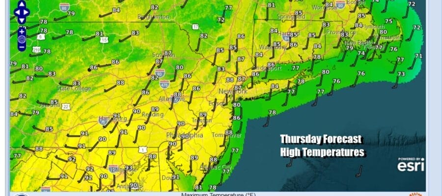
We another hot humid day ahead this Thursday but we can say that temperatures today will be a little lower than what we have seen the past few days especially inland where mid 90s each afternoon has been commonplace the last few days. Humidity levels also will be lower today as dew points drop into the mid 60s. It is still going to be humid but it will feel better than yesterday when dew points were off the wall. Overnight some thunderstorms rolled through parts of Eastern Pennsylvania to Southern New England. We will see some sunshine today and highs will be in the mid 80s near the coast and upper 80s to around 90 inland.
SATELLITE WITH LIGHTNING STRIKES

WEATHER RADAR

With all this heat and humidity you would think we would be seeing our fair share of thunderstorms but this has not been the case. However it does seem that we will be getting some rain later Friday into early Saturday morning. The Bermuda high offshore will be building back westward and a southerly flow aloft develops along the East Coast.

An upper low and surface trough sitting off the Southeast Coast will track around the western side of the Bermuda high on a southerly flow along the East Coast. This brings an area of rain up the coast later Friday lasting into early Saturday morning. This system is capable of producing an inch to an inch and a half of rain for much of area from the Delmarva Peninsula to Southern New England. Lower amounts will occur in areas to the west in Eastern Pennsylvania and to the north in the Hudson Valley.

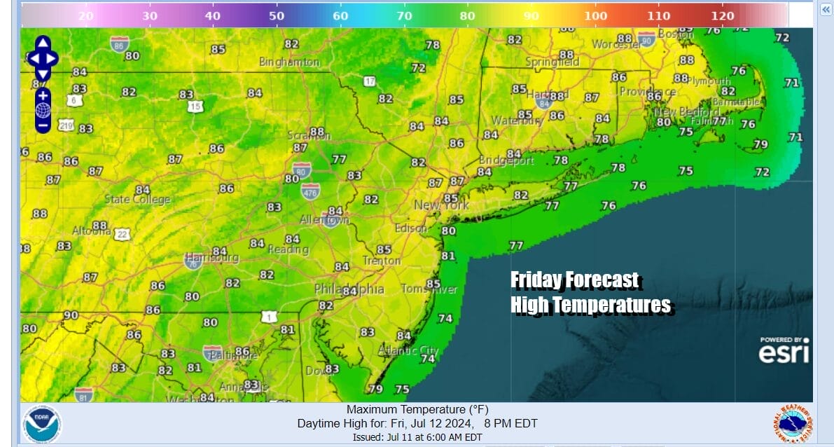
Thanks to clouds increasing Thursday night into Friday morning we won’t have much if any sun Friday. That will hold temperatures down and highs will probably be mostly in the upper 70s and lower 80s. Rain develops from south to north late in the morning to mid afternoon and continues into Friday night. While it is raining temperatures will likely settle in the 70s.
Once the rain exits Saturday morning sunshine returns and so does the heat and humidity. Highs Saturday will be back into the 90s away from the ocean and humidity levels will be very high. Sunday we will see hot and humid conditions with highs in the low to mid 90s. There is the chance for late day and nighttime showers and thunderstorms Sunday night into Monday morning. Monday and Tuesday of next week will be very hot and very humid thanks to a west wind and sunshine. Highs both days will be in the mid to upper 90s and I would not be surprised if we see some areas hit 100 degrees.
BE SURE TO DOWNLOAD THE FREE METEOROLOGIST JOE CIOFFI WEATHER APP &
ANGRY BEN’S FREE WEATHER APP “THE ANGRY WEATHERMAN!
MANY THANKS TO TROPICAL TIDBITS FOR THE USE OF MAPS
Please note that with regards to any severe weather, tropical storms, or hurricanes, should a storm be threatening, please consult your local National Weather Service office or your local government officials about what action you should be taking to protect life and property.
(Amazon is an affilate of Meteorologist Joe Cioffi & earns commissions on sales.)


