
Brutal Heat Humidity Next 4 Days
Could See 100 Degree Plus Highs In Some Areas Tuesday

Brutal Heat Humidity Next 4 Days
Could See 100 Degree Plus Highs In Some Areas Tuesday
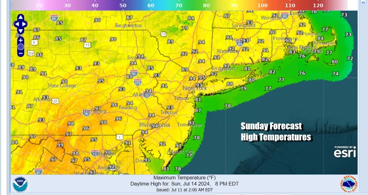
The unrelenting humidity continues through Wednesday. Clouds and rain at least produced a break in the 90 degree plus highs Friday and Saturday. Now a 4 day stretch of weather begins today which will bring the hottest temperatures of the summer so far for Eastern Pennsylvania to Southern New England and points south to Maryland and Virginia. Today we see highs back into the low 90s with a few middle 90s in hot spots. Today will be a day of sunshine and only the smallest chance for an isolated shower or thunderstorm.
SATELLITE WITH LIGHTNING STRIKES

WEATHER RADAR

The Bermuda high is building back westward across the Southeast US. This puts us into a mostly west wind setup beginning Monday and lasting into Wednesday. This is typically how we see hot temperatures in the summer time for all areas. The flow from off the ocean is cut off unless you are on a beach and standing right in the ocean.

Thunderstorm chances will be there late Monday into Monday evening, and again late Tuesday into Tuesday evening. There may be severe weather risk well inland north and west of the coast for the possibility of isolated severe thunderstorms. Otherwise Monday will be very hot and very humid with highs reaching the middle to upper 90s in many locations. Some hot spots might hit 100.

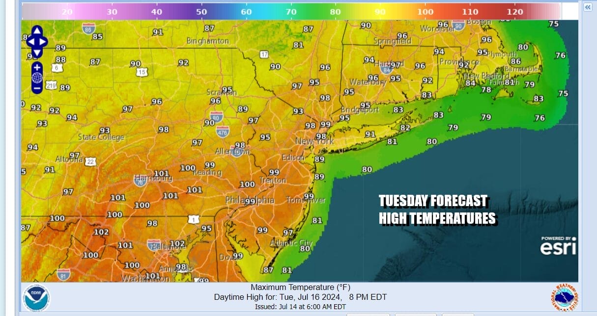
Tuesday could possibly go down as the hottest day of the summer (so far) with highs that could reach 100 degrees or higher. The best chances for this will be in Southern Pennsylvania, interior Central and South Jersey and points southward into Maryland, Delaware and Virginia. Everyone else will see highs in the middle to upper 90s and it will only be slightly cooler at the immediate coast. There is the risk for late day scattered thunderstorms and always the chance for an isolated severe thunderstorm.

Wednesday will be the last very hot and very humid day as a cold front will approach. Highs will again be in the 90s and we will see the likelihood of showers and thunderstorms late in the day into Wednesday night. Severe weather risk is likely to be somewhat elevated. Once the front passes we will finally see a break in the oppressive humidity Thursday and Friday. Dew points will drop into the 50s and sunshine will take highs only back to the low and middle 80s which is reasonable for this time of year.
BE SURE TO DOWNLOAD THE FREE METEOROLOGIST JOE CIOFFI WEATHER APP &
ANGRY BEN’S FREE WEATHER APP “THE ANGRY WEATHERMAN!
MANY THANKS TO TROPICAL TIDBITS FOR THE USE OF MAPS
Please note that with regards to any severe weather, tropical storms, or hurricanes, should a storm be threatening, please consult your local National Weather Service office or your local government officials about what action you should be taking to protect life and property.
(Amazon is an affilate of Meteorologist Joe Cioffi & earns commissions on sales.)


