Slow Improvement Continues As We Head Into the Weekend Warmer Temps

Slow Improvement Continues As We Head Into the Weekend Warmer Temps
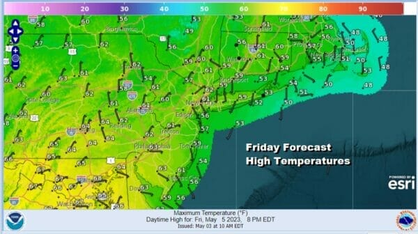
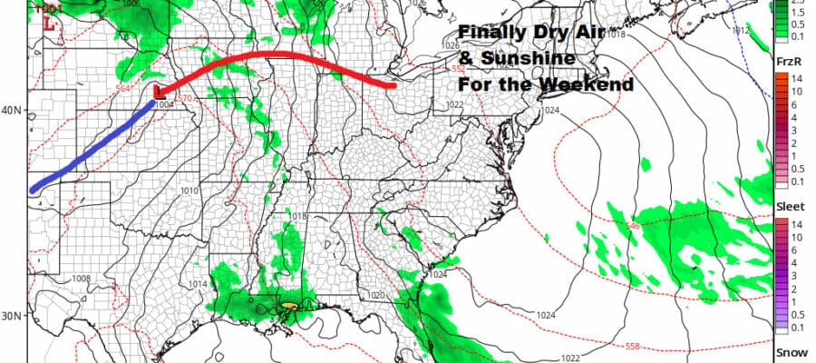
We continue to make slow progress in the Northeast and Northern Mid Atlantic states. The upper air storm that kept us in showery rains and clouds most of the week has moved a little further east but we do have one last upper trough rotating around the low to get through today. While the day starts with sunshine, clouds will develop and there is still the chance there could be some scattered afternoon showers, however this should be a day where the sun has more of the action. Temperatures will reach the upper 50s and lower 60s this aftenoon. Once we get through the evening hours, clouds and any scattered showers will disappear and skies should clear overnight with most Saturday morning lows in the 40s.
SATELLITE

WEATHER RADAR

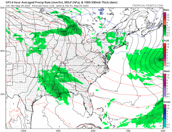
High pressure in Eastern Canada will be nosing southward along the East Coast. This should provide us with more in the way of sunshine for both Saturday and Sunday. It will also put us in a bit of a sweet spot for the weekend as it walls off mositure to the west and south from moving up the East Coast so the weekend will be rain free.
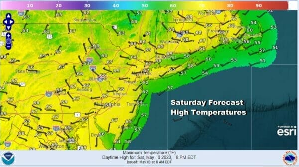
Even though we are in a regime where temperatures generally be below average, the added sunshine this weekend will allow temperatures to reflexively snap back closer to normal levels Saturday and we should go a little above average Sunday. Saturday highs will be in the mid 60s to around 70 in some places.
Sunday should be a nice day overall though areas to the south might see some clouds coming in from the west but it will be rain free. There will be enough sunshine to take temperatures into the low and middle 70s in most locations though there will be local sea breezes along south and east facing shorelines and temperatures will likely be about 10 degrees or so lower in those locations.

We should be able to hold on to sunshine Monday for much of the day and that will take us to the mid to upper 70s for highs. Perhaps some warm spot could approach 80 degrees. Then low pressure over the Lower Great Lakes will head southeast thanks to the high to our north and this will bring clouds and showers into the picture for Tuesday into Wednesday. At least after the gloom and doom for the last week or so, we are going to get some payback with a nice three day stretch of weather. Happy weekend to all!
BE SURE TO DOWNLOAD THE FREE METEOROLOGIST JOE CIOFFI WEATHER APP &
ANGRY BEN’S FREE WEATHER APP “THE ANGRY WEATHERMAN!
MANY THANKS TO TROPICAL TIDBITS & F5 WEATHER FOR THE USE OF MAPS
Please note that with regards to any severe weather, tropical storms, or hurricanes, should a storm be threatening, please consult your local National Weather Service office or your local government officials about what action you should be taking to protect life and property.


