
Omega Block Showery Rains Thunderstorms &
Local Flash Flood Potential Next Few Days

Spring is known for blocking patterns to set up and we have one set up now across the United States. It is called an “omega” block because it looks like the greek letter omega. Basically it looks like the number 8 laid on its side. You can see on the loop of the upper air map above that we have two upper lows. One is in the Ohio Valley and the other is in the Southwestern US. In between we have a ridge of high pressure in the Plains.

The block keeps weather systems from moving along so if you are on the wrong side of the block you have a problem. That is the situation right now in the Eastern US. A stalled front lies up and down the Appalachians with a low in West Virginia. The satellite loop as well as the radar loops show moisture off the East Coast moving northward and this continues today and to some extent Tuesday.
SATELLITE WITH LIGHTNING STRIKES

WEATHER RADAR

It doesn’t rain all the time in a set up like this but eventually as daytime heating takes hold, showery rains develop and intensify. You also get some thunderstorms in the mix and that produces heavy rain and the potential for local flash flooding. This is what we can expect this afternoon into tonight across Pennsylvania, New Jersey, the Hudson Valley, NYC, Long Island and Connecticut.

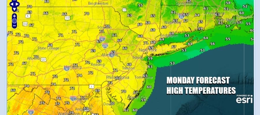
Obviously it is a muggy sticky day given all the rain and the saturated atmosphere. Even if the sun were to peak through clouds will immediately develop. Midday rains will spread from the coast westward and northward. Temperatures today will be mostly in the upper 60s and lower 70s. Rain will continue tonight and wind down somewhat only to fire up again Tuesday. Highs Tuesday will be in the upper 60s to mid 70s.
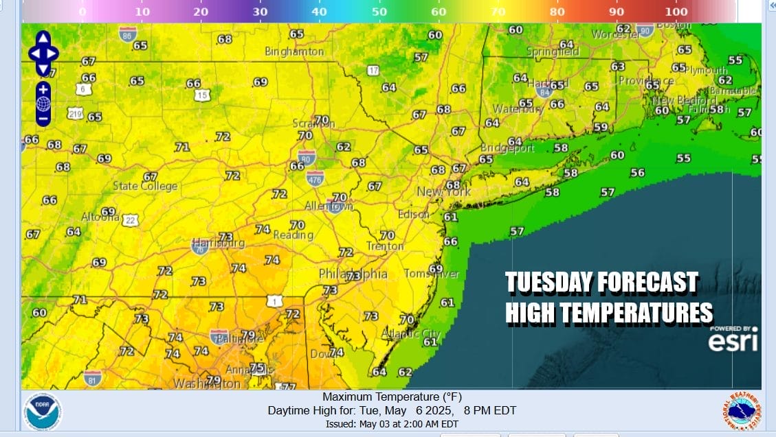
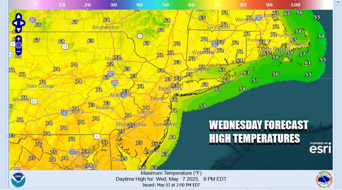
Tuesday also opens the door to some severe weather risk and the Storm Prediction Center has a marginal risk for isolated severe thunderstorms from Northeast Pennsylvania to Northern New Jersey and the Hudson Valley. Wednesday the upper low from the Ohio Valley moves into New England. This will allow for more in the way of some sun but we will still see scattered showers and thunderstorms develop. Wednesday highs will be in the 70s.
Thursday could see some scattered showers and it will probably be the best of the week, which isn’t really saying much. Highs will be in the 70s with a mix of sun and clouds. Weather conditions will deteriorate Friday into the weekend as another low comes up the East Coast and it looks we could see a widespread soaking rain developing Friday and possibly lasting into the first part of Saturday.
BE SURE TO DOWNLOAD THE FREE METEOROLOGIST JOE CIOFFI WEATHER APP &
ANGRY BEN’S FREE WEATHER APP “THE ANGRY WEATHERMAN!
MANY THANKS TO TROPICAL TIDBITS FOR THE USE OF MAPS
Please note that with regards to any severe weather, tropical storms, or hurricanes, should a storm be threatening, please consult your local National Weather Service office or your local government officials about what action you should be taking to protect life and property.


