
Showery Rains Thunderstorms Through Early Wednesday
More Rain Late Thursday Into Early Saturday
It is another day in the land of the Omega Block and that means that not much has changed from yesterday. We still have an upper air low to the west along with a north south frontal boundary. We have some rain and downpours overnight in some places. Now we are going to see downpours and thunderstorms fire up again. Temperatures continue to hold in a range in the upper 60s to lower 70s in most places.
SATELLITE WITH LIGHTNING STRIKES

WEATHER RADAR

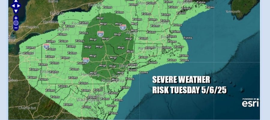
The upper air storm is beginning to move to the northeast today and this is going to create a more unstable atmosphere over the Northeast and Northern Mid Atlantic states. As the upper low gets closer thunderstorms that develop could reach severe levels in some cases. The Storm Prediction Center has a marginal risk for isolated severe thunderstorms across Northern and Eastern Pennsylvania, Northern New Jersey to the Catskills and the Hudson Valley west of the Hudson River.

Once we get through this evening the atmosphere should begin to settle down overnight. It appears that the upper low is moving out a little faster which is sort of good news because it will bring improving weather conditions for Wednesday, however it also means that the next weather system that will be forming in the Southeast US will be coming in a little faster.

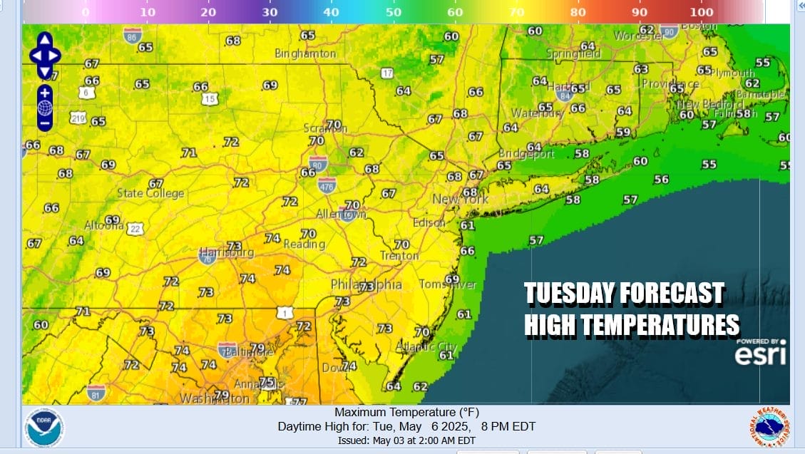
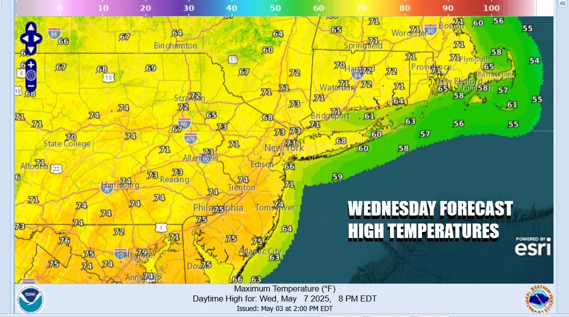
It appears that Wednesday will be the better weather day with decreasing clouds and increasing amountos of sunshine, especially in the afternoon as the upper air low pulls east and way from New England. Temperatures Wednesday should respond somewhat with highs reaching the low to middle 70s in most places.
Thursday a weather front pushes southeast as another upper trough digs in the Appalachians. We will have arriving clouds Thursday with the risk for some late day showers and thunderstorms. Initially there is a higher chance inland verses the coast. Temperatures Thursday will be in the low and middle 70s. Then as the European model shows, low pressure develops in the Mid Atlantic Friday bringing a steady rain in later Friday morning and lasting into early Saturday morning. Onshore winds Friday and rain will make for a raw day with highs in the 50s. Weather conditions do look to improve over the weekend as the rain should be mostly done before daybreak Saturday.
BE SURE TO DOWNLOAD THE FREE METEOROLOGIST JOE CIOFFI WEATHER APP &
ANGRY BEN’S FREE WEATHER APP “THE ANGRY WEATHERMAN!
MANY THANKS TO TROPICAL TIDBITS FOR THE USE OF MAPS
Please note that with regards to any severe weather, tropical storms, or hurricanes, should a storm be threatening, please consult your local National Weather Service office or your local government officials about what action you should be taking to protect life and property.


