
Improving Weather Conditions But More Rain Late Thursday & Friday
Mother’s Day Looking Sunny
We are halfway through the week and finally we are seeing some genuine overall improvement. The omega block pattern has broken down and the first upper low from the Ohio Valley is now moving across New England taking showers with it to the northeast. Today we will see patchy clouds and some sunshine. We are still under the southern end of the rotation of the upper low but the atmosphere is more stable. We are not mentioning any showers in the forecast. High temperatures this afternoon will be in the low to middle 70s.
SATELLITE WITH LIGHTNING STRIKES

WEATHER RADAR

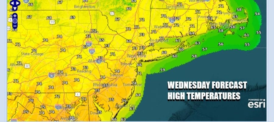
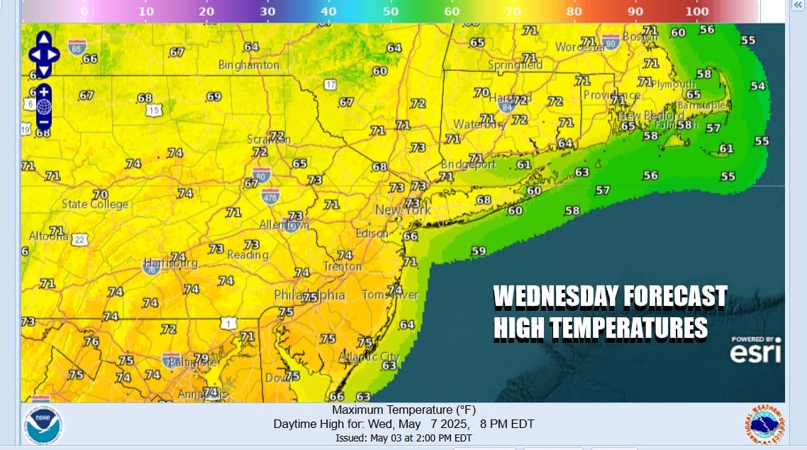
The improving weather conditions won’t last long because the other half of the old omega block in the form of an upper low in the Southern Plains will be heading eastward and this will set off low pressure to develop in the Carolinas on a dying frontal boundary. This will cause clouds to increase during the day Thursday. Some showers could develop inland by late in the day but for most the day is dry.

Low pressure to the south and high pressure to the north sets up a northeast onshore flow for Thursday night and Friday. Note the surface low crawls slowly northward so this is going to be a prolonged rainfall event but that is good news for what is left of any dry conditions that cover Eastern Pennsylvania to Southern New England will see temperatures Thursday in the low to mid 70s as clouds increase.
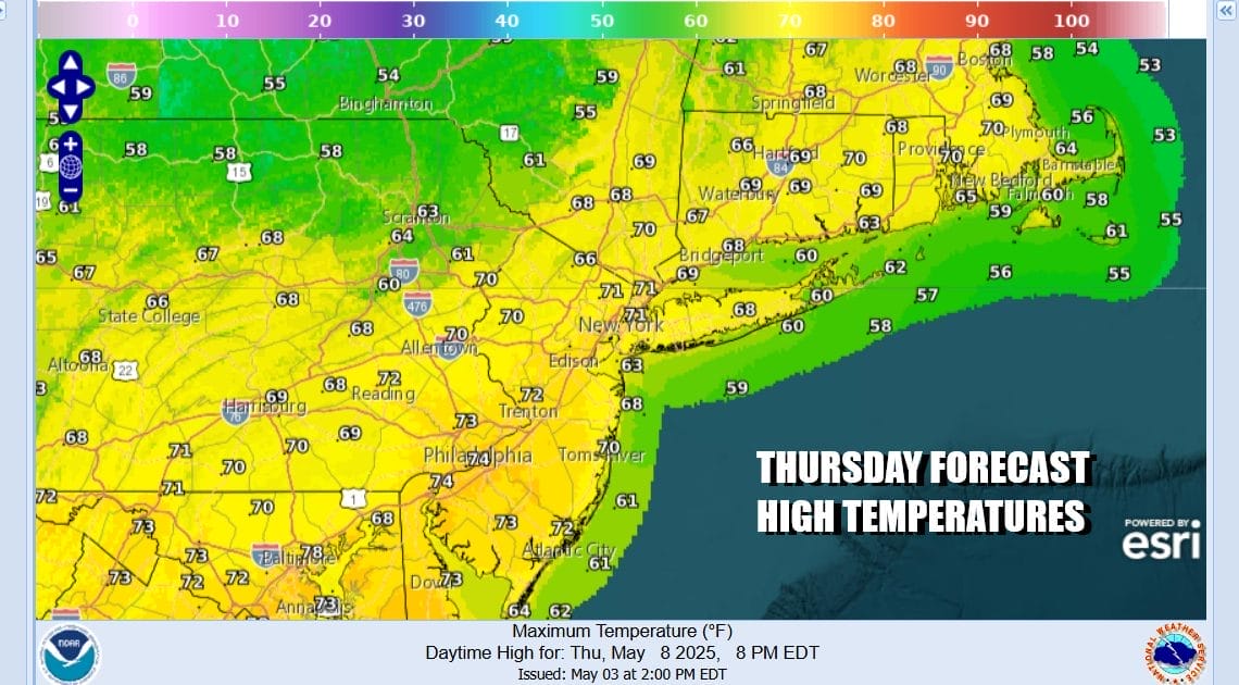
Friday will be a chilly raw rainy day with high temperatures just in the mid 50s to lower 60s. It will be an ugly day but the low is going to start to move slowly northward and northeastward. Rain will last into the first part of Friday night before ending from west to east. Barring any complications. the rain should be gone by daybreak Saturday.

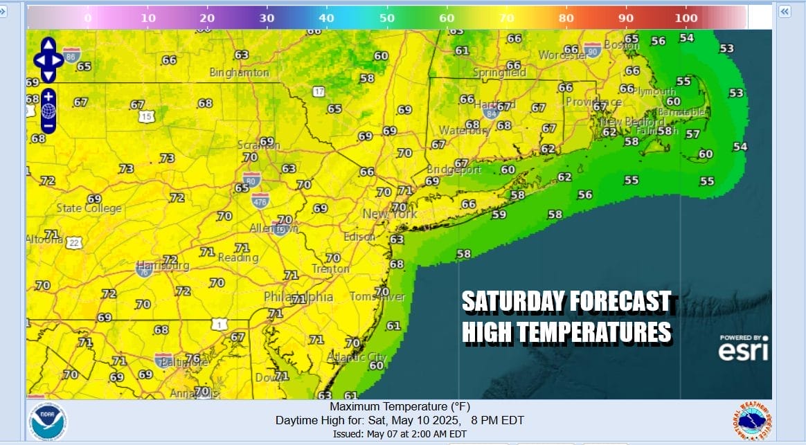
This is going to leave us in a pretty good spot for the weekend. The low moves away and high pressure builds in behind it. Any leftover clouds Saturday morning will give way to some developing sunshine. High temperatures Saturday afternoon will be in the upper 60s and lower 70s.
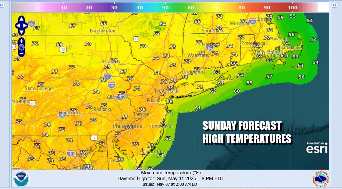
Sunday is Mother’s Day and it is going to be a nice day of sunshine from start to finish. High pressure builds in from the Great Lakes. We are at the time of year where if you have sunshine, temperatures have no where to go but up. Sunday highs will be in the mid to some upper 70s. Absolutely no rain is in the forecast and I don’t see anything to complicate matters.
Next week is going to start off dry so Monday looks like a good day. Lower pressures in the Gulf States will likely send up another low late Tuesday into Wednesday and that looks to be a shot for another round of rain. However we do not have a blocking pattern setting up so it will be a system that moves along and once it is done, weather conditions should improve for the end of next week.
BE SURE TO DOWNLOAD THE FREE METEOROLOGIST JOE CIOFFI WEATHER APP &
ANGRY BEN’S FREE WEATHER APP “THE ANGRY WEATHERMAN!
MANY THANKS TO TROPICAL TIDBITS FOR THE USE OF MAPS
Please note that with regards to any severe weather, tropical storms, or hurricanes, should a storm be threatening, please consult your local National Weather Service office or your local government officials about what action you should be taking to protect life and property.


