
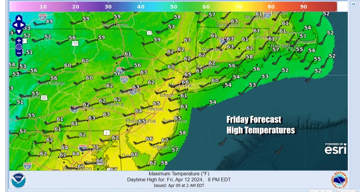
Showery Rains Continue Today A Mixed Weather Weekend
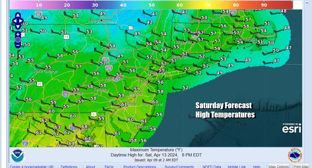
Scattered Showers Early Saturday & Late Sunday

Showery Rains Continue Today A Mixed Weather Weekend
Scattered Showers Early Saturday & Late Sunday

It was a rather stormy night for some as thunderstorms developed and moved northward up the coast. This brought heavy rain and wind as the storms passed. This storm system which is east of Lake Huron today still has some work to do over the Northeast and Northern Mid Atlantic. The upper trough with the storm has to rotate through and this could set off some more showery rains as the day wears on.
There could even be a thunderstorm or two in the mix as the cold front sweeps offshore. West to southwest winds will be on the strong and gusty side but will probably be just below wind advisory criteria. Look for winds of 20 to 25 mph with gusts into the 30 mph plus range. Temperatures this afternoon will be mostly in the mild 60s. Skies should partially clear tonight however the upper trough remains and there will be some clouds around as well. Early morning scattered showers are possible. Most lows will be in the 40s.
SATELLITE WITH LIGHTNING STRIKES

WEATHER RADAR

We describe the weekend as a mixed one as we will still have the upper trough from this storm system to deal with Saturday. We are looking for clouds around at least through Saturday morning and there could be another shower or two scattered around until midday but clouds should decrease and sunshine increase as the day wears on. Saturday highs will be in the upper 50s and lower 60s..
Sunday we will see things work in reverse with sunshine to start the day but clouds will arrive as the day wears on from northwest to southeast. A cold front will be heading southeast from the Great Lakes and this could set off some scattered showers and maybe even a rumble or two of thunder. Sunday high temperatures will be back into the 60s. Showers should wait until late in the afternoon or evening to move through.
 Next week looks to start dry and on the warmish side for Monday and Tuesday. Highs should reach into the 70s both days at least if you are inland and away from the ocean influence of a sea breeze. The next storm system will be in the Plains this week and take a track well to the west and north but we could see some showers late Wednesday and another risk for rain or showers at the end of the week.
BE SURE TO DOWNLOAD THE FREE METEOROLOGIST JOE CIOFFI WEATHER APP &
ANGRY BEN’S FREE WEATHER APP “THE ANGRY WEATHERMAN!
MANY THANKS TO TROPICAL TIDBITS FOR THE USE OF MAPS
Please note that with regards to any severe weather, tropical storms, or hurricanes, should a storm be threatening, please consult your local National Weather Service office or your local government officials about what action you should be taking to protect life and property.
(Amazon is an affilate of Meteorologist Joe Cioffi & earns commissions on sales.)


