Rain And Wind Tonight Into Friday as Major Storm Heads to Great Lakes,
Mixed Weather Weekend

Rain And Wind Tonight Into Friday as Major Storm Heads to Great Lakes,
Mixed Weather Weekend

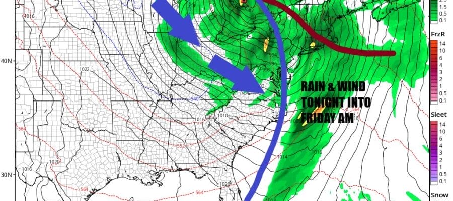
Low pressure has moved out of the Gulf States and is now in the Ohio Valley. It is heading northeast into Eastern Michigan and eventually winds up east of Lake Huron in Southern Canada. The trailing cold front is heading east with rain ahead of it. A warm front is pushing northward and bringing rain into New England today followed by more rain late today and tonight as the cold front nears.
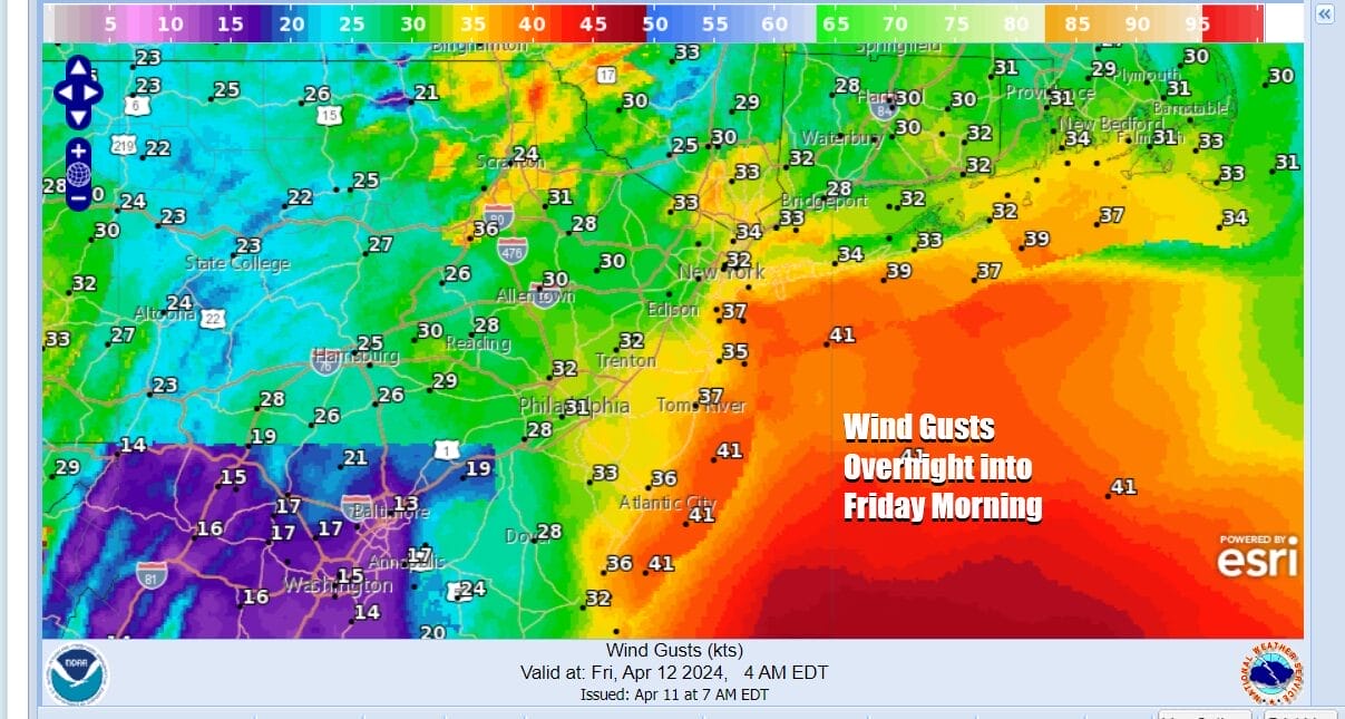
Winds will be increasing late today and tonight from the south as the pressure gradient tightens up. The south wind will also cause coastal flooding issues for south and east facing shorelines at high tide today and tonight. Winds will likely gust to 30 to 40 mph or more along the coast from the Jersey shore to Long Island and Southern New England. We are borderline wind advisory criteria along the coast. Wind gusts should be a bit less inland.
SATELLITE WITH LIGHTNING STRIKES

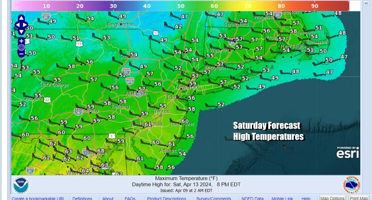
WEATHER RADAR

Rainfall forecast amounts are a bit tricky. There could be a few thunderstorms in the mix so there may be some areas that get some upside as far as final amounts are concerned. Three quarters of an inch to an inch and half seems a reasonable forecast with the highest amounts occurring inland this time rather than the coast since the low is tracking to the west, rather than up along the coast like the last two.

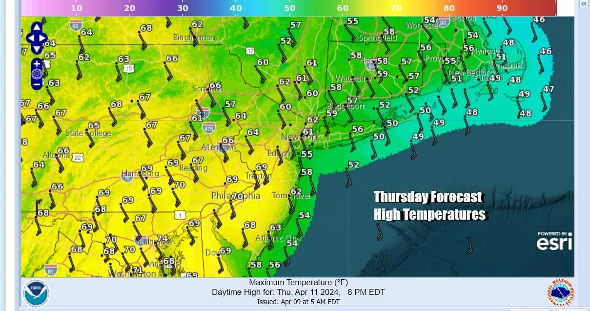
As far as temperatures are concerned today, most highs will be in the mid 60s to some lower 70s with the warmest temperatures in Southern New Jersey, Southern Pennsylvania and points southward. Severe weather risk reaches as far north as Delaware Bay back into Maryland. We do not expect this area to be extended northward at this time.
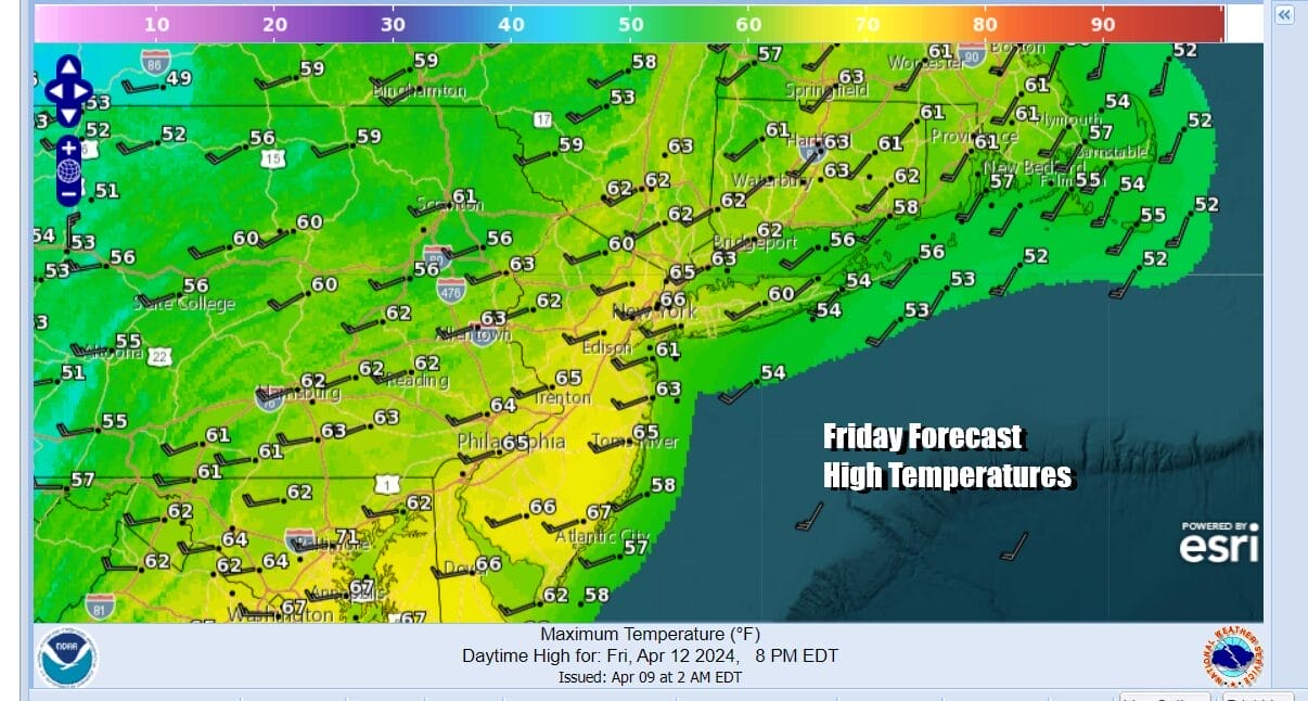
Rain tonight will be heavy at times into Friday morning before the front passes and winds turn to the west. Winds will be gusting 25 to 35 mph so that is just below wind advisory criteria. We will have leftover clouds and there will be showery rains around as an upper trough moves through. A rumble or two of thunder is not out of the question. Temperatures Friday will be in the 60s.
The weekend appears to be a mixed bag. Gusty winds will last into the first part of Saturday but we should have enough dry air to bring back sunshine. Highs Saturday will be in the 60s and it appears that Saturday may be just a little bit better than Sunday.
Sunday brings another cold front as a trough rotates around an upper low in Eastern Canada. The front will have limited moisture with it but enough that we could see some showers approach from the northwest Sunday afternoon. Look for sunshine followed by arriving clouds with highs in the 60s. Scattered showers are possible late in the afternoon and evening.

Next week sees another major storm developing in the Rockies and Plains but this low heads to the Western Great Lakes and into Central Canada rather than come east so the impact in the Eastern US will be limited to a chance for some showers Wednesday. Another chance for showers could come next Friday but the weather should be dry and on the warmish side of normal in between these two systems.
BE SURE TO DOWNLOAD THE FREE METEOROLOGIST JOE CIOFFI WEATHER APP &
ANGRY BEN’S FREE WEATHER APP “THE ANGRY WEATHERMAN!
MANY THANKS TO TROPICAL TIDBITS FOR THE USE OF MAPS
Please note that with regards to any severe weather, tropical storms, or hurricanes, should a storm be threatening, please consult your local National Weather Service office or your local government officials about what action you should be taking to protect life and property.
(Amazon is an affilate of Meteorologist Joe Cioffi & earns commissions on sales.


