Showery Rains Coastal Flooding Thanks to Offshore Low & Onshore Flow

Showery Rains Coastal Flooding Thanks to Offshore Low & Onshore Flow
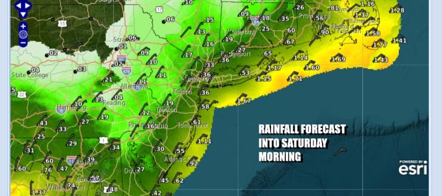
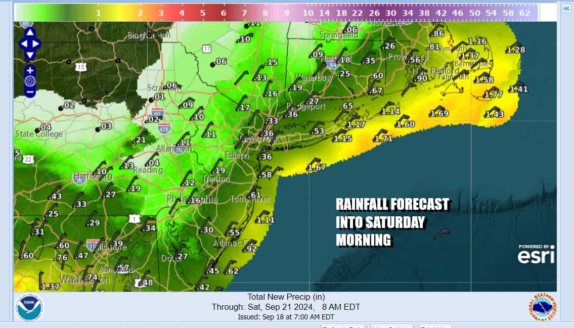
We have descended into the land of gloom and doom and I suppose it should be no surprised that after 10 days of nearly perfect September weather we are about to pay some of that back with several days of onshore flow, lots of clouds, and occasional rain. At least from the standpoint of rain, we do not expect much and most of this is spread out from today into Saturday morning and there will be stretches where we won’t see any rain at all.
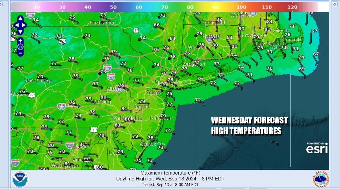
Clouds have moved in from the south and east overnight and it will be an overcast day. We also see rain on the radar. Offshore is an area of steady heavier rain and that seems destined to get to Long Island, Southern and Southeastern England later today and into tonight while to the west we have clusters of lighter rain showers with some areas not seeing much. Temperatures today will generally be in the upper 60s to mid 70s.
SATELLITE WITH LIGHTNING STRIKES

WEATHER RADAR

Coastal areas will be dealing with this onshore flow and the high tide cycle from the full moon and then we have the autumnal equinox this weekend so put that all together and we will see higher than normal tides from Southern New England and Long Island south to New Jersey into Delaware over the next several days and probably through the weekend. Minor to localized moderate flooding is forecast at times of high tide.

Thanks to blocking in the atmosphere, we are stuck with this low offshore into the weekend. Recent model runs linger this low longer and longer and higher pressure in Northeastern Canada takes longer and longer to build southeastward. This leaves us in cloudy skies Thursday through Saturday. From time to time we will see areas of light rain and drizzle. At other times it will just be cloudy. Temperatures each of the next 3 days will be in the upper 60s to mid 70s by day and upper 50s to mid 60s by night. We will keep our fingers crossed this low will drift far enough south to allow for improvement Sunday or Monday but there are no guarantees on this.
BE SURE TO DOWNLOAD THE FREE METEOROLOGIST JOE CIOFFI WEATHER APP &
ANGRY BEN’S FREE WEATHER APP “THE ANGRY WEATHERMAN!
MANY THANKS TO TROPICAL TIDBITS FOR THE USE OF MAPS
Please note that with regards to any severe weather, tropical storms, or hurricanes, should a storm be threatening, please consult your local National Weather Service office or your local government officials about what action you should be taking to protect life and property.
(Amazon is an affilate of Meteorologist Joe Cioffi & earns commissions on sales.)


