Showers Thunderstorms Severe Weather Risk
Weekend Looks Mostly Dry Colder Next Week
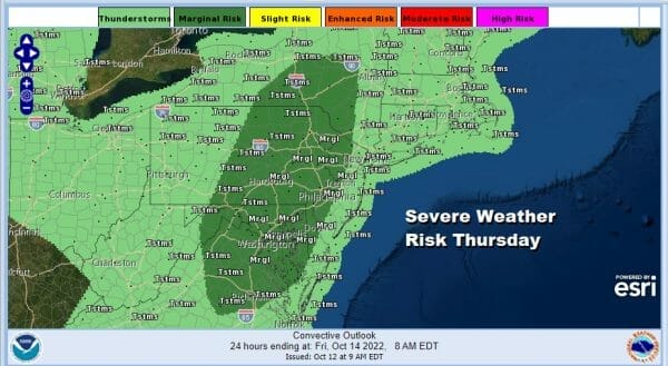
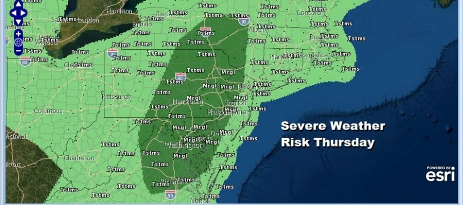
The nice weather that began the week takes a pause today as we have the first of 3 cold fronts/weather systems that will be moving through. First time in nearly a month the word humid is part of the outlook today as dew points will shoot up through the 60s on a strong southerly flow. Add to that a little tropical forcing and you have severe weather risk per the Storm Prediction Center.

The severe weather risk also comes with a 2% risk of tornadoes. Marginal risk for severe weather to me means that there will be some isolated severe thunderstorms in the mix. Otherwise today will be a humid day with showery rains and the chance for thunderstorms this afternoon and tonight. The rain will not be continuous as the radar shows some gaps but the dry periods probably won’t last long. High temperatures today will be in the upper 60s to lower 70s along with a gusty south wind along the coast.
SATELLITE

WEATHER RADAR

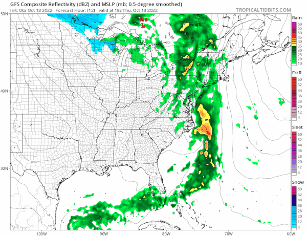
Rainfall potential is on the order of 3/4 inch to 1.25 inches for Eastern Pennsylvania to Southern New England which will bring more relief to the summer drought. The front will move along tonight and the showers will be overwith during the early morning hours from west to east. The we have Friday and the weekend which right now looks ok overall.
Friday looks to be no worse than partly sunny with highs in the mid to upper 60s. The first shot of cool air plays out to our west and we will have to wait for 2 other fronts to pass. Saturday starts off the weekend on a solid note with sunshine and highs in the mid to upper 60s. Looking at the GFS loop above which runs from today into next Tuesday you can see the series of fronts moving through. Sunday the second front comes through and it appears to pass through mostly dry so we will just mention an isolated shower. Otherwise it will be cloudy to partly sunny with highs in the 60s. Monday the third and final front moves through and this brings in a solid shot of cold air that will arrive Monday night and probably last all next week. This is a rather important set up for the longer term because it looks like we may be in a stretch of below average temperatures for the next week to 10 days at least beginning next Tuesday.
BE SURE TO DOWNLOAD THE FREE METEOROLOGIST JOE CIOFFI WEATHER APP &
ANGRY BEN’S FREE WEATHER APP “THE ANGRY WEATHERMAN!
MANY THANKS TO TROPICAL TIDBITS & F5 WEATHER FOR THE USE OF MAPS
Please note that with regards to any severe weather, tropical storms, or hurricanes, should a storm be threatening, please consult your local National Weather Service office or your local government officials about what action you should be taking to protect life and property.


