Nice Seasonal Weekend Before Colder Air Arrives Next Week
Last night’s cold front produced some solid rainfalls of 1 to 2 inches in some places which dents the summer drought conditions even further. The last of the clouds are slowly moving east so we should continue to see decreasing clouds and increasing sunshine from west to east this afternoon, though for eastern areas from Long Island and points east it might take a little longer. Temperatures this afternoon will top out mostly in the mid to upper 60s. Radars are quiet right now and should remain so probably through daytime Sunday.
SATELLITE

WEATHER RADAR

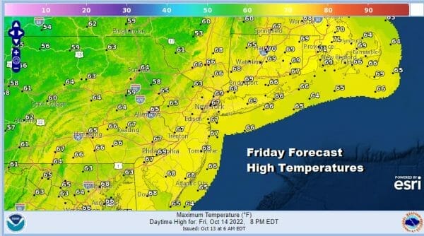
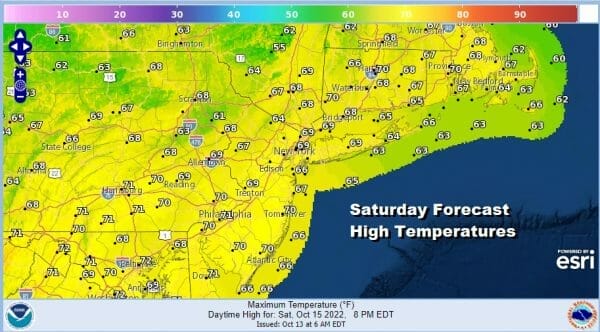
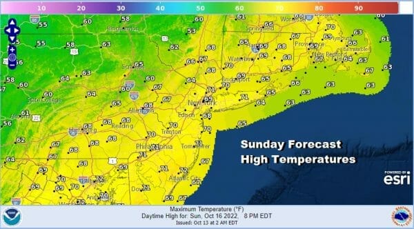
Tonight skies should be mainly clear with most lows in the mid 40s to lower 50s. Saturday and Sunday both look like two decent days. Saturday should be mostly sunny and nice with highs in a range of 65 to near 70 degrees. Sunday we are seeing partly sunny skies with perhaps more clouds in the afternoon than in the morning. Sunday highs will also be in a range of 65 to near 70.
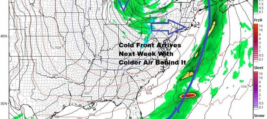
The next front will be approaching Sunday into Monday. It will not be as active or as wet as the front from yesterday. Some showers will be coming up from the southwest later Sunday night into Monday as the cold front passes through. This will start the process of bringing in a shot of colder air for the middle and latter part of next week.
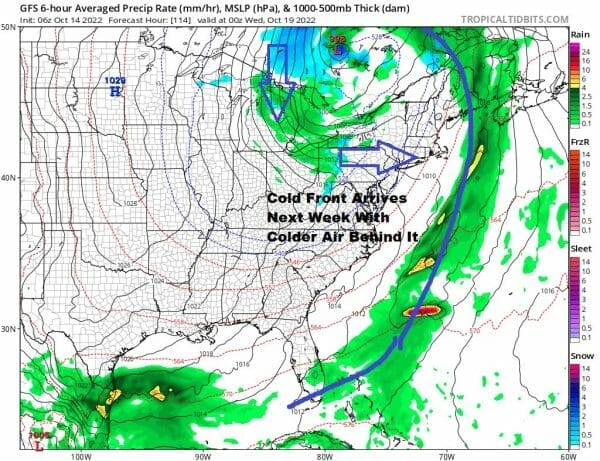
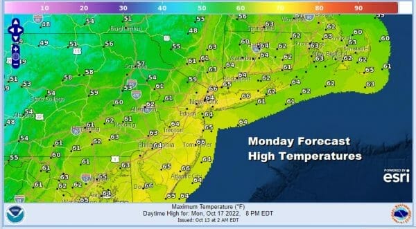
We will start to feel the arrival of the colder air later in the day Monday once the front moves offshore. We will likely top out in the 60s Monday and then see temperatures to trend lower later in the day and certainly for Monday night into Tuesday.
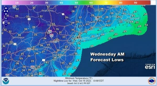
Tuesday morning lows will be in the 30s inland and low to mid 40s near the coast. Tuesday we will see a mix of sun and clouds with a bit of a northwest breeze and highs just into the 50s. Then we will head down to near 40 in warmer urban and coastal areas Wednesday morning while inland lows will be in the 30s and it might be cold enough for first freezes in some places.
Wednesday will be chilly for this time of year with a mix of sun and clouds with highs just in the upper 40s and lower 50s followed by another chilly night Wednesday night into Thursday morning. We will see temperatures moderate a bit late in the week. No rain is forecast next week other than the chance for showers on Monday.
BE SURE TO DOWNLOAD THE FREE METEOROLOGIST JOE CIOFFI WEATHER APP &
ANGRY BEN’S FREE WEATHER APP “THE ANGRY WEATHERMAN!
MANY THANKS TO TROPICAL TIDBITS & F5 WEATHER FOR THE USE OF MAPS
Please note that with regards to any severe weather, tropical storms, or hurricanes, should a storm be threatening, please consult your local National Weather Service office or your local government officials about what action you should be taking to protect life and property.


