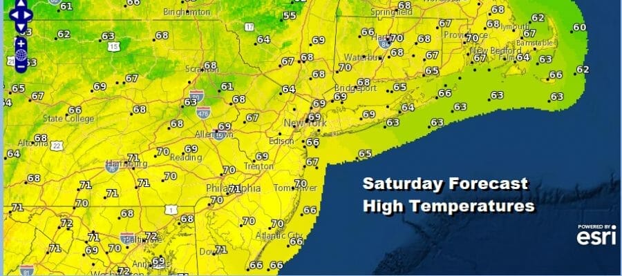
Autumn Weekend of Sunshine
Showers Cold Front Brings Cold Shot Tuesday Through Thursday
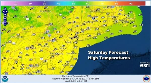
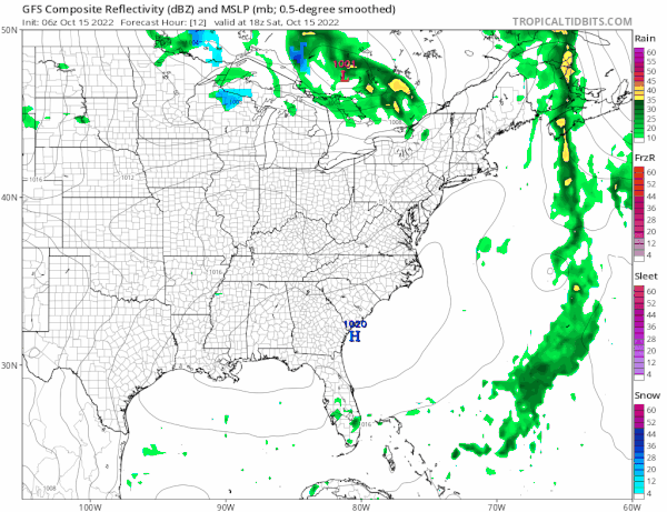
The weekend is here and we are going to enjoy a good deal of sunshine today. To the east we have a stalled front with clouds running north into Eastern Maine and Nova Scotia. To the west we have high clouds rotating around a strong upper trough developing over the Great Lakes. That leaves us stuck in between in dry weather and sunshine today. Highs will reach the upper 60s to around or just over 70 degrees. Radars are mostly quiet with the exception of some scattered showers near the coast of Southeast New England.
SATELLITE

WEATHER RADAR

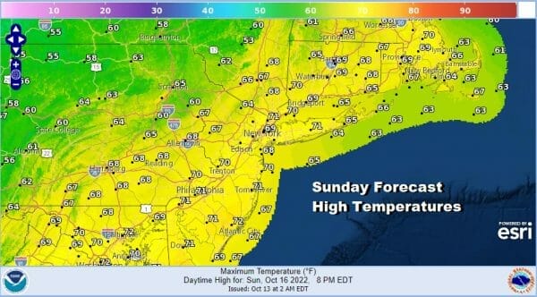
Tonight should start clear at least but we will probably see some patchy low clouds and a little fog in cooler valley areas. Overnight lows will be in the 40s to lower 50s. Sunday will be a partly sunny day as we have the next trough and cold front approaching from the west however no rain is forecast during the day and into Sunday evening. Highs will be in the mid to upper 60s.
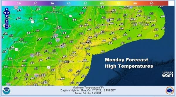
The first of two cold fronts will approach Sunday night into Monday morning and with that front there oculd be some scattered showers Sunday night into Monday morning. It won’t amount to much in the way of rain. Then we get a break during the day Monday but there will be clouds around with highs in the low to mid 60s.
Monday night the second front will be moving through with some showers and this front ushers in the colder air from the Great Lakes, Plains and Ohio Valley for Tuesday into Thursday. Upstate NY and NW Pennsylvania could see some lake effect snow showers from this which would be the first time this season.
We will probably see a mix of sun and clouds on Tuesday. There is the outside chance for an isolated shower inland as the cold air moves in with a slightly unstable air mass. Highs Tuesday will be in the low to mid 50s in most places and then we head down to the 30s to near 40 degrees Wednesday morning.
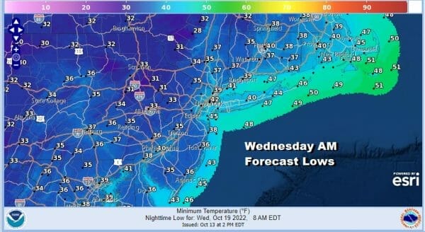
Wednesday we will see sunshine but it will be chilly with highs in the upper 40s inland and mostly lower 50s coast and warmer urban areas. That sets us up for cold Wednesday night and with clear skies lows will be near 40 warmer urban settings but inland araes will drop down close to or even below freezing bringing the first freezes of the season inland.
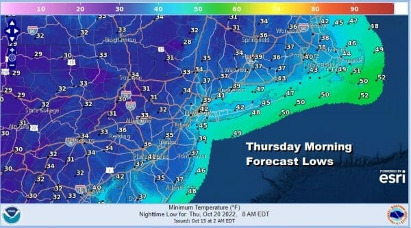
Thursday will be sunny and chilly with highs mostly in the upper 40s and lower 50s. Friday we will start to see temperatures moderate some with some sunshine taking highs through the 50s to near 60. Other than what happens rain wise Sunday night into early Monday and again late Monday into early Tuesday, the week ahead looks dry and rainfall amounts will generally be on the light side. No major storms are on the horizon anytime soon.
BE SURE TO DOWNLOAD THE FREE METEOROLOGIST JOE CIOFFI WEATHER APP &
ANGRY BEN’S FREE WEATHER APP “THE ANGRY WEATHERMAN!
MANY THANKS TO TROPICAL TIDBITS & F5 WEATHER FOR THE USE OF MAPS
Please note that with regards to any severe weather, tropical storms, or hurricanes, should a storm be threatening, please consult your local National Weather Service office or your local government officials about what action you should be taking to protect life and property.


