Showers Thunderstorms Possible Sunday Night Cooler New Week
Tropical Storm Risks Rise Central & South Florida

Showers Thunderstorms Possible Sunday Night Cooler New Week
Tropical Storm Risks Rise Central & South Florida

The weather world can go from calm and quiet to active and stormy rather quickly. The Northeast & Northern Mid Atlantic have been in the quiet and calm part for much of the last several weeks. We will see a minor interruption of that calmness Sunday night. Today however looks to be a nice start for the weekend. Weak high pressure lies overhead and we should see ample sunshine today for much of Eastern Pennsylvania to Southern New England. It will be a warm day with an ocean wind from the south. That will help to keep temperatures in check to some extent but highs should reach the middle to upper 70s without much difficulty. Temperatures will be a few degrees cooler along south and east facing shorelines.
SATELLITE WITH LIGHTNING STRIKES

WEATHER RADAR

We have no issues tonight under a mainly clear sky as lows bottom in the upper 50s to mid 60s. There could be some patchy fog developing in some areas overnight into Sunday morning. During the day Sunday we will see some sunshine to start but clouds will be developing and moving in from the west ahead of the next cold front. That front will pass Sunday night with some showers and perhaps even an isolated thunderstorm. Depending on clouds, most highs will be in the 70s.
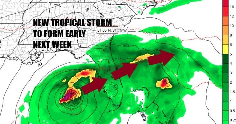
This weather front will pass offshore and next week we will see a cooler trend to temperatures as a nice air mass complete with a little autumn chill will build into the Northeast and Northern Mid Atlantic states. This will be a dry week with no rain in the forecast all week long. Meanwhile in the Gulf of Mexico this weekend low pressure has developed in the Southwest Gulf of Mexico and it seems that conditions have become more conducive for tropical storm development.
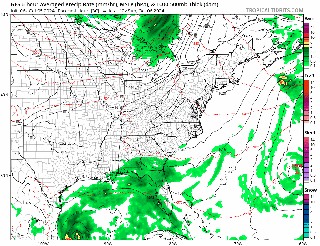
Weather models all see to agree that this system will reach tropical storm strength early next week and possibly to hurricane strength by Tuesday. Given the state of the upper flow which is generally west southwest, this system likely tracks east or east northeast and makes a run for the Florida west coast and then crossing over to the other side. Wednesday appears to be the day that the hurricane nears the west coast of Florida. An old frontal boundary to the north will force the track east northeast and this is not a risk for areas further north in Georgia or the Carolinas though the coast could get skimmed by this after it crosses over to off the Florida east coast. High pressure to the north and a deep upper air trough off the coast of New England will prevent this system from moving up the Eastern Seaboard.

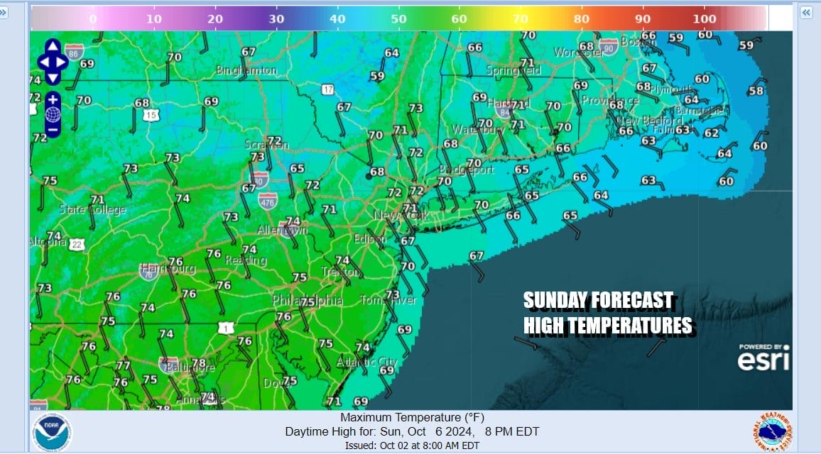
Monday we should see weather conditions improve as the Sunday night showers exit. Look for developing sunshine and a northwest wind. Monday highs will be in the upper 60s and lower 70s. Cooler air will be coming in for Tuesday through Thursday. We see sunshine all three days though there might be a few clouds in the mix Tuesday. Highs generally all three days will be in the 60s. Nights will turn chilly with lows in the 40s to near 50 Tuesday morning and in the 40s Wednesday and Thursday mornings. Some 30s could be in the mix in colder inland areas.
BE SURE TO DOWNLOAD THE FREE METEOROLOGIST JOE CIOFFI WEATHER APP &
ANGRY BEN’S FREE WEATHER APP “THE ANGRY WEATHERMAN!
MANY THANKS TO TROPICAL TIDBITS FOR THE USE OF MAPS
Please note that with regards to any severe weather, tropical storms, or hurricanes, should a storm be threatening, please consult your local National Weather Service office or your local government officials about what action you should be taking to protect life and property.
(Amazon is an affilate of Meteorologist Joe Cioffi & earns commissions on sales.)


