Cold Front Brings Showers Tonight Cooler Week Ahead With Autumn Chill
Milton Forecast to be Major Hurricane As It Heads to Western Florida

Cold Front Brings Showers Tonight Cooler Week Ahead With Autumn Chill
Milton Forecast to be Major Hurricane As It Heads to Western Florida

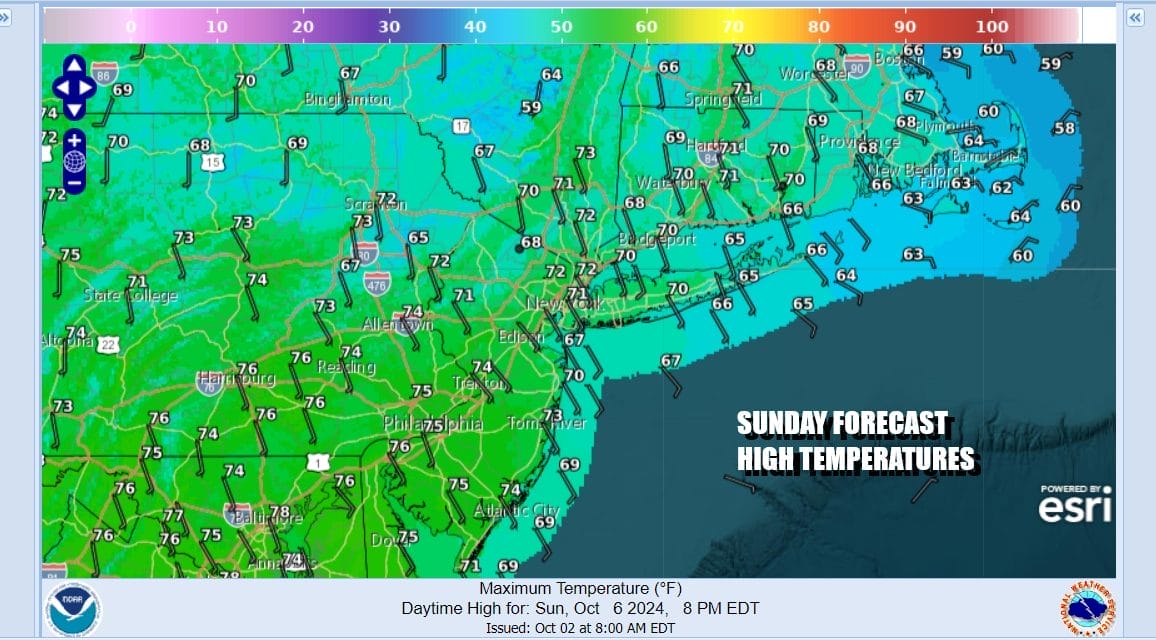
The second half of the weekend will be almost as good as the first half. We have no weather issues during the dayside as a cold front to the west won’t get here until tonight. Satellite shows clear skies and the radars are quiet so we should have a good deal of sunshine into this afternoon before any clouds roll in. Temperatures today will be mostly in the 70s. Ocean winds will keep things cooler along the shore.
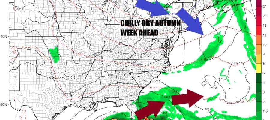
The weather front that is coming will mark the leading edge of cooler autumn air that will be moving in for much of this week. You can look for a line of showers and perhaps a thunderstorm to move through overnight and it looks like it could linger into Monday morning since the front appears to be slowing down somewhat as it heads to New England and the Mid Atlantic. Part of that probably has to do with the development of Tropical Storm Milton in the Southwest Gulf of Mexico which will likely be a hurricane tonight.
SATELLITE WITH LIGHTNING STRIKES

WEATHER RADAR

Clouds and rain from a lead disturbance today in the Eastern Gulf of Mexico is not tropical in nature but from an old frontal boundary. Heavy rains are forecast over Florida today and flash flood watches are up for much of Central and South Florida but this is not related to Milton. That comes Wednesday as Milton moves into the Florida West Coast somewhere between Port Charlotte and Tampa as my guess at this time and likely as a category 3 hurricane.
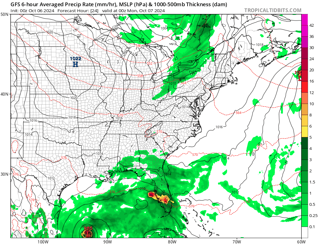
Given the amount of misinformation out there, Milton is not going to effect the Western Carolina mountains as this is an entirely different upper air set up. The storm is blocked from moving northward this time around thanks to high pressure over the Great Lakes and into the Mid Atlantic. Instead Milton will cross Florida and move off the East Coast Wednesday night and then continue out eastward into the Atlantic Ocean.

Back to weather in Eastern Pennsylvania to Southern New England some lingering showers or a thunderstorm Monday will give way to decreasing clouds in the afternoon from west to east. High temperatures will be in the 70s until the front passes and then we will see temperatures drop to the 40s to near 50 Tuesday morning on northwest winds and nice dry air.
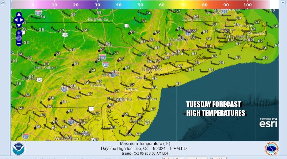
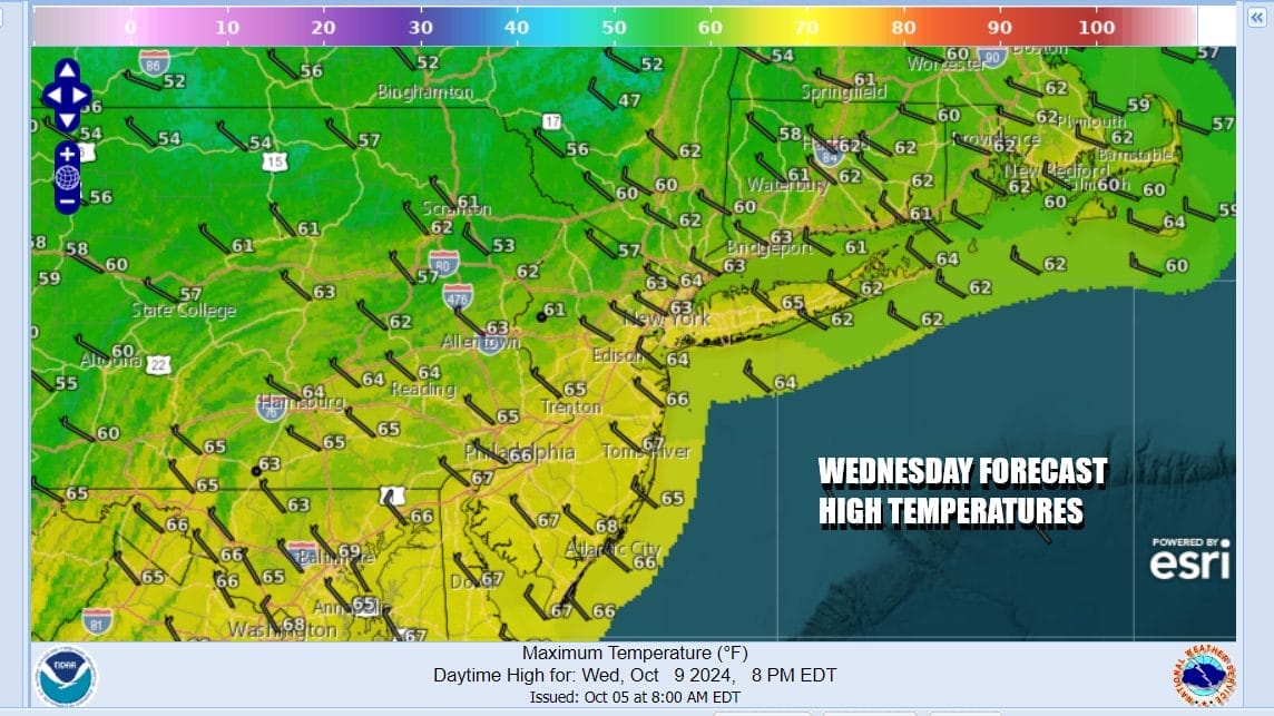
Tuesday will be a nice autumn day of sunshine with most highs in the mid to upper 60s. We will be down in the 40s in many areas Tuesday night into Wednesday morning. Some 30s are possible in chilly spots. Wednesday will be sunny and cool with most highs in the low to middle 60s.
The coolest of the cool air will be Wednesday night into Thursday morning as most lows will be in the 40s along the coast and we will probably see a host of 30s inland. Perhaps well inland the first frosts of the season will develop. Thursday will be a sunny day with most highs in the low to mid 60s. Friday will be a nice sunny day with highs again mostly in the 60s. Other than any showers tonight into Monday, we will continue to be in a drier than average weather pattern through next weekend!
BE SURE TO DOWNLOAD THE FREE METEOROLOGIST JOE CIOFFI WEATHER APP &
ANGRY BEN’S FREE WEATHER APP “THE ANGRY WEATHERMAN!
MANY THANKS TO TROPICAL TIDBITS FOR THE USE OF MAPS
Please note that with regards to any severe weather, tropical storms, or hurricanes, should a storm be threatening, please consult your local National Weather Service office or your local government officials about what action you should be taking to protect life and property.
(Amazon is an affilate of Meteorologist Joe Cioffi & earns commissions on sales.)


