Heading into a Dry Warm Weekend Cold Front Showers Monday Cooler Tuesday

Heading into a Dry Warm Weekend Cold Front Showers Monday Cooler Tuesday
We continue to move along in a very quiet weather pattern. It covers much of the United States and the amount of adverse weather going on is minimal. Satellite and radar loops show clouds and a small area of showers are ahead of a cold front now moving through the Great Lakes. This leaves Eastern Pennsylvania to Southern New England with dry conditions and sunshine today. Some clouds will probably come into the mix later today and into this evening as the cold front nears. Temperatures will be mostly in the 70s except 60s along south and east facing shorelines.
SATELLITE WITH LIGHTNING STRIKES

WEATHER RADAR

This weather front will pass through tonight with minimal issues other than clouds. Most overnight lows will be in the mid 50s to lower 60s. Over the next few days it will be about the northwest flow which is dry. Cold fronts will pass through from time to time. The next one follows Sunday night. There could be a few showers when that front goes by. Afterwards we see a shot of cool air coming down from Eastern Canada.
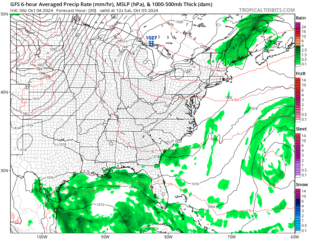
The only area that will have adverse weather to deal with in the coming days is the immediate Gulf Coast & Florida. Pressures across the Gulf of Mexico are lower than normal. There is an old frontal zone lying across the Gulf of Mexico and Florida. From this we could see low pressure develop over the weekend or more than likely next week. Conditions for tropical storm development are not all that favorable in the current pattern but it does create an alley for tropical moisture to spread over Florida. This likely means waves of heavy rain developing there beginning Sunday and lasting into next week. None of this is coming up the Eastern Seaboard.

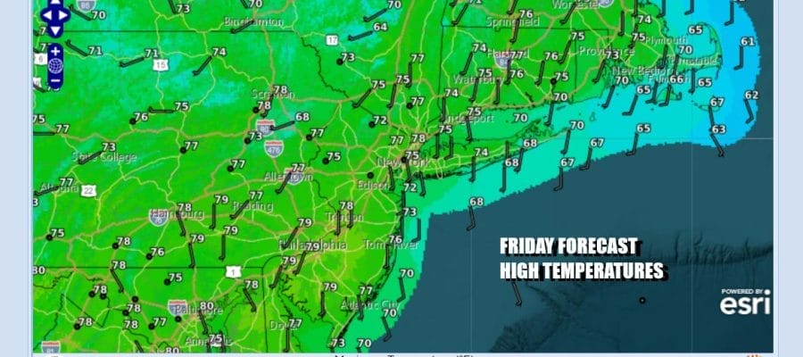
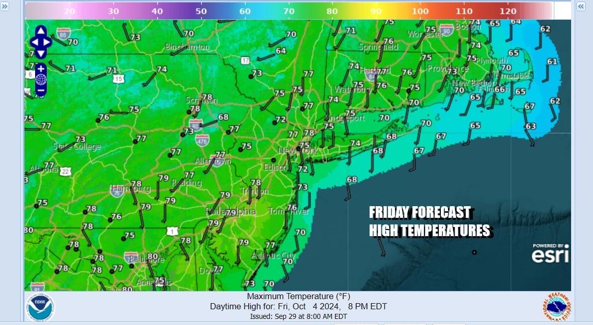
This leaves Eastern Pennsylvania to Southern New England in dry weather and sunshine for Saturday. High temperatures will be in the mid 70s to around 80 degrees from north to south. Sunday we are ahead of the arriving cold front so look of sunshine, warm conditions, and perhaps some late day clouds. Sunday highs will also be in the mid 70s to a few upper 70s.
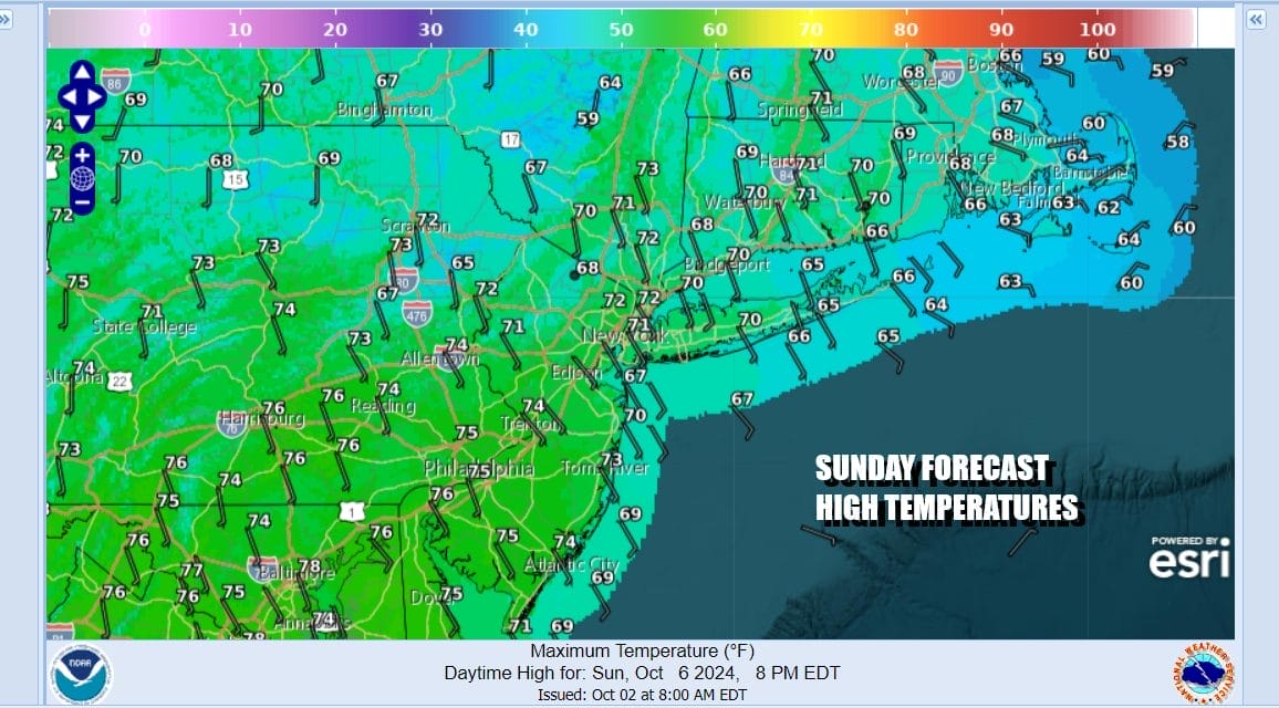
Some showers will move through Sunday night. The rain will not amount to much. Monday sees decreasing clouds and increasing sunshine on northwest winds and highs in the low to mid 70s. Much cooler air will move in for Tuesday through Thursday next week where daytime highs will be mostly in the 60s and nights will be dropping into the 40s to lower 50s so we will be in a zone of lower than average temperatures. That looks to be the general patten going forward in the longer range but the pattern also looks to remain dry through much of next week.
BE SURE TO DOWNLOAD THE FREE METEOROLOGIST JOE CIOFFI WEATHER APP &
ANGRY BEN’S FREE WEATHER APP “THE ANGRY WEATHERMAN!
MANY THANKS TO TROPICAL TIDBITS FOR THE USE OF MAPS
Please note that with regards to any severe weather, tropical storms, or hurricanes, should a storm be threatening, please consult your local National Weather Service office or your local government officials about what action you should be taking to protect life and property.
(Amazon is an affilate of Meteorologist Joe Cioffi & earns commissions on sales.)


