Nice Weather Through the Weekend Weak Front Passes Friday Night

Nice Weather Through the Weekend Weak Front Passes Friday Night
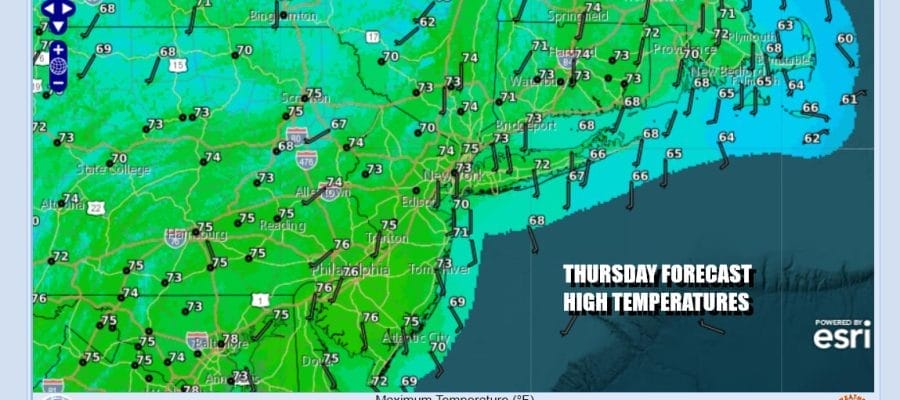
Yesterday’s cold front has passed, weakened, and is just about gone. Now we can enjoy the dry air that has been covering most of the US this week. Today is going to be a very nice day. There will be some early leftover clouds due to the dying cold front but we will see sunshine develop and it should rule the day especially in the afternoon. The sun will help raise temperatures nicely as well as highs will reach the low and middle 70s. Radars are nice and quiet and should remain so through Friday. Skies will be mostly clear tonight with most lows in the 50s.
SATELLITE WITH LIGHTNING STRIKES

WEATHER RADAR

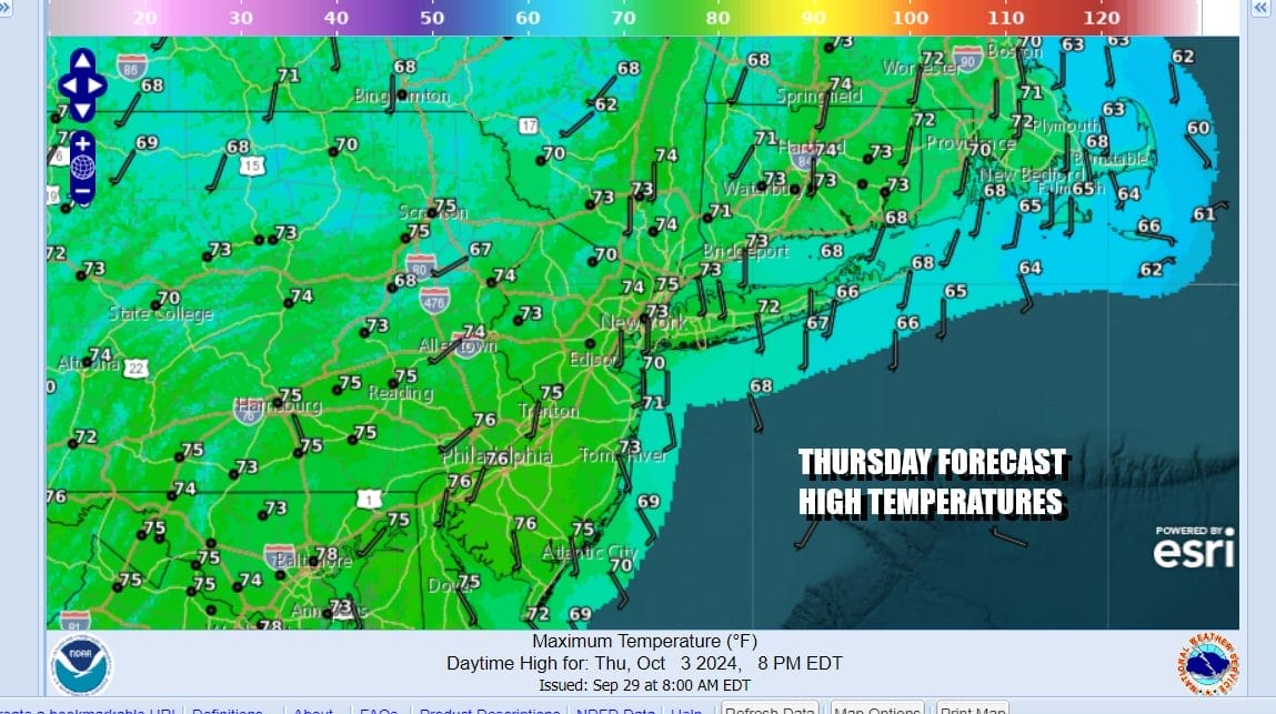
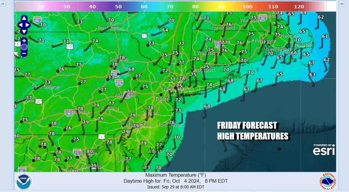
Friday should start with some sunshine but we will probably see some clouds come into the mix especially in the afternoon. There is a cold front that will be sweeping eastward across the Great Lakes and moving through New England Friday night. Moisture in the atmosphere remains very limited so we are going to leave showers out of the forecast for Friday night. Highs Friday will be in the mid to upper 70s.
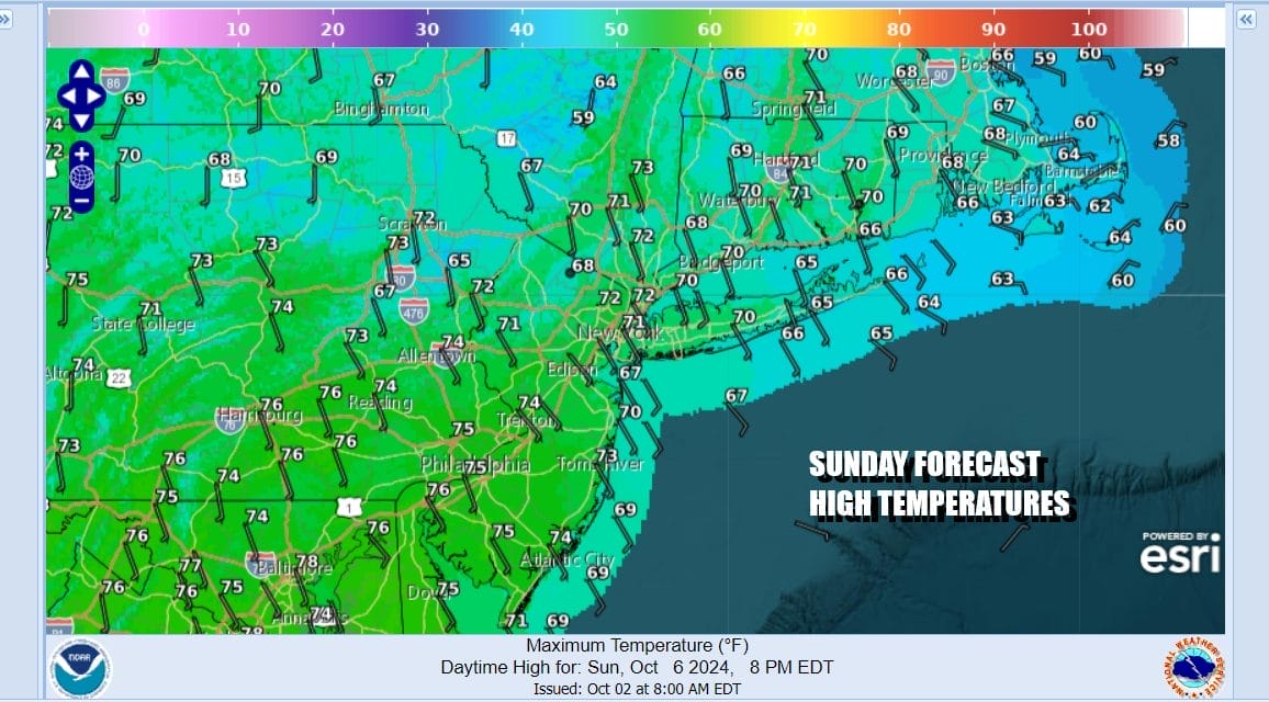
Once this weather front passes through Friday night we will settle into a nice weekend. Sunday probably winds up being the better day than Saturday. Look for some sunshine and clouds for Saturday. Highs will be in the middle to upper 70s. Sunday we will probably have more sun and fewer clouds with highs again in the mid to upper 70s.

High pressure will slide east over the weekend and that will be followed by another stronger cold front Monday. This comes with a developing low in Eastern Canada and it will be followed by a shot of colder air for Tuesday and Wednesday of the new week. The front that arrives Monday will be limited again regarding moisture with a greater chance for showers to the north and northeast in New England.

Monday will be a warm day with the risk for showers and a mix of sun and clouds and highs in the 70s. Then we will see the coolest air of the fall season so far arrive for Tuesday, Wednesday, and lingering into Thursday. We will likely see a breezy to windy day Tuesday with temperatures in the 60s and then we will see widespread 40s for lows inland Tuesday night into Wednesday. The coolest of this cool air mass will be next Wednesday into Wednesday night. We still have a pattern that is a dry one across the US and we do not see this changing anytime soon. Florida and areas right along the Gulf Coast will be the exception to this as lower than normal pressures will continue in the Gulf of Mexico along a stalled frontal boundary. Tropical storm formation is possible but not likely at this time given mostly hostile conditions aloft.
BE SURE TO DOWNLOAD THE FREE METEOROLOGIST JOE CIOFFI WEATHER APP &
ANGRY BEN’S FREE WEATHER APP “THE ANGRY WEATHERMAN!
MANY THANKS TO TROPICAL TIDBITS FOR THE USE OF MAPS
Please note that with regards to any severe weather, tropical storms, or hurricanes, should a storm be threatening, please consult your local National Weather Service office or your local government officials about what action you should be taking to protect life and property.
(Amazon is an affilate of Meteorologist Joe Cioffi & earns commissions on sales.)


