Showers From Time To Time Into Thursday Warm Rain Free Friday Weekend

Showers From Time To Time Into Thursday Warm Rain Free Friday Weekend

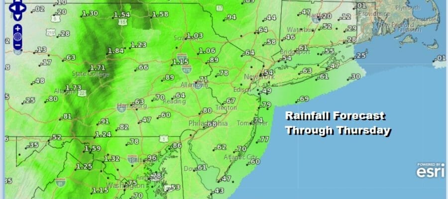
We continue to sit inside an east west band of clouds that lies from Southeastern Canada southward to the Mid Atlantic states. We continues to watch a warm front to the west inching its way eastward. We still have some rain or showers to deal with from time to time today into Thursday but it will not rain all the time and in fact for some areas much of the time it will be rain free. Rainfall amounts should be under an inch unless some heavier downpours line up overhead and the best chances for that will be in Pennsylvania west of I-81.
SATELLITE

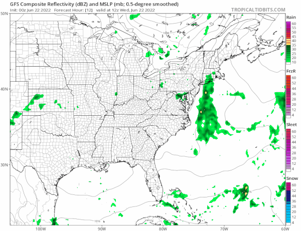
WEATHER RADAR

With clouds and showers around, plus a wind off the ocean from the southeast, temperatures today will not get out of the 70s. Overnight look for the chance for some showers or a downpour with lows in the 60s. Thursday we will go with the same idea of clouds and the chance for some scattered downpours however low pressure develops offshore and takes the upper trough and fronts all to the east so weather conditions may start to improve at some point later in the day. Highs will be in the upper 70s and lower 80s.
This leaves us with Friday and the weekend. There is no fresh Canadian air mass moving in so it will leave us with a warm humid Friday through Sunday with some sunshine and each day and little to no rain in the forecast. It will be very warm and it will be somewhat humid but not crazy humid. Highs Friday will be in the low to middle 80s with 70s along the coast.

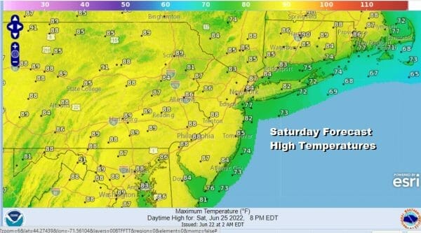
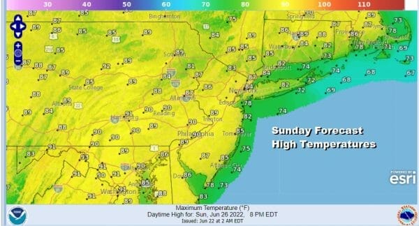
Saturday we will see temperatures edge up a little higher but we hesitate to call it downright hot. In my view hot is when temperatures climb up into the 90s over a wide area and the heat lasts for several days or longer. We are not seeing that but it will reach middle to upper 80s on Saturday and mid 80s to near 90 degrees in some places on Sunday. Humidity will start to go higher Sunday and that could trigger a late day scattered thunderstorm inland.
The next change in air mass will come Monday in the form of a cold front and upper trough. The northwest flow from Canada will strengthen again next week and opens the door for showers and thunderstorms next Monday and there could be severe weather risk that front. That will be followed by a slightly cooler drier air mass after that front passes.
BE SURE TO DOWNLOAD THE FREE METEOROLOGIST JOE CIOFFI WEATHER APP &
ANGRY BEN’S FREE WEATHER APP “THE ANGRY WEATHERMAN!
MANY THANKS TO TROPICAL TIDBITS & F5 WEATHER FOR THE USE OF MAPS
Please note that with regards to any severe weather, tropical storms, or hurricanes, should a storm be threatening, please consult your local National Weather Service office or your local government officials about what action you should be taking to protect life and property.


