Showers Exit Leftover Clouds Warmer Than Average Temperatures
Continue Through the Weekend
Overnight showers thanks to a weak weather system moving through the Northeast continues to move away and that is going to leave us in leftover clouds for today. We do have overcast skies with patchy fog and drizzle around. Checking out the radar loop there are a few leftover scattered showers around but they should gradually diminish as the day wears on, and most of you probably won’t see much. Otherwise it is just a minor interruption in a rather warm pattern in the Eastern US.
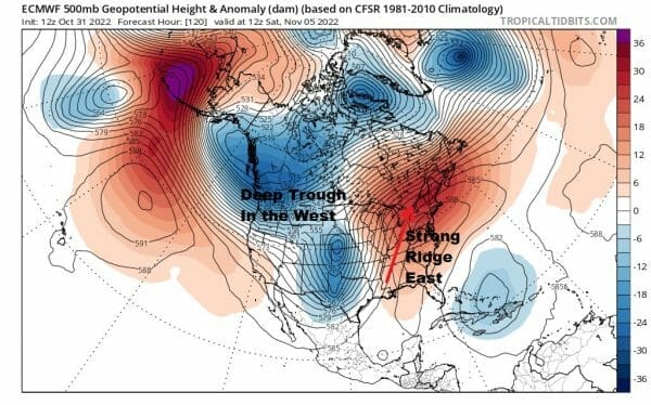
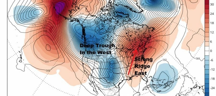
This is a warm set up for the start of November with a ridge of high pressure in the Eastern US and a series of deep troughs in the Western US. This will allow us to see temperatures running 5 to 10 degrees above normal through Friday and we could be 10 to 15 degrees above normal this weekend! Back to today with leftover clouds and maybe some brigthening of skies or a break or two of sun could let temperatures reach the mid to upper 60s this afternoon.
SATELLITE

WEATHER RADAR

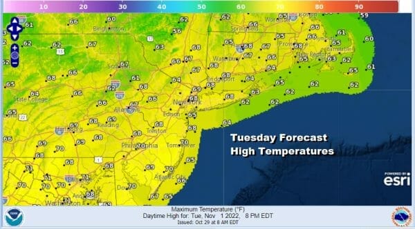
Moving on to tonight skies should clear out nicely with lows in the mid 40s to lower 50s. The next three days will be warmer than average and we should see sunshine or at least some sunshine each day. Wednesday highs will be in a range of 65 to near 70 degrees.

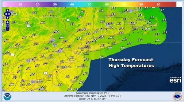
Nights will be clear and cool but not cold with most lows in the 40s inland and maybe a few cold spots in the 30s; warmer urban centers will be in the lower 50s. Thursday and Friday we will see sunshine but there will be a bit of a wind flow off the ocean. It will be nothing major and not enough to bring in clouds other than maybe some nighttime and early morning patchy low clouds. The wind from the east will hold the temps down a little but we will see highs in the mid to upper 60s.

High pressure moves from New England southeast to off the Mid Atlantic coast. This changes the wind direction from east to south to southwest and possibly even to the west by Sunday. This will be very supportive in taking temperatures even higher over the weekend. In fact we could see record or near record highs being set. Saturday highs will be in a range of 70 to 75. Sunday could see highs reaching the middle and possibly the upper 70s in some places.
BE SURE TO DOWNLOAD THE FREE METEOROLOGIST JOE CIOFFI WEATHER APP &
ANGRY BEN’S FREE WEATHER APP “THE ANGRY WEATHERMAN!
MANY THANKS TO TROPICAL TIDBITS & F5 WEATHER FOR THE USE OF MAPS
Please note that with regards to any severe weather, tropical storms, or hurricanes, should a storm be threatening, please consult your local National Weather Service office or your local government officials about what action you should be taking to protect life and property.


